In brief: The National Weather Service has confirmed the formation of a tornado in northwest Harris County this afternoon. More storms are expected over the next couple of hours before a brief lull, followed by a broken line of storms later this evening. Please be weather aware!
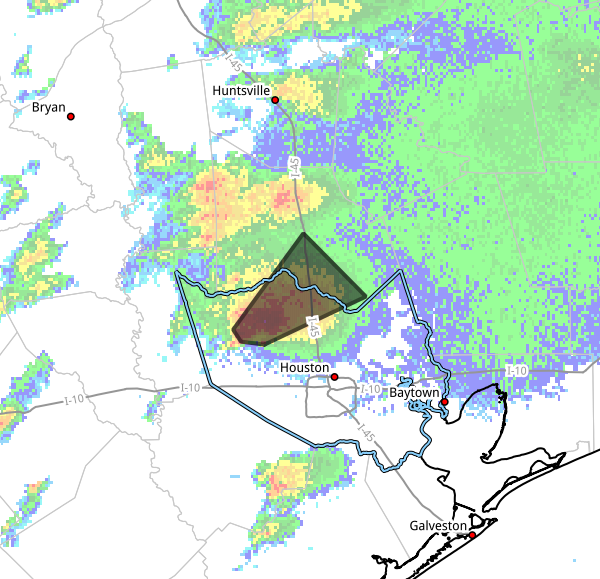
Hi everyone. Just wanted to jump in with a quick post this afternoon as showers and thunderstorms to the west and north of Houston have been a little more intense than anticipated. We already have seen a couple of tornado warnings earlier today, one to the west of Harris County, and another near Cypress and Jersey Village. As of 1:38 pm CT today, the National Weather Service confirmed a tornado near Willowbrook, moving to the northeast. The warned area is shown below:
For the most part we think these storms will continue to drift north, away from Houston later this afternoon. However, we cannot rule out some lingering storms (mainly north of Interstate 10) during the afternoon hours. And given what we’ve seen so far, some of these storms could be capable of producing tornadoes.
There may be some clearing later this afternoon and evening before a broken line of storms associated with a front moves through the area, from northwest to southeast. Our latest modeling indicates this line should reach areas such as Katy and The Woodlands in the vicinity of 8 pm, downtown Houston around 10 pm, and the coast after midnight. More severe weather will be possible as these storms move through. Calmer conditions are expected from Tuesday onward.
