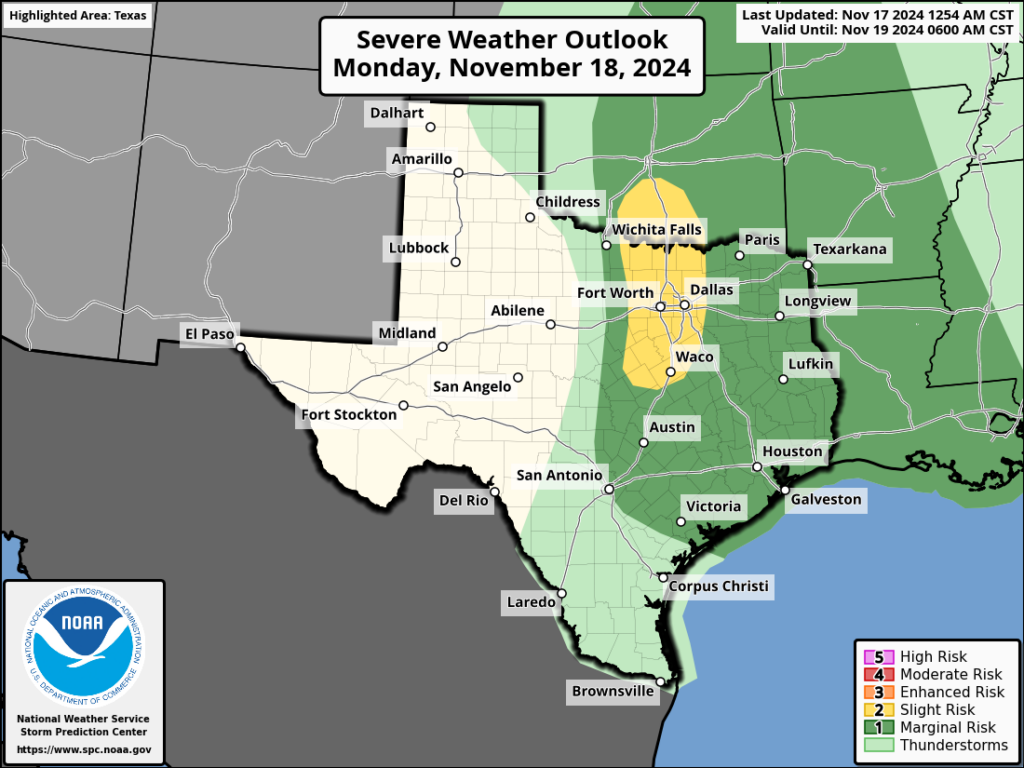
In brief: I hope everyone is enjoying their weekend in Houston, and we’re sorry to interrupt. But I wanted to give readers a heads up about the intermittent rain chances our region will face over the next 36 hours or so. We’re watching the potential for some minor street flooding today, and strong thunderstorms Monday.
The pattern for the next two days will be unsettled due to an advancing front that is running into very warm air over the Gulf of Mexico with plenty of moisture at hand. For the most part, the rainfall today and Monday will not be too disruptive. However, the atmospheric conditions are such that we could see some inclement weather, including the possibility of some strong winds on Monday.
Sunday
As of 8:30 am this morning, there is a line of showers running almost due north from Alvin and Pearland to Kingwood and Cleveland. We expect to see this kind of training pattern pattern today whereby some locations pick up in excess of 1 or 2 inches of rainfall under these bands, and most of the rest of the area only sees light rain. It’s possible there could be some minor street flooding where these bands establish themselves. Most of our guidance indicates significantly less activity over night, so showers should be on the wane by this evening. Highs today will reach the lower 80s for most locations.

Monday
On Monday the front itself will push into Houston, and we should see a line of showers and thunderstorms ahead of it. The timing is still a bit uncertain, but I’d expect the line to coalesce to the west of Houston by around noon, and push through during the afternoon hours. It should reach the coast by around sunset give or take an hour or two. This line will be moving fast enough that I don’t expect any major flooding problems, but for some areas there will be a period when it passes when thunderstorms are a bit gnarly. There is also the potential for some damaging winds, but the chances for tornadoes and hail are quite low. The rains will end quickly behind the front as drier air filters in.
Next week
Skies will clear out by Monday night, and we’ll see ample sunshine through next weekend. A shot of colder air arrives on Wednesday, and we should see a couple of nights in the 40s, which will be our coldest weather of the season. Look for full details on all of this in our regular post on Monday morning.
Fundraiser
I just wanted to mention that our annual fundraiser is ongoing for two more weeks. Your support is critical to the operation of the website, and all we do here at Space City Weather. More information on how to donate or buy merchandise can be found here.

Training showers is a new term for me. Until my husband defined them as a line of showers, I thought you were being cute and saying they were in training for the big thunderstorms!
“Gnarly.” Assuming this is a technical meteorological term meaning stay inside.
Well gag me with a spoon.
Did not know that rain had to train. I guess that without training it’s just humidity or maybe fog.
The training rain stays mainly on the plain.
Shockingly, we got rain up here in Magnolia. Started at 3.20am for 30 minutes, then started again about 4.30am. Nice drenching, thankfully.
.
Went for our morning walk at 6.20am. It was 72°F and very humid, no rain.
.
Went to HEB at 10am – then driving back, had a medium rain for 30 minutes.
Much needed rain … glad the rain clouds didn’t follow the “a line of rain on the northeast”.
Please consider adding a water bottle next year to your fundraiser merchandise. 😊
I guess since the showers were in training is why we didn’t get much here? I mean more experienced showers would have produced more rain?
This humidity is disgusting. I can’t stand this anymore. My family and I are so ready to leave. These final months in Houston are absolutely dragging. The only thing keeping me sane is knowing there is a light at the end of this tunnel: no more heat, hurricanes, and humidity. As of February I am gone.
I don’t blame you, this climate is getting phatetic. The forcast for this supposed cold front we were supposed to get keeps getting warmer and warmer with each update. We were supposed to get highs in the 60s for 3 days in a row with lows in the 40s. Now it’s only one day in the upper 60s and that will go up mark my words. They also said It was supposed to be cool until Thanksgiving starting on Wednesday but now temperatures are already going to get back into the 80s all Thanksgiving week. I am convinced we are not going to have a winter this year.
We are definitely not having a winter this year. We will have a few days of colder weather in January but it is going to be short lived. I would bet Christmas day is going to be 80+ degrees. My entire family hates it here and we all have endless sinus/allergy problems from the humidity, allergens, and poor air quality. I’m so glad I made the decision to leave. I will not miss this cesspit at all.