In brief: Tropical Storm Rafael formed in the Caribbean Sea on Monday, and it could well become a hurricane before moving into the Gulf of Mexico later this weekend. Although we don’t have any major concerns here in Texas, we are sharing this post from our sister site, The Eyewall, so readers can be informed about the situation. We’ll continue to monitor things, of course.

Hello, Rafael
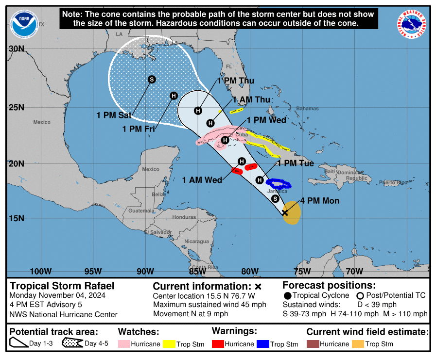
As of Monday afternoon Tropical Storm Rafael has winds of 45 mph, and it appears to be in an environment that will promote steady, if not rapid intensification over the next 24 to 36 hours.
Model guidance is in good agreement through tomorrow and Wednesday on a track taking Rafael due northwest just west of Jamaica, across the Cayman Islands, and right into western Cuba as healthy hurricane. Tropical storm force winds extend out about 105 miles from the center, so a tropical storm watch has been issued for the Lower and Middle Florida Keys. Hurricane Watches are posted for Cuba, and warnings are posted for the Cayman Islands.

In addition to the tropical storm and hurricane conditions, heavy rain and flooding are a possibility for Jamaica, the Cayman Islands, and Cuba as well. Heavy rain will eventually work into portions of Florida and the Southeast as well as Rafael comes north. More on that in a second.
Once it reaches the Gulf of Mexico
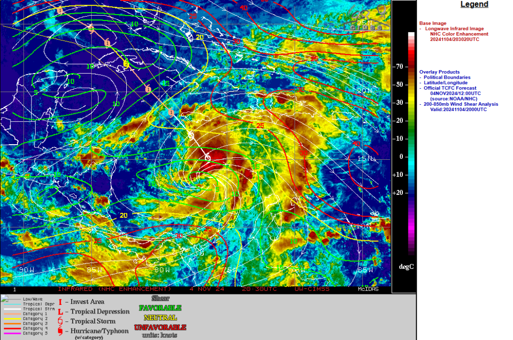
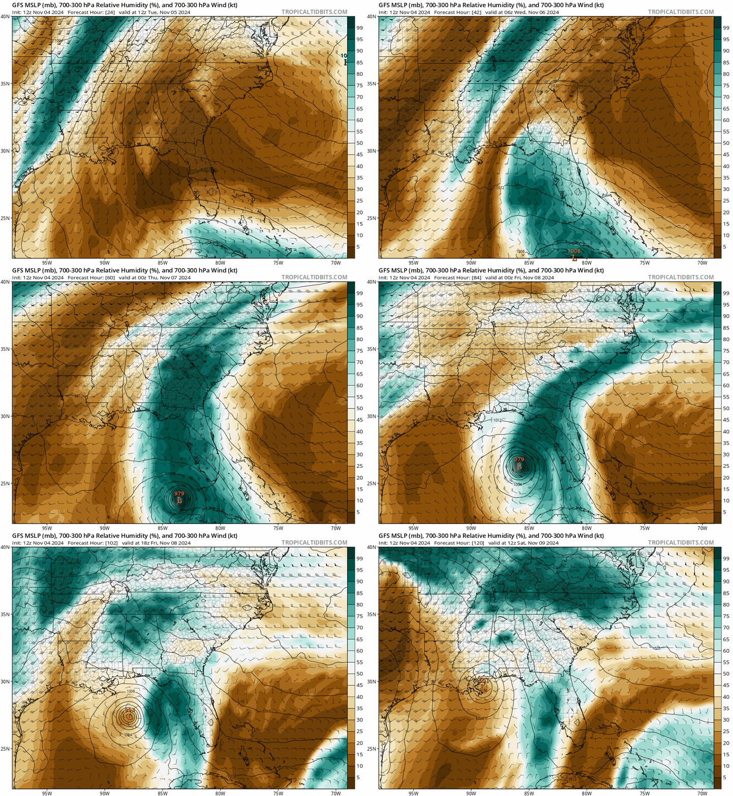
So where will Rafael go on the other side of Cuba? That’s a tough question right now, as there are several factors in play once the storm gets into the open Gulf of Mexico. Moisture surging out ahead of Rafael will “pre-saturate” the Gulf to make it somewhat more hospitable for the storm to maintain intensity as it comes halfway across the Gulf of Mexico. But once it gets into the northern Gulf, the combination of significant dry air and wind shear may be Rafael’s undoing.

The wind shear is always a bit of a question mark; sometimes as storms come north, the shear can help to actually vent the storm a bit, which can unintentionally cause further strengthening. In this case, I think the shear is too strong, and this ample dry air (and there’s a lot of it) will likely take its toll on Rafael.
Because the storm will likely be weakening, I would reason that it should keep going northwest or even west northwest across the Gulf, almost like an aimless wanderer. If Rafael maintains its intensity longer than we anticipate, it could turn more north-northwest toward the Florida Panhandle or the central Gulf Coast. For now, impacts on the Gulf Coast are probably limited to pockets of heavy rain, rough seas, and minor tidal flooding issues. But as with any storm during hurricane season, it makes sense to monitor it closely in the coming days.
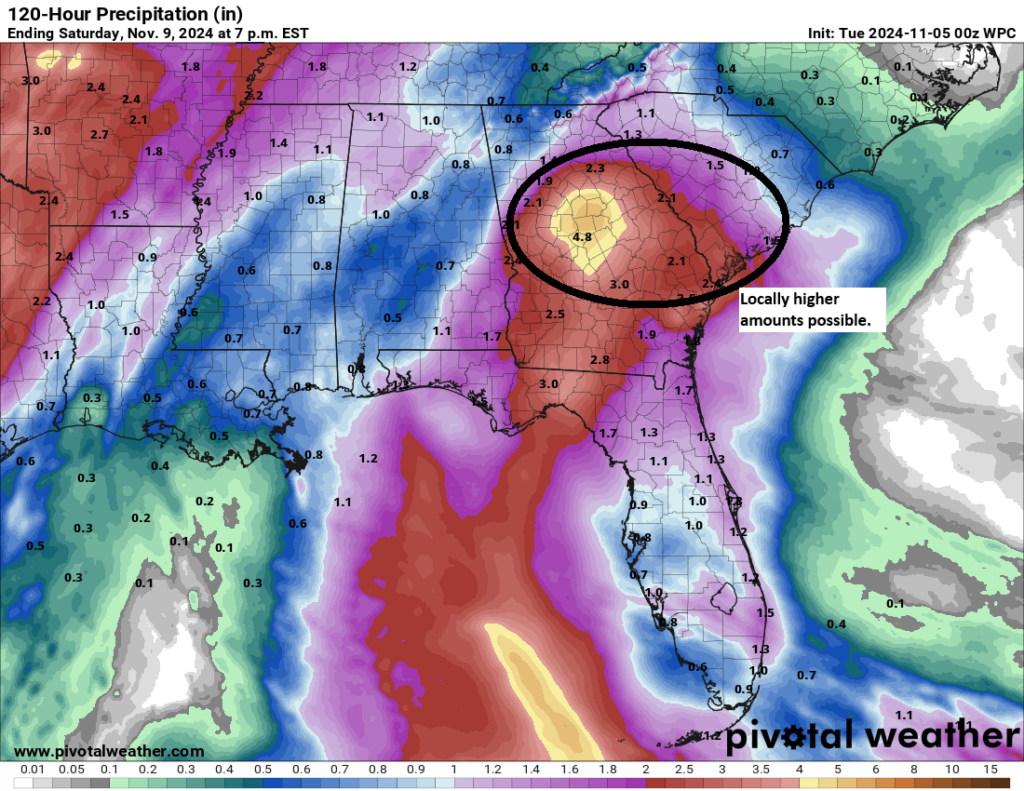
In terms of rain, it will be interesting to see how that initial surge of moisture interacts with a cold front approaching the Southeast on Wednesday and Thursday. There are model uncertainties on exactly how this will play out, but it appears that a significant rainfall event may unfold over central Georgia or southern South Carolina. This will be south of the hardest hit areas from Hurricane Helene. But it still means heavy rain and flooding are possible. Right now, the forecast calls for about 3 to 6 inches of rainfall, but some models do drop bullseyes closer to 10 inches in some areas southeast of Atlanta or west of Charleston.

The important takeaway here is that with Rafael expected to weaken due to dry air, there should not be a second surge of rain that follows this like we saw with Helene. So, it’s something to monitor closely in central Georgia and South Carolina, but the hope is that it will be manageable beyond localized issues. We’ll keep an eye on this.
Once Rafael dissipates, that’ll do it. Another area just north of the Caribbean may try to develop in several days, but it’s not a concern right now.

Ohhhh my most trusted, highly regarded, weather persons. (That’s a suck up icymi)
Long time reader who waited to schedule a domicile move until early Nov in deliberate effort to avoid “Hurricane in the Gulf” thingies..
Can ya’ll get that magical black Sharpie going?
I need you to make this thingy not happen.
“Unintentionally” seems like a strange word here. This is the product of blind natural forces: where’s the intention? Perhaps “paradoxically” or “counter-intuitively” would work better.
Interesting to see how the cold front and Rafael reacts when they hit each other? I thought this scenario produces tornadoes!!
A cold front this weekend (which is more likely than not) pushes Rafael away.