In brief: Houston’s weather remains mostly calm for the foreseeable future. Two things to watch for this week are uncharacteristically hot temperatures on Thursday, and then a lunar eclipse later that night. Hopefully we’ll see partly cloudy skies so the eclipse is viewable.
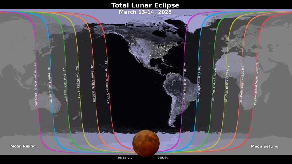
Lunar Eclipse
The greater Houston region, indeed all of North America save for the western half of Alaska, will be treated to a total Lunar Eclipse on Thursday night. Unfortunately the eclipse will occur rather late, with the Moon entering the Earth’s umbra (darkest part of its shadow) at 12:09 am CT on Friday morning. Totality, at which point the Moon is tinted a coppery red, lasts from 1:26 am CT to 2:31 am CT. NASA has more information about the eclipse here. So will it be cloudy? I believe our region will see at least partly cloudy skies, and I expect that to increase to mostly cloudy by sunrise on Friday morning. So the forecast is not ideal. However, the totality will last long enough such that I do expect some breaks in the clouds that will allow the eclipse to be visible.
Tuesday
After Monday’s splendid weather we have another pleasant day on tap, with mostly sunny skies. After temperatures start out this morning in the upper 40s, we’ll see highs reach the upper 70s. Expect southwesterly winds, with a few gusts up to 15 or 20 mph later this afternoon. All in all, very, very nice outside today.

There are zero weather concerns for the Houston Livestock Show and Rodeo this evening. Temperatures will be mild, in the lower 70s, heading into the show, with a breeze from the southwest. After the show, it will be in the low- to mid-60s outside, with mostly clear skies. Lows on Tuesday night will only drop to around 60 degrees with the warmer, southerly flow.
Wednesday
After the potential for some fog on Wednesday morning, we should see a mostly sunny day, with highs reaching around 80 degrees. A weak front will push through, but it’s not going to change much other than bringing some slightly drier air that will play into Thursday’s weather. Low temperatures on Wednesday night will only drop into the low 60s.
Thursday
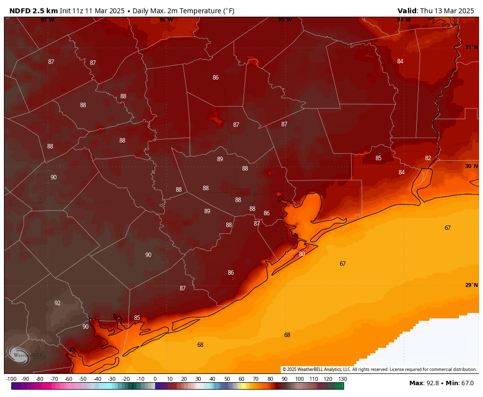
The combination of slightly drier air and warm air advection from the southwest will lead to a very warm day on Thursday, with some parts of the Houston metro area possibly hitting 90 degrees. Most of us should remain in the upper 80s, but it’s going to feel warm regardless, especially for mid-March. Low temperatures on Thursday night will fall into the mid-60s.
Friday
The development of some clouds may help put a lid on temperatures Friday, holding them generally to the mid-80s. But it will still feel rather warm outside, with a fair amount of humidity. A cold front is coming, but it probably will not arrive until early on Saturday, so expect a fairly warm night.
Saturday and Sunday
I don’t expect much in the way of precipitation with the front, perhaps a few light showers, we’ll see. Quickly afterward we should see clearing skies, probably some time on Saturday morning. As a result we’ll be left with clear skies and lower humidity for the remainder of the weekend. Look for highs in the vicinity of 80 degrees and nights around 50 degrees, give or take. Seriously, this will be an exceptional weekend for outdoor activities.
Next week
We should see a gradual warm-up next week through about Wednesday, at which some point some sort of front is likely to trundle through. Whether this brings us any rain is anyone’s guess. I’ll give it a solid maybe.

Starting to get 2011 vibes
Drought hater, wash your mouth out with lifebuoy. 2011 is profanity at its dirtiest around here.
🤣😂
have mercy on us poor gardeners, you’ll frighten us to death! 🤣
Upper 80s has become common in March over the past several years. It is not a rare freak event anymore. We can’t even go through February without hitting the mid to upper 80s anymore in this warming hellscape that is Earth now.
That is true, back in my day March used to still be a fairly cool month with most days in the 60s and 70s with most nights in the 40s and 50s. Now March is just as warm if not warmer than April used to be now.
While it’s currently early March 2025, Houston has seen temperatures reach 88 degrees on March 13, 1942, and March 14, 2008, which are notable high temperatures for that time of year.
Now let’s discuss the extremes March weather can throw Houston’s way: Houston hit 96 degrees on March 30, 1946, so there’s a chance Houston records its first 90-degree day in March.
I remember going to Austin last February, and the wildflowers had already started to bloom on I10, and it was about 78F outside. I guess the norm. It was certainly pretty – but way too early.
Yes, it is too early. We have always had a fluke year here and there of early-season heat, but it seems to have become the norm in recent years. Anytime you get Southwest winds, expect unseasonable heat in the winter and early spring. Sometimes, mid-latitude cyclones pass north of Texas in such a way that the counterclockwise winds flowing around the low steer that hot, dry desert air straight into our region. This is what led to Houston hitting a record high of 91 on February 20th, 1986, and 90 on February 22nd, 1996.
….and the warm air inversion that comes with that such that a rain cap returns. Other than a little frontal activity this weekend it sure seems like the Houston DRY is getting set up. Had to water the fallen-over impatiens this morning. Ha.
Exactly, that is why the spring of 1996 and 2011 were so dry cause we just kept on getting stuck in that cap fed wind pattern ahead of most of the cold fronts. It seems to be a common symptom of La Nina, but it can definitely still happen regardless of the ESNO phase.
I think March is the driest month of the year here, because of the cap. I sure hope it’s just a temporary March thing and it doesn’t keep going throughout the Spring like 2011!!!
The Reverend Horton Heat will bring even more heat to the White Oak Music Hall…….
Now there’s another round of decimation at NOAA, another 10% of jobs to be cut. NOAA has already lost balloon capacity.
With these new cuts, that’s 1 of 4 jobs gone at NOAA.