In brief: Parts of central Houston saw some fairly strong showers and thunderstorms on Tuesday, with a few isolated areas picking up 1 inch, or more, of rain. That pattern of sporadic afternoon storms should occur through Saturday before high pressure asserts a little more control. We also discuss the chances of a tropical system forming in the southern Gulf late this week.
Wednesday
The overall story remains the same for Houston’s weather in the coming days, with hot weather and just enough instability and moisture to support the possibility of scattered showers and isolated thunderstorms. These storms are most likely during the afternoon and evening hours, at a time when kids are coming home from school, participating in after-school activities, or during the evening commute. Today, however, I expect slightly less coverage than we saw on Tuesday. Overall I would say there is about a 30 percent chance of showers, with isolated storms. Highs today will range from the lower 90s near the coast to the upper 90s inland, with plenty of humidity.

One thing that’s been noticeable this summer, to me, is the lighter winds. This is because we have not seen tight pressure gradients (i.e. very strong pressure systems) to really draw in the onshore winds. Today, for example, winds will come from the west at about 5 mph, with only slightly higher gusts. Winds may be a little more pronounced on Friday and Saturday, but overall they look to remain in the 5 to 10 mph range for quite a while.
Thursday and Friday
The forecast remains similar to end the work week, with highs in the 90s. Thursday and Friday may see slightly better rain chances, with 50 percent coverage of showers, and a few embedded thunderstorms. The most likely period for these showers remains the afternoon.
Saturday and Sunday
Saturday should see a continuation of this pattern, with highs in the mid-90s for most locations and a healthy chance of showers and thunderstorms. As high pressure starts to build some, I think most of Houston may push into the upper 90s on Sunday, with decreased (but non-zero, to be clear) rain chances. All in all this should be one of our hottest weekends of the year, which is to be expected in mid-August.
Next week
Temperatures for most of next week look hot, in the mid- to upper-90s, with lots of sunshine. I think rain chances will take a step back toward the 20 to 30 percent daily range. So yeah, full-on summer for Houston.

The tropics come alive
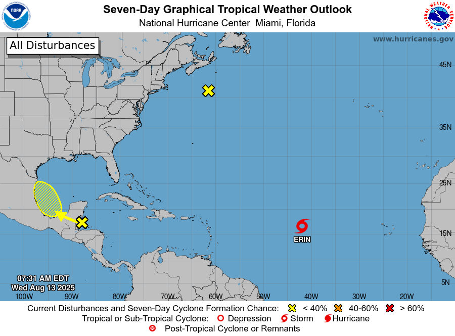
In the Atlantic Tropical Storm Erin continues to struggle with the intrusion of some drier air, but should soon move into more favorable conditions. A hurricane is likely to form later this week, or this weekend. The majority of modeling still shows the system turning before threatening the United States, but Bermuda is definitely at risk.

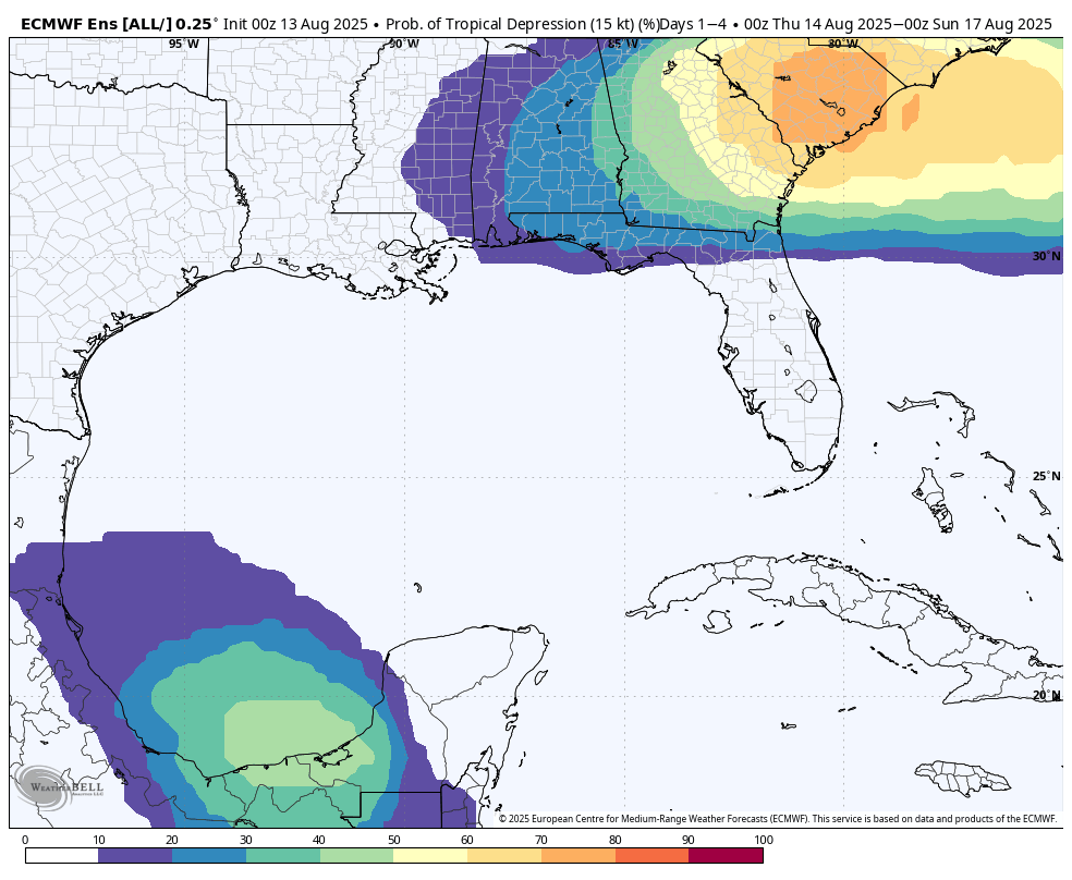
Additionally the National Hurricane Center is tracking a low pressure system that should emerge into the Bay of Campeche on Thursday or so. There is a slight chance of some development over the southern Gulf, and you always want to keep an eye on anything in that region in August. However, none of the models are particularly excited about this tropical low, and the atmospheric conditions are not super supportive. So, at this point, the most likely scenario is that the low has minimal to no impact on our weather. We’ll see.
