In brief: It should be pretty hot in Greater Houston today, as humidity drops and the sun comes out. More warm weather continues into next week. We may also finally see some legitimate rain chances in the forecast by late next week or weekend. Details are TBD, but the signals for unsettled weather are there.
Updated 2/27 11:10 AM…see editor’s note below.
Houston failed to hit record highs Thursday, but as Eric noted in the morning, despite the clouds, we still managed another 80-degree day, with 83 for a high yesterday. That was our 14th 80 degree day of meteorological winter, which puts us in 5th place all time for most wintertime 80s behind 2021, 2025, 2017, and 1911. We tied with 2012. We will probably finish with 16 total this winter, putting us in a tie with 1911 for 4th place. More 80s to come.
Editor’s Note: Thank you to astute reader JFS in the comments. 2025-26 actually holds the record for most 80 degree days in a winter, and it’s not quite close. Matt made the mistake of lumping December 2026 (which has not happened yet) with January and February 2026, instead of using December 2025. Foolish math error, and I apologize.
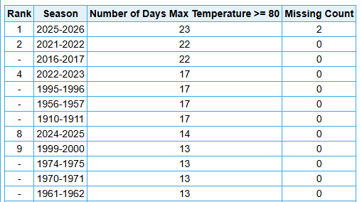
2025-26 should finish at 25 80 degrees days, besting the 2021-22 and 2016-17 record of 22. Yes, this was a historically warm winter in Houston.
Today through Sunday
We have some patchy fog around the area this morning, but rest assured, humidity is going to tumble after about 9 to 10 AM. With increasing sunshine, that should allow temperatures to launch into the mid-80s this afternoon. I would not be shocked to see us bust hotter than forecast in some spots, with enough sunshine.
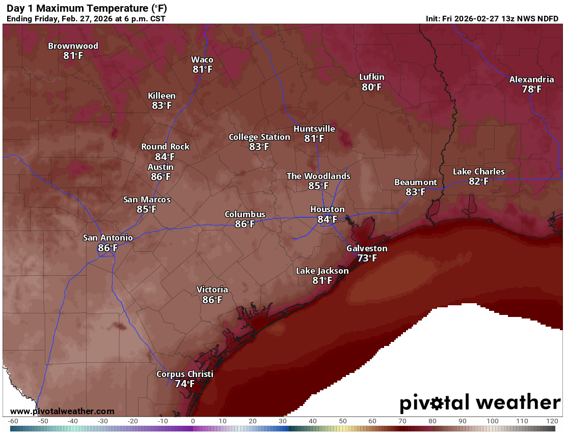
As we go into Saturday and Sunday, the song remains mostly the same: Some morning clouds, afternoon sun, and highs generally in the low to mid-80s. It will be breezy each afternoon, with some gusts up to 20 or 25 mph possible. Humidity will creep back up as well.
Monday through Wednesday
Things look repetitive on Monday and Tuesday with more of the same. By the time we get to Wednesday, we are going to begin to see a change in the weather pattern over the southern Plains. This will introduce at least a chance of showers or thunderstorms to the forecast on Wednesday afternoon, though it’s too far out to be too confident in anything specific right now.
Later next week
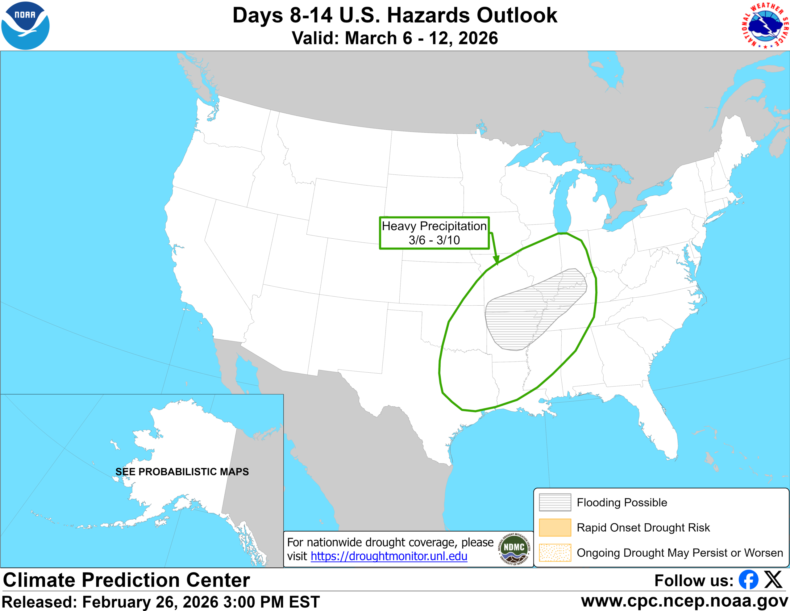
This change in the pattern is expected to have some legs late next week. The Climate Prediction Center’s hazards outlook for days 8 to 14 does highlight East Texas for heavy rain risk on March 6th through the 10th.
I’ve been following this for the last few days, trying to get a sense of how “real” a change this is, or if it’s the modeling bluffing. One fail mode in these situations is where all the rain ends up from northeast Texas into the Ohio Valley and we get maybe one or two bursts, an inch or two, and that’s it. That may happen here too, but there is pretty good across the board model agreement on at least unsettled weather for southeast Texas.
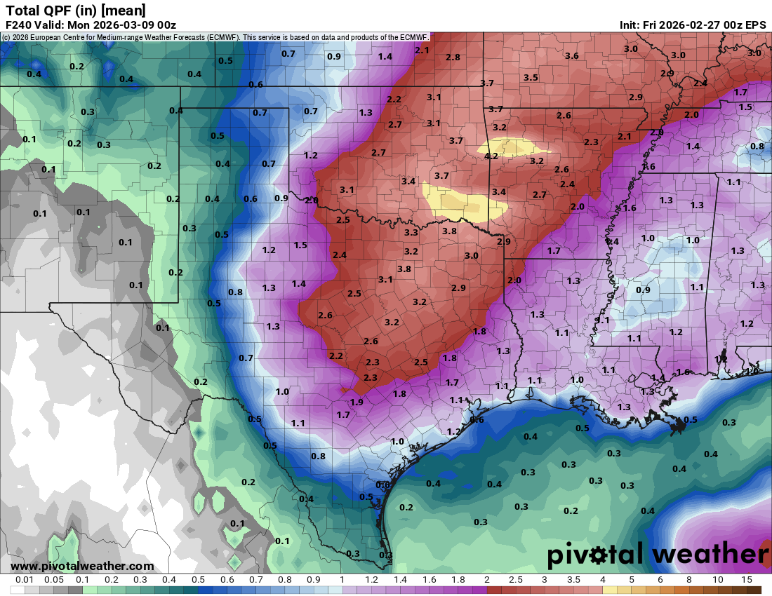
I do think the heavier rain risk is probably in that northeast Texas belt from roughly Waco through Texarkana right now, but either way, we should get at least one or two periods of rain and thunderstorms beginning later next week and into the weekend in our area too. Whether it’s enough to truly dent the drought, we shall see.
