In brief: The overall forecast has not changed much, with warm weather persisting through Saturday afternoon before a cool front arrives. Also, we’re welcoming your ideas to improve Space City Weather!
How would you improve us?
The brain trust of Space City Weather will be meeting at an undisclosed location tonight (hint, they serve good pizza) in Houston to discuss our plans for the coming year, and also future directions of the site. No, we’re not planning to change any of fundamental parts of what we do here (such as no-hype forecasts and dad humor). But we are always looking for better ways to meet our readers where they are, and ensuring we’re getting the most reliable information to the broadest audience for free. So if you have any ideas you think would improve Space City Weather, from how we distribute our content to the content itself, leave suggestions in the comments below or use the contact button.
Thursday and Friday
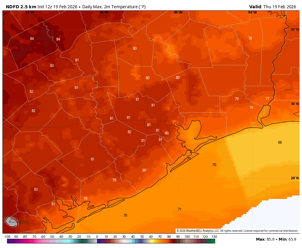
The overall forecast has not changed much. Today and Friday will bring partly to mostly cloudy skies, with muggy air, and high temperatures ranging from the upper 70s to lower 80s. A few days ago it looked like we might hit the mid-80s this week, but we are likely to be spared from that by more clouds than previously anticipated. Nights will still be exceptionally warm for this time of year, however (our lows in the mid- to upper 60s will fall just a couple of degree below record high minimums of 69 degrees). There also will be a slight chance of showers today, but anything that reaches the ground will probably be misty or light, so don’t expect anything in the way of accumulations.
Saturday
This will be another warm and humid day, with a chance of light mist or showers as temperatures push up to around 80 degrees (or a bit above). A front will arrive during the afternoon hours, with drier and cooler air moving in at some point on Saturday evening. I don’t anticipate any showers or storms with the frontal passage. Lows will drop into the upper 40s by Sunday morning as skies clear out.
Sunday and Monday
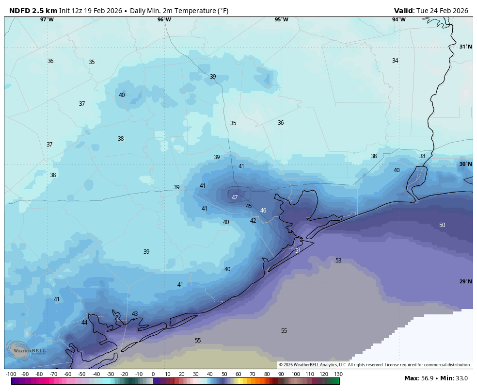
Winter’s back! These will be cooler days with highs probably in the 60 to 65 degree range along with sunny skies. Sunday will be breezy, but I expect winds to settle down by Sunday evening. Sunday and Monday nights will definitely be on the chilly side. I expect lows of around 40 degrees in Houston, with slightly cooler conditions for inland areas. However I expect the region to remain above freezing, if only a few degrees in the cold spots such as Conroe.
Next week
Tuesday’s highs may be in the 60s, but by Wednesday we’ll be on a distinct warming trend, with highs in the 80s likely for the rest of the work week. Some sort of front may arrive by next weekend, we’ll see.
