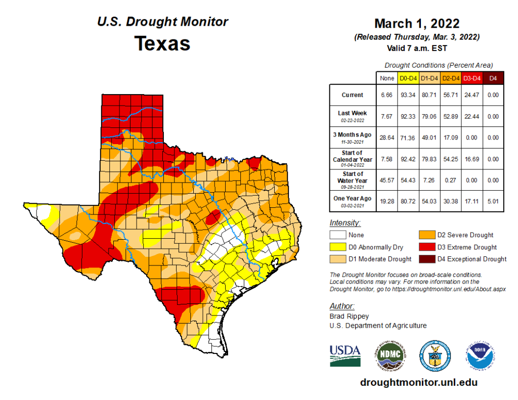
I’m going to open today’s post with a few comments about drought that’s been developing or festering across Texas. The updated Drought Monitor data came out yesterday, showing almost 57 percent of Texas in severe drought or worse.

Three months ago, less than 20 percent of Texas was in drought that excessive. We did see some improvement in early February across the state, but things have turned back worse again. Locally, things are not too bad just yet, with mostly the outskirts of Greater Houston even classified in drought at all. But rainfall is expected to average at or below normal the next 2 weeks, so this story will be one to watch in the weeks ahead. We are still technically in a La Niña (cool tropical Pacific Ocean), which tends to favor drier weather in Texas. As that has been in place over the last year or two, we’ve managed to get bailed out before things got too severe. We will see if we can pull that off again this spring.
Friday
As temperatures warm up and humidity gradually flows back into the Houston area, we continue to see some patchy fog in the area.
The rest of the morning will see gradual clearing, though Galveston and the Bay Area could see fog emerge at any point today. Otherwise, expect partly sunny skies and temperatures making a run toward the upper-70s. A few locations could even eclipse 80 degrees. There will be a noticeable southeast breeze through the day.
It’s Ricky Martin’s turn at the Houston Livestock Show & Rodeo tonight, and if you’re going, you’ll be livin’ la vida buena. Look for temperatures around 70 degrees initially, only dropping into the mid-60s after the show. No weather woes are expected, though there will be that fairly steady southeast breeze.
Weekend
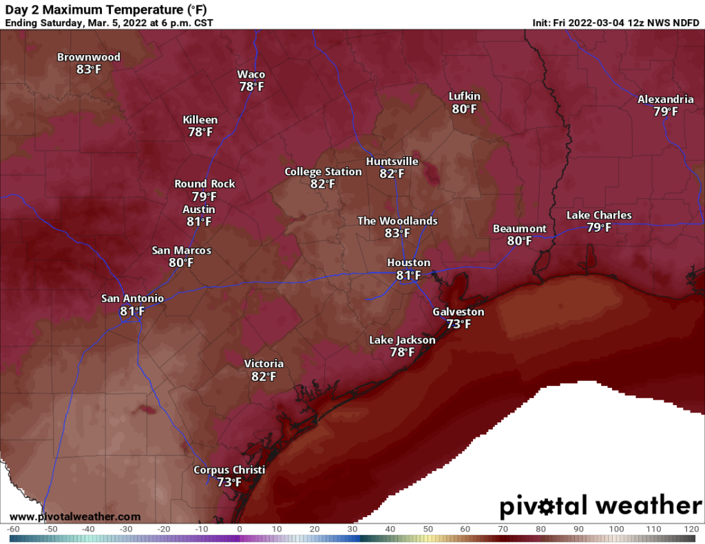
This weekend will see fairly similar weather on both days: Fog, clouds, some sun, a gusty southeasterly breeze, warm temperatures, and higher humidity. Fog will be a little tougher to pinpoint due to the winds, but at times, we’ll likely see some fog along the coast and near the bays, especially in the morning. By afternoon, virtually everyone should just see clouds and sun. Look for highs in the 80s.

Morning lows will generally be in the 60s. Any rain chances this weekend are likely to be limited to a few showers or some sprinkles, nothing that should interfere with any plans you may have.
Monday
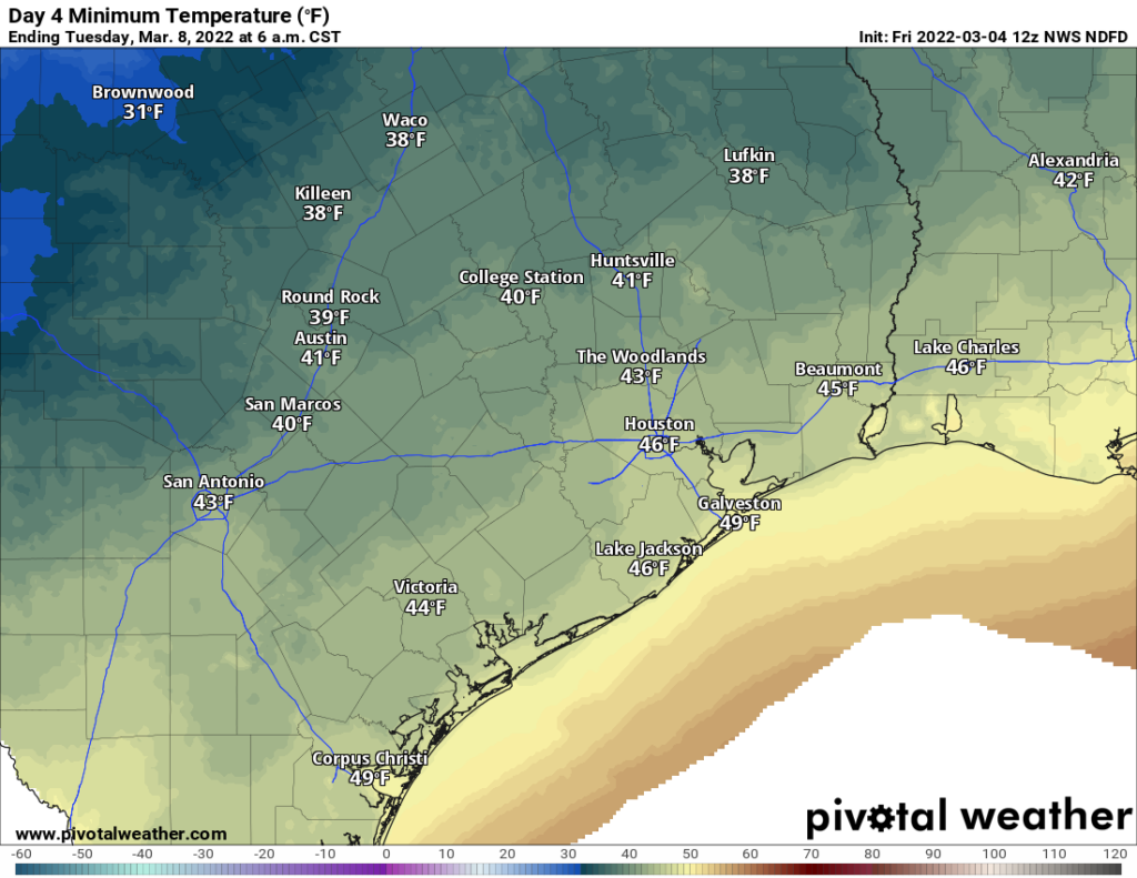
Our next cold front will likely cross the region on Monday morning or afternoon. I would expect at least a broken line of showers and thunderstorms as it pushes through, which should give many of us some rain. Behind the front, temperatures should drop from the 70s into the 60s or 50s. We may warm up with some clearing in the afternoon, as well as drier air. But then look for 40s by Tuesday morning.

Rest of next week
The forecast gets a little trickier after Monday with a couple quick moving systems and cold fronts in the offing. This should allow us to have a generally cooler week but perhaps an unsettled one as well. We’ll fine tune the details on that for you on Monday.

I do not mind some rain. God knows we need it around here where I live. It is starting to get quite dried out. But what I do not like are the winds that we have had this year and last, associated with these “cold fronts.” Feels like the world is getting blown away. Also the number of cold fronts that we are getting this year. My brother lives in Evergreen, CO. He has same complaint. Hurricane level winds blowing down from the N and NW. And very little snow to go with their storms the past two years as well.
Gotta love climate change. It is real folks……