In brief: Today’s post discusses the ‘why’ of yet another weak front on the way for Houston this weekend, and the potential for some healthy rain chances on Friday night and Saturday morning as it pushes into the region. Sunday and the first half of next week should bring fair weather before another, stronger front likely arrives about a week from now.
Why have we been getting weak fronts?
So far this fall we’ve yet to really get a strong cold front, which brings in a concerted push of colder and drier air down from the north and northwest. I call these “in-your-face” fronts, which you can literally stand outside and feel as they move in. One of the reasons for the lack of these fronts is that the overall pattern has favored glancing blows, which bring in more Pacific air rather than dragging colder Canadian air down into the region.
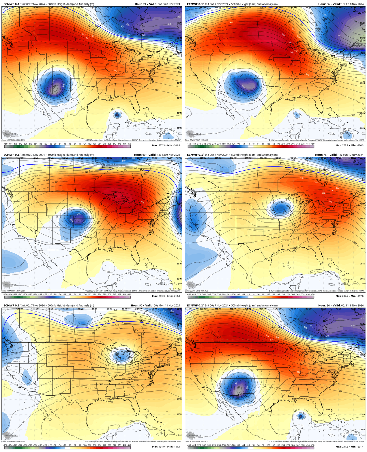
The GIF image below showcases what will happen this weekend, when a very weak front arrives. The dark blue area over New Mexico is the low-pressure system in the upper level of the atmosphere what will drive the front. Instead of moving due west, it instead goes across the Midwest of the United States and ends up in Michigan by Sunday. This we are getting the tail end of the front’s energy, rather than its full impact. And this translates into a weak push of cooler and drier air.

Thursday
“Low” temperatures this morning across the Houston area are generally in the mid- to upper-70s, which are running nearly 20 degrees above normal. This is because the earlier week front that moved offshore has moved back onshore as a warm front, so we’re feeling the influence of the Gulf of Mexico. We saw some light, patchy showers overnight, but most of today should be rain-free, with partly sunny skies. Expect high temperatures in the low- to mid-80s. Winds will be light, generally from the east, at 5 to 10 mph. Lows tonight will drop into the mid-70s.
Friday
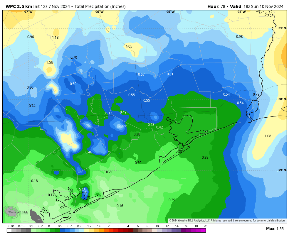
This will be another warm, and humid day. However, skies will be mostly cloudy, and we’ll see increasing rain chances during the afternoon hours. As a front approaches, and meshes with ample moisture in the atmosphere, we’ll see very healthy rain chances on Friday night into Saturday. We don’t anticipate any flooding, but if you have plans to be out and about on Friday evening or night, be prepared for the possibility of getting splashed on. Friday night will be warm and humid as well.
Saturday
As a weak front moves into the region, we’ll continue to see fairly decent rain chances on Saturday morning, probably about 50 percent area wide. With mostly cloudy skies, we can probably expect to see high temperatures in the upper 70s, with shower activity waning during the afternoon and evening hours—but we cannot rule out some isolated showers during this time period. Lows on Saturday night should get down to about 70 degrees.

Sunday
We should finally see a little (emphasis on little) bit of drier air on Sunday, but there’s still the potential for some isolated showers during the morning hours at least. Expect partly sunny skies during the afternoon hours, with high temperatures in the vicinity of 80 degrees. Lows on Sunday night should get into the 60s for most of Houston, which is probably about as best we can do with a dying front like this.
Next week
The first half of next week should see mostly sunny skies, with days in the mid-80s and nights in the upper-60s for the most part. Humidity will be present, but not excessive with slightly lower dewpoints. A stronger front looks likely to move in by Wednesday or so, but we’ll have to wait for the finer details with how cool things get. I’m hoping for some nights in the 50s, which is normal for this time of year.

Tropics
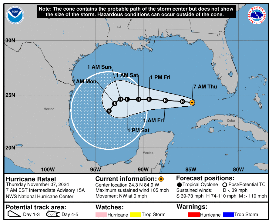
Hurricane Rafael crossed Cuba into the Gulf of Mexico on Wednesday, and it is now moving toward the central Gulf of Mexico. Eventually it is likely to be rebuffed by high pressure and steered southward toward Mexico. As we’ve been saying for some time, this system is of no real concern to Texas.

If schedules permit, it sounds like those of use training for the marathon would be better suited to long run on Sunday instead of Saturday?
Could we get our warmest November if we don’t get nights below 50s soon enough?
It is highly possible if we don’t see a sharp pattern change over the 2nd half of the month. The warmest November on record in Houston was in 1965. We had 11 80+ degree days that month with most nights only in the 60s.
We are in a very similar pattern this November except we are currently warmer than that Novemebr was.
Yesterday’s map (on a different website) showed it heading towards LA and AL. What is going on???
See the front above that’s moving to the ENE instead of EAST. The high behind it is expected to push Rafael towards the SW Gulf
Can we do anything to get a cool front? Are space lasers available? Can we request HAARP do something?! Something?? I kid but this non-fall is not cool.
Thanks Eric. I know you don’t like being the messenger.
We can get deeper into November, which should help. We’ll have a winter forecast out on Friday, actually.
I’ll give you like $50 if you make it cold with your magic weather wand.
I’ve got like $3.50 to add
Thanks for the consistently informative posts! I have a question: At what point in the year does the surface temperature of the Gulf start dropping and what temp does it get down to? Thanks!
The link below should help. For monthly water temp data, go to the bottom of the page:
https://seatemperature.net/current/united-states/galveston-texas-united-states-sea-temperature
Will it ever get cold? I’m 7 months pregnant and looking for relief via fall/winter and the joy that comes with that.
Maybe next week we get a stronger front front, but too early to confirm
I really really hope this comes to be, but lately these stronger fronts in the extended forecasts have become the carrot in front of the donkey. It’s the same thing every week with temps plummeting in 7 days, and the next day it’s still 7 days out, and so on. Thankfully, I’ve learned one of Eric’s golden rules – anything forecasted more than a few days out should be taken with a grain of salt.
You can have the feet of snow where getting here in New Mexico.
Please send it over!
It will definitely get cold eventually. It may not get cold very much this winter, but it still will get cold at times. Even during our warmest winter on record in 2016-2017 we had a handful of very cold days.
I’m just really ready to be done with lows in the 70’s, especially these ridiculous mid 70’s
Why did the forecast change from north into LA to west toward Mexico?
Go read the “theeyewall dot com” … explanation is there.
“ Tropics
Hurricane Rafael crossed Cuba into the Gulf of Mexico on Wednesday, and it is now moving toward the central Gulf of Mexico. Eventually it is likely to be rebuffed by high pressure and steered southward toward Mexico…….”. — Space City Weather
“ Tropics
Hurricane Rafael crossed Cuba into the Gulf of Mexico on Wednesday, and it is now moving toward the central Gulf of Mexico. Eventually it is likely to be rebuffed by high pressure and steered southward toward Mexico………” — Space City Weather
Is there an echo in here?? 🙂
It is quite clear the planet is on an uncontrollable drive to a hotter climate and we should all be prepared for a completely different world than we have hitherto been used to. This today on the BC site:
‘It is now “virtually certain” that 2024 – a year punctuated by intense heatwaves and deadly storms – will be the world’s warmest on record, according to projections by the European climate service.”
We are leaving a very perilous world for our children to inhabit.
We need to export this heat to Mars and start terraforming it.
Doom alert:
It’s warmer by 2 degf since 1980 when almost all the warming began. We know this fact by reliable instrumentation. Ice will melt, albeit slowly. Say 1” per decade sea level rise. Plenty of time to move or sell the beach house. More atmospheric water – get flood insurance. Even the mountains have valleys. Where there is drought, somewhere else is getting a lot of rain. We know this. Tax policy or deficit spending (likely the latter) that is “doing something about it now” is what is scary. Don’t know if you’re in that camp. The engineering world knows the tech right now is inadequate. Li battery cars, massive wind, and solar projects aren’t in it. Wait for fusion power which will, by economic course, dial down carbon burn. Bigger badder storms are only models. Leave the spending available for amelioration of those without resources.
I’m willing to ditch my car, not fly anymore nor take any cruises. I’ll ride my bike or walk everywhere. Anybody else with me?
It was downright gross outside this morning
I hope this Christmas isn’t 84 degrees and humid like a couple of years ago. That’s definitely a bummer.
Oh, BTW, Beryl was supposed to hit MExico, too.
Meanwhile, it’s snowing in the panhandle of Texas while we are stuck in the sauna.