In brief: Houston is continuing to see exceptionally warm weather this week, and we’ll also experience ongoing windy conditions. There will be a very slight chance of storms north of the region today and Friday, and the risk of more widespread severe weather on Saturday. Afterwards conditions appear to be gorgeous next week.
Thursday
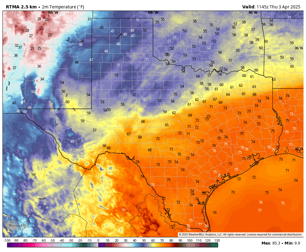
Temperatures continue to be very warm this morning across the Houston region. The normal low for the city, on April 3, is 57 degrees. Yesterday, the minimum temperature at Bush Intercontinental Airport only reached 76 degrees, which smashed the previous record for high minimum temperature of 72 degrees for the day. We’re likely to set a similar record today.

A robust southwesterly flow in the atmosphere will continue to funnel warm air into the region today and Friday. This will help push temperatures up to around 90 degrees for most of Houston today even though skies are likely to remain partly to mostly cloudy. For April, that’s impressive heating without lots of direct sunshine.
The other factor in our weather will be the presence of a frontal boundary just to the north of the Houston area. This will do a couple of things. First, it will support strong southerly winds, at about 15 mph with gusts up to 30 or 35 mph. And secondly, for northern areas (probably along and north of Highway 105) it will produce a slight chance of storms. Down in the Houston metro area we cannot rule out some sprinkles, but we should remain dry for the most part. (By the way, this storm risk is historically high in the Mid-South, and you can find more information about this on The Eyewall). Expect another very warm night in the mid-70s.
Friday
We should see similar conditions on Friday, albeit with a slightly higher chance of showers in the Houston area, and thunderstorms for locations in Montgomery County and points north. Temperatures likely will be in the upper 80s for most of the Houston area.

Saturday
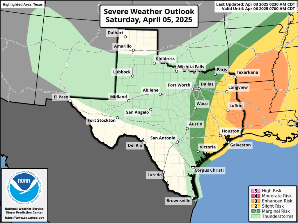
I’ve had a ton of questions about weddings and various outdoor activities on Saturday, due to the timing of the front, winds, and potential for thunderstorms. We’re just now coming into the range of high-resolution models, so we should start to get better details over the next 12 to 24 hours. What we know is that a front will push into Houston on Saturday, likely reaching the urban core of the city by around noon, and pushing off the coast afterward. The entire area faces a slight risk of severe weather during this frontal passage, with the usual threats of wind, hail, and possibly a tornado. At this time, it looks like the period of most concern for storms will be from mid-morning to the early evening in Houston. We should be able to nail this down more in Friday’s post. Highs on Saturday will be in the mid-80s with plenty of humidity ahead of the front before temperatures drop to around 50 degrees by Sunday morning.
Sunday
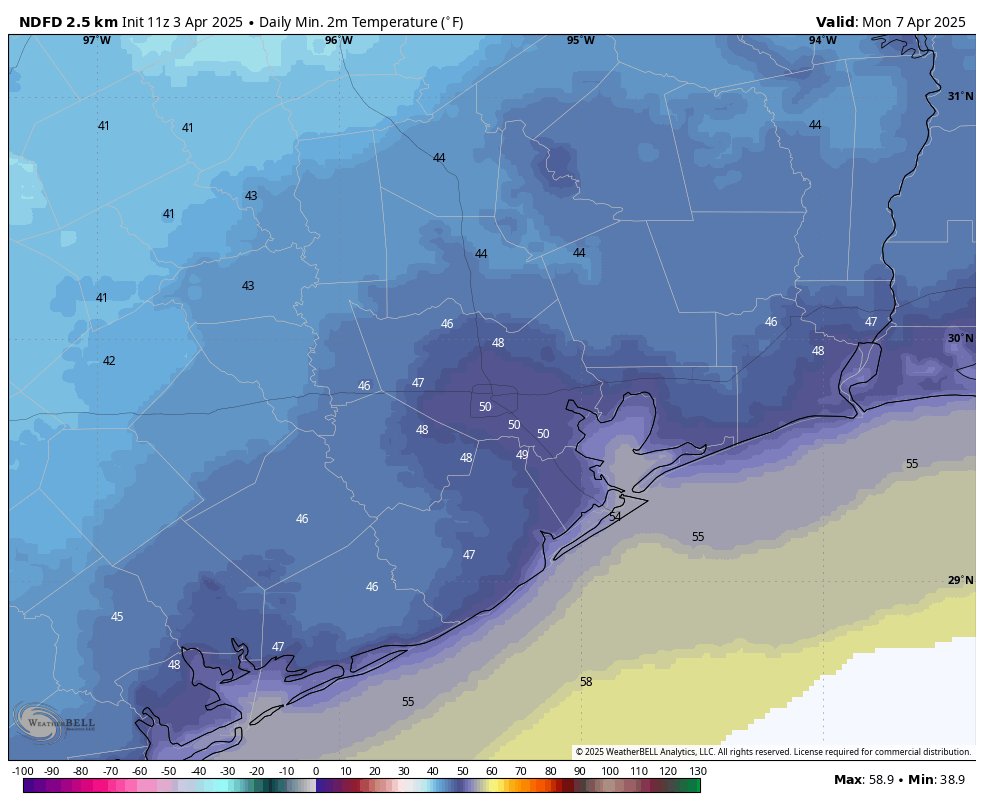
I expect rains to end at some point on Saturday night, but we cannot entirely rule out a few showers on Sunday morning. But skies should be clearing, and there will be plenty of drier air. Expect highs in the mid-60s, if you can believe it. It will be a bit breezy, with northerly winds of 15 mph or so, and higher gusts. These winds should die down by Sunday night, as lows drop into the upper 40s for much of the region.

Next week
Highs remain in the 70s, and lows in the 50s, through at least Wednesday of next week. Although the temperatures likely climb back into the 80s toward the end of the week, the air still looks reasonably dry. In short, it should be a splendid, spring-like week.

Despite all of the rain across Texas last week, the drought monitor map for the state doesn’t look that different. No wonder there’s a widespread feeling the drought picture is cooked.
What’s being “cooked”? My SIL lives in the Hill Country and she says it’s bad.
‘cooked’ in today’s slang means broken or not working; Scott was saying that there is a widespread feeling that the drought picture is inaccurate.
“It is a regular spring rain, such as I remember walking in,—windy but warm.” – Henry David Thoreau
I will take warm and windy…
Ok, Glenn, time to share the leprechaun juice you sip in the mornings – I want some
Will “points north” be stormy on Saturday too? We are part of an outdoor event in Kingwood on Saturday
Running has been ridiculous – for April – the past few days. This morning at 5 a.m. it was 77 with a 72 dew point. That’s July type stuff. Not looking great for Bellaire Trolley Run Saturday morning. Hopefully we can sneak it in before the t-storms arrive. Great news for those running the Art Car Run on Sunday as they will enjoy temps 20 degrees cooler. 🙁
I agree with your comment – this weather is way too balmy for early April.
The last thing this place needs is more hot and humid days. My electric REP loves the added use of my air conditioner though.
This because the Gulf is much warmer than it used to be thanks to two very controversial words. The waters are evaporating more moisture, leading to hotter and more muggy air in-between the cool fronts.
Any risk of my 9:45AM flight out of IAH getting cancelled or delayed?
I read today that there are expectations of further cuts to NOAA, that extra approvals will be needed for things like Hurricane Hunter contracts and the dropsondes they use during hurricane season.
That they are discussing even further cuts & staffing reductions, along with implementing a restructuring of the EMC (Environmental Modeling Center) that oversees the maintenance and functioning of all major US weather modeling.
This is what we’re facing going into the new hurricane season on June 1st.