In brief: Another possible hard freeze awaits Houston on Sunday morning with colder air starting once more today. Remember your plants, pets, pipes, and neighbors. However, it does look like we swing back warmer next week for a time before our next chance of rain around midweek.
If you enjoyed the cold temperatures earlier this week, we have good news for you. If you hate the cold, we also have good news for you. Let’s just call it a good news Friday!
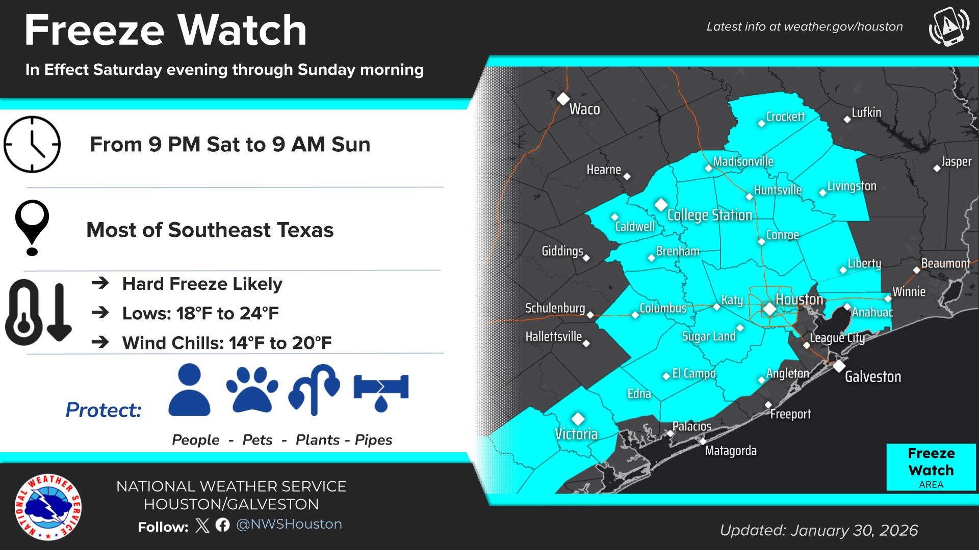
Basic cold weather preps again this weekend
We tend to treat the cold with some cheekiness, but it’s obviously always serious business here in Texas when it gets this cold. Saturday night and Sunday morning is the timeframe you want to really take some precautions on the extra sensitive plants, keep the pipes wrapped, and absolutely bring the pets inside.
Today
This morning may see some mixed sun and clouds before we likely go mainly cloudy for the afternoon. There is a chance that we’ll see the back edge of the clouds begin to push through the region by late afternoon and evening, followed by a clear and colder overnight. Highs will be in the 50s today as long as we get some breaks in the clouds or maybe they aren’t super thick. Otherwise, we’ll say upper-40s to low-50s.
Saturday
With clear skies will come colder temperatures tonight. Lows will be in the 30s with a light freeze possible outside the 610 Loop. Temps may dip into the 20s in some far-flung rural areas in Liberty, Walker, northern Waller, Austin, or Colorado Counties. A cold weather advisory has been posted for the entire area for Saturday morning.
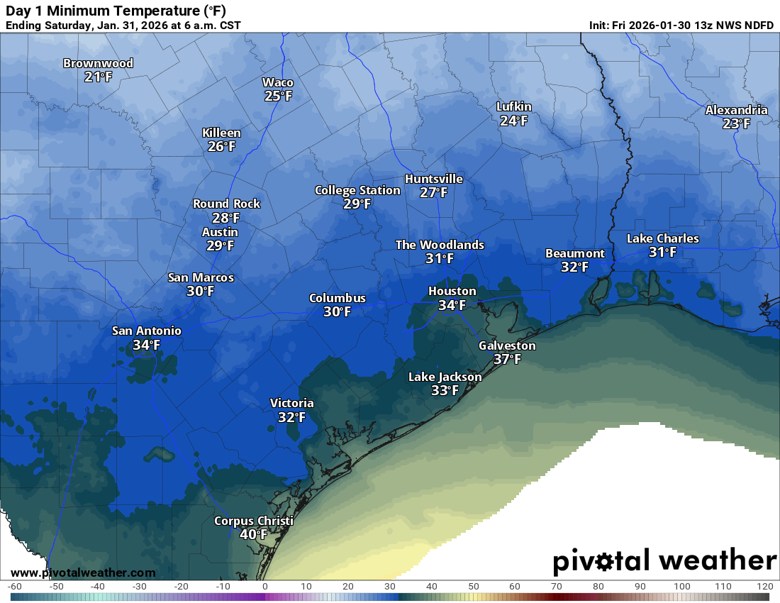
Saturday itself should be a blustery but nice winter day with sunshine and highs in the 40s. The wind will make it feel more like the 30s however, even with the sunshine.
Sunday
We would advise cold weather preparations, which most of you already implemented this week anyway to continue on Sunday morning. Lows should drop into the 20s area wide.
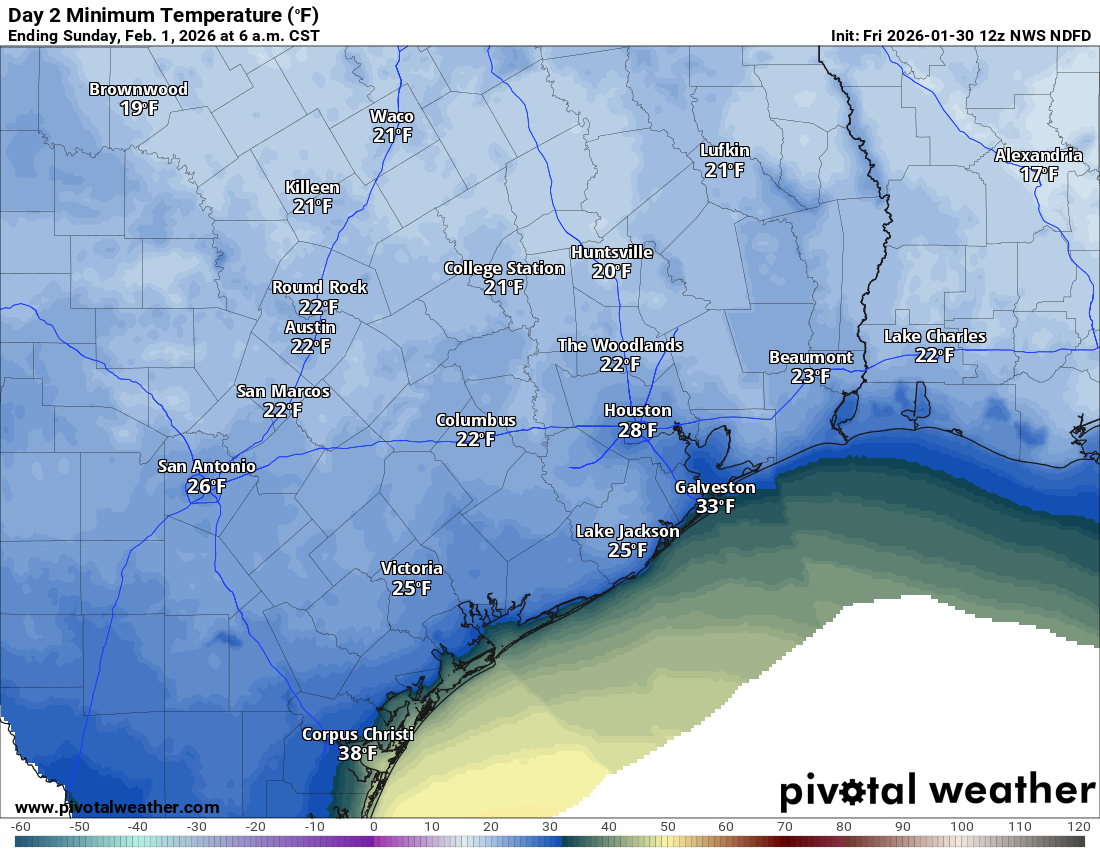
A few locations may even dip into the teens in rural or sheltered spots. There is even some chance that a few places in the area check in as cold on Sunday morning than they did at the peak of the cold earlier this week. Coastal areas will drop to near freezing. A freeze watch is in effect.
The rest of Sunday looks glorious with sunshine, lighter winds, and highs in the 50s. Just an absolutely picture-perfect winter day.
Next week
We should continue the warming trend Monday with sunshine and highs in the 60s. A few freezing temps are possible in outlying areas one last time Monday morning, with 30s or low 40s elsewhere. Tuesday should be even warmer with highs near 70 degrees and lows in the 40s and 50s. The forecast looks a smidge trickier later next week with a chance of showers or storms and a cold front either later Tuesday or Wednesday, followed by more seasonably cold air than the unseasonable cold we saw this week to close out the first week of February.
