In brief: The overall track forecast for Francine remains more or less the same, with the storm very likely to remain off the coast of Texas, and strike southwestern or south central Louisiana on Wednesday. This post discusses the impacts to Houston, and answers some of the burning questions we’ve received about Francine, including “western” shifts and such.
Francine status
Francine’s intensity remains just below hurricane strength, with 65 mph sustained winds, at 10 pm CT. The storm is moving to the north-northwest at about 5 mph, according to the National Hurricane Center, and it soon should begin a turn to the north, and then the northeast.
Track and intensity outlook
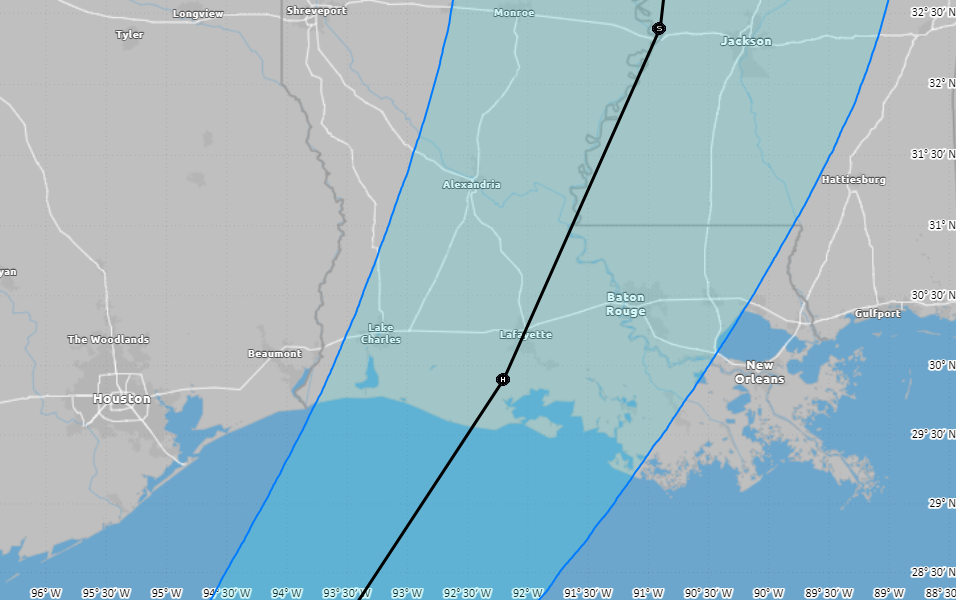
The National Hurricane Center track forecast has not changed much since this afternoon, aside from a slight eastward shift. At this time the entire state of Texas is now outside the cone of uncertainty. The storm’s forward motion on Tuesday night and Wednesday is now expected to be a little faster than normal, so Francine could reach the Louisiana coast as early as the afternoon hours on Wednesday. For more information on impacts to Louisiana, which could be severe, please check out our companion site The Eyewall.
Houston impacts
There is not much change in outlook. We could see some showers and thunderstorms moving into Houston tomorrow by or before noon from the Gulf of Mexico. Frankly, these storms don’t look too organized or problematic. Areas nearer to the coast are more likely to see rain, with the potential for 1 to 3 inches, and possibly a few higher bullseyes. Further inland, showers will be hit or miss. Scattered rain shower chances will persist overnight and through much of Wednesday, but this does not look to be a washout for anyone.
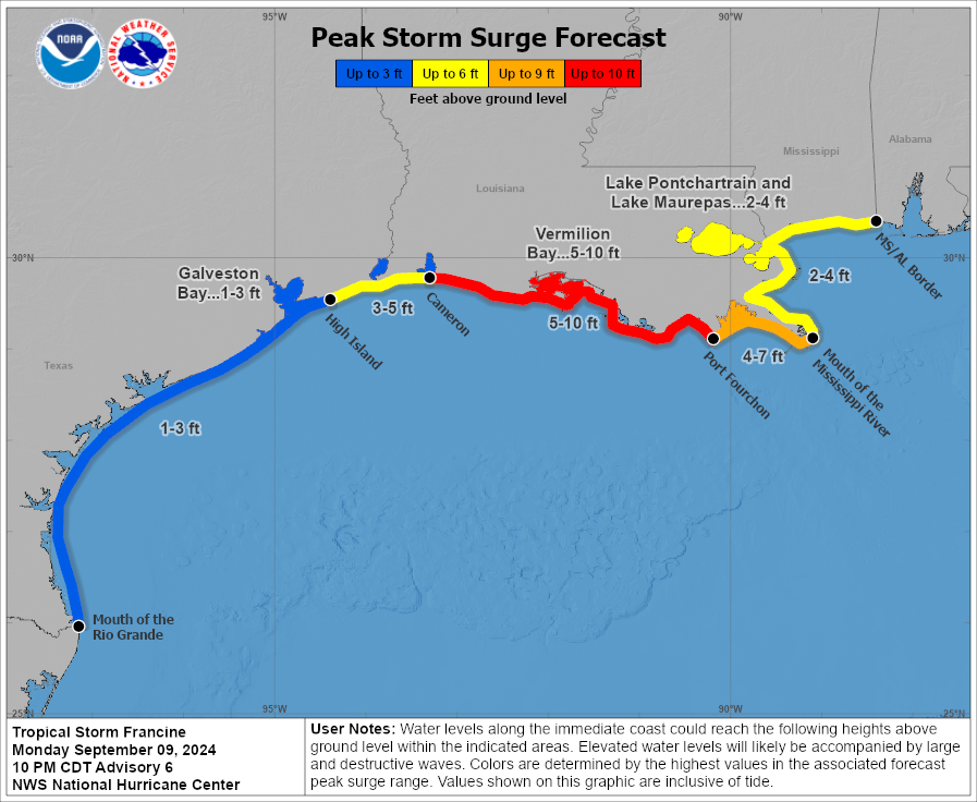
In terms of winds, there probably won’t be much to worry about in the city of Houston. Down closer to the coast we could see some sustained winds of 30 or 35 mph, with higher gusts, but that probably is the worst case scenario. The strongest winds will likely push through on Tuesday night. Seas should be 1 to 3 feet above normal along Galveston Island and Bolivar Peninsula, and a bit higher further to the east toward Cameron, Louisiana.
Why is this not a repeat of Beryl?
A lot of people have asked in the comments, and via email, why we’re confident that Francine is going to turn away from Houston. After all, the forecasts were wrong for Beryl, so why not now? There are a couple of answers to this. First of all, the Beryl track errors occurred about four to five days before landfall. We’re now less than two days from Francine making landfall in Louisiana. So confidence is naturally higher with a near-term forecast.
The second reason is that our modeling guidance has been very consistent over the last 24 to 48 hours, and in some cases significantly longer. Whereas there were some outlier model solutions with Beryl that indicated a Houston strike was possible, virtually every model we are looking at indicates that Francine will pass well offshore the Texas coast, and eventually make a landfall in Louisiana. This is a remarkable consensus, and when you have a consensus in a near-term forecast, your confidence is very high.
With that said, I get that the PTSD from Beryl is very real. Some forecasters, including this site, definitely made some errors with that hurricane. We try to learn from every storm. Most importantly, we want to make sure we have your trust, so that you’ll trust us when we say a storm like Francine is almost certainly going to be fine for Houston.
What about that western wobble earlier Monday?
There was a lot of brouhaha this afternoon about Francine shifting west, and the center wobbling west, and all manner of talk about how the Texas coast was suddenly at risk for serious impacts from this storm. All of this because the National Hurricane Center nudged the official track about 10 to 15 miles westward—a nudge that was more or less meaningless when it comes to Texas impacts.
In fact, as of 10 pm the track shifted back east some, completely erasing the much heralded western “shift” noted earlier today. The bottom line, don’t buy the hype.
Are you guys really sure that Francine isn’t coming to Texas?
We’re sure there are many people named Francine who are coming to Texas in the near future, and we should welcome them with open arms and warm hearts. But yes, we’re pretty darn confident that Francine the named storm is not coming to Texas this week. I mean, there’s a very slim chance it could come ashore in the Beaumont-Port Arthur area, but very likely not.
Really, really sure?
Yes.
But just to be sure, when’s your next update?
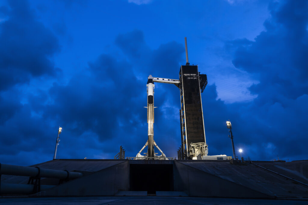
Well, I’ve got to stay up to cover the Polaris Dawn launch tonight at 2:38 am CT from Florida. There are four great people launching into space on a Crew Dragon vehicle, and I consider some of them my friends. So I want to see them safely into space. But I aim to have tomorrow’s update posted no later than 7:30 am CT. Wish me luck, y’all!

Everything I read says that as a storm strengthens, its track tends to straighten out. Clearly Francine is strengthening faster than most forecasts. So it follows that it should also take a more northerly track. Right int o Houston. Tell me I’m wrong. Please.
You’re wrong. Have a good night.
Hmmm. Strong-wider hurricanes maybe are affected by more distant forces, they touch them more, so seems the smaller = straighter if anything. Except for turning rightward as head north all else is tricky (due to earth narrowering as head to poles so Coriolis Effect means all else equal a northern going mass of air will drift right). Too many factors for me to compute, trust the models, though post 2000 the sample size of hurricanes is still low for models to know it all (300 named storms?))..
Comments like this are exactly why people who have zero experience or training are causing panic all over social media like Facebook and reddit. The amount of unnecessary panic and blatantly wrong info I’ve seen spread on social media these past couple of days is mind boggling. Just leave it to the experts and stop playing armchair meteorologists.
Ken, not only are you wrong, what you’ve just said is one of the most insanely idiotic things I have ever heard, I pray God have mercy on your soul.
My Mama says that alligators are ornery because they got all them teeth and no toothbrush.
Very much appreciated. Enjoy your busy evening
You’re the only one i trust!! THANK YOU
Good luck and hoping for a safe launch! 🚀
Great post! Nailed it 🔨
What are the expectations regarding the water surge inside Galveston bay and Clearlake?
1-3 feet, so not really impactful.
Some news stations in Houston are going feral over Francine, with blatant fear mongering and preying off of Beryl PTSD. Thanks for keeping a level head at SCW!
You mean ABC 13?
Thank you, Eric! Good luck tonight! Safe travels for your friend!
Good luck and safe travels to your space buddies
Thanks so much for frequent reassuring reports.
Instructions unclear, evacuated Katy.
Probably for the best!
That used to be so funny when I lived in Houston during Ike. Guess where I live now? :-/
Think it will affect air travel in and out of hobby on Wednesday afternoon
No.
I don’t think I’ve ever seen an eye wobble dramatically affect the track of a tropical system. They’re actually fairly common when the eye is reforming or if the system is in the process of getting its act together.
Glad to miss you, Francine!
Go Crew Dragon and Polaris Dawn!!
And thank you (again!), Eric!!!
Hi Mike! They made it!
Thank you so much SCW. Such a treasure.
Awake at 2:38 AM. That’s dedication!
Thanks for all of your hard work!! Your site is absolutely the best!
Good luck Eric!
And thank yall for all that you’ve done and continue to do.
Successful launch! Waiting or news on the potential spacewalk – really exciting.
The views of Dragon separating from the Falcon 9 upper stage were breathtaking. Sounds like all is going well, but we shall see!
Thank you for your weather reports! There is a photographer from Pittsburgh that has a great photo and story about your friends launch. Dustin McGrew Photography. If you want to see it.
Great photo!