A very serious flooding event has been developing this afternoon to the northwest of the Houston metro area, primarily from Brenham through College Station to an area north of Huntsville. The National Weather Service has issued a flash flood warning for the following area until 6pm CT Thursday.
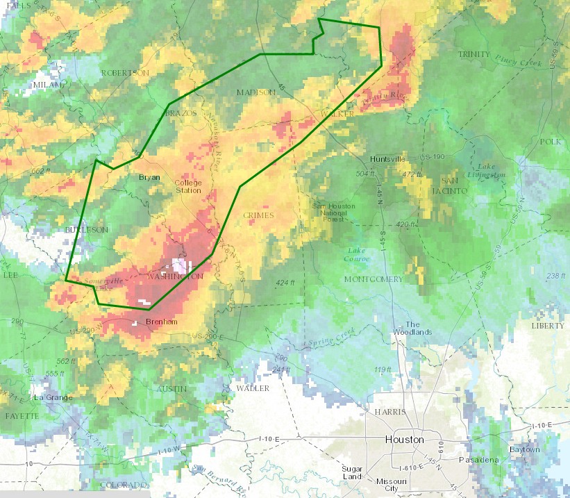
For some areas in excess of 6 to 10 inches of rain have already fallen today and more is coming down along a nearly stationary boundary. Some roads in the Brazos Valley area are already impassable.
Some of the storms have been trying to sag southwards, but they have been running up against an airmass coming in off the Gulf of Mexico. In addition a capping inversion will probably help to limit thunderstorm development for most of the Houston metro area this afternoon and evening. Nonetheless areas along, and northwest of a line from Sealy to The Woodlands to Livingston should probably remain watchful for storms this afternoon and evening. Although at least one confirmed tornado has developed near College Station today, I think the primary threat is going to remain heavy rain and potentially flooding.
If the Houston area does become threatened by widespread activity later today we will update here.
Posted at 3:15pm CT on Thursday by Eric Berger
I just hope it holds till after rush hour if it does come