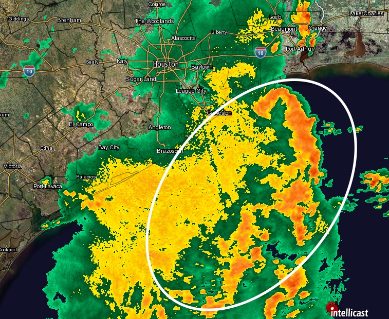
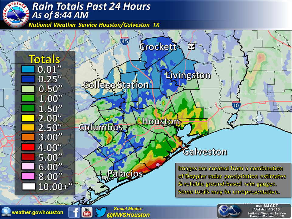
As the upper-level low pressure system has slowly moved south-southeast during the last 24 hours we’ve seen the focus of the heaviest rains move closer to the Texas coast and offshore. This is borne out both in the radar image this morning, and 24-hour rain totals.
When we look at total rain accumulations during the 24 hours preceding 9am CT on Saturday morning we can see, too, that the heaviest rains shifted from north of Houston to closer to the coast, and east of the area.
This does not mean we are as yet entirely out of the woods.
TODAY
After this morning’s precipitation moves off I think most of the Houston area will see a break during the late morning and early afternoon hours. However as we get some clearing skies, this daytime heating could help generate showers due to the proximity of the upper-level low pressure system. I’d be most concerned about strong clusters of thunderstorms during the late afternoon and evening hours. Hopefully they’ll be more scattered than widespread, but we’re not confident in that forecast.
SUNDAY
As the upper-level low continues to spin away from the upper Texas coast we’ll see lower rain chances on Sunday, but still at least the potential for some scattered, heavy rain showers. It’s probably going to be one of those days where it’s sunny one minute, raining cats and dogs the next, and then 15 minutes later clearing again. Bottom line: I don’t think we’re going to have to worry about the really widespread, organized storm systems that can cause significant flooding.
MONDAY and TUESDAY
We should return to a more summer-like pattern, with a chance of scattered afternoon showers, but mostly just warm, sunny and humid days. Highs probably will finally reach 90 degrees for this year sometime next week.
Eric, What does this mean: “more scattered than widespread”? Not trying to be a jacka$$, just to understand if there is a specific meteorological meaning to the words because to me they are pretty much synonyms. ?
Thanks, Dan
Scattered means significantly less than 50 percent coverage of storms; whereas widespread is closer to 50 percent or more.
How interesting..radar at 3:00 pm shows the center of the low pressure we have been under appearing to be over Trinity Bay…the rotation of the spotty storm cells clearly outline the system rotation! Not to worry guys, I ain’t no threat to your expertise!
What about that cold front that’s supposed to clear us out? Won’t there be a chance of severe storms when THAT moves through?