Good morning. The very heavy rain stayed well to the north of Houston during the overnight hours, with 1 to 10 inches falling across east Texas, generally increasing from Conroe north through Shreveport (there’s a flash flood warning in effect for parts of San Jacinto County, East Central Montgomery County and Polk County). Areas in East Texas such as Henderson and Marshall were hit especially hard.
So far a capping inversion has held over Houston, to keep most of the metro area high and dry. However there’s one more round of heavy storms off to the west of Houston that will likely break this cap as it moves through later this morning. As a result the entire region is under a severe thunderstorm watch through 11 a.m.as this system moves toward Houston.
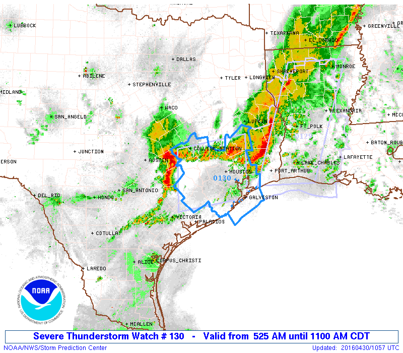
The leading edge of these storms will probably reach the western part of the Houston metro area between 7am and 8am, and the progressively moving system should be out of the area by noon. At this time the heaviest storms look to occur north of Interstate 10.
The primary threat from this line of storms will be damaging winds, with gusts potentially up to 60 mph. Given the area’s already moist soils we’ll need to be concerned about downed trees and power lines. We may again see some power losses in the metro area.
However because the heaviest rains remained well north of Houston during the overnight hours we no longer need to be overly concerned about the potential for high rainfall totals and widespread flooding. This system has the potential to drop a quick 1 to 3 inches of rain, but as it appears likely to continue moving along we should only see some localized flooding problems in low-lying areas, rather than major problems.
Still looks like we’ll see a break this afternoon and tonight, with only some scattered showers and thunderstorms returning Sunday. Monday again has the potential for some heavy rain. We’ll reassess that forecast in greater detail after this line of storms moves through.
Posted at 6:10am CT on Saturday
Eric
I got a weather station for Christmas and love it. But, now I’m ready for a better one…. This AcuRite station doesn’t give me wind gusts. Do you have a recommendation??
Also just a thank you… I moved out to my horse ranch in Montgomery and depend on your forecasts for so much and always feel prepared. Just a quick note though…. A lot of us in these “outlier” areas have lots of reasons because of our livestock to be really attuned to what’s happening with the weather. Sometimes I feel like we get lumped into “north Houston ” or “areas far northwest” when we really don’t consider ourselves that far out.
Typically it doesn’t matter but when you do think we could be directly effected some way, a little more targeted info would be SO appreciated.
THANKS!!!
I have heard good things about this Ambient system, but I don’t know how well it reports gusts.
http://www.ambientweather.com/amws1000wifi.html