Sunday produced widespread, heavy rain across the Houston area, with generally 1 to 5 inches. Accumulations were greatest near Galveston, and just to the southeast of the Houston area. Some of the storms were quite ominous, such as the clouds depicted in this photo from the Galveston-Port Bolivar Ferry System. Others, such as a large system that moved through downtown during the afternoon hours, produced a lot of lightning.

The conditions that produced these storms, particularly a moist atmosphere and slow-moving upper-level low pressure system will remain in place today, so we can expect another wet day before we begin transitioning to drier weather later in the week.
Today
As the upper-level system slowly moves from west to east across the region, we’ll see another wet day—especially later this morning and into the afternoon hours as daytime temperatures move into the mid- to upper-80s. Some regions could see another 1 to 3 inches, with greater localized amounts, especially to the east-southeast of Houston, from Galveston to Baytown. Given the already wet soils, we’ll have to be more concerned about the potential for flash flooding today. We’ll keep an eye on things.

Tuesday
The upper-level storm system will finally be exiting the area on Tuesday, but enough instability and moisture will remain to produce some scattered to widespread showers, especially for areas to the southeast of Houston, from Galveston up the coast to the Beaumont area. Western areas should begin drying out later on Tuesday.
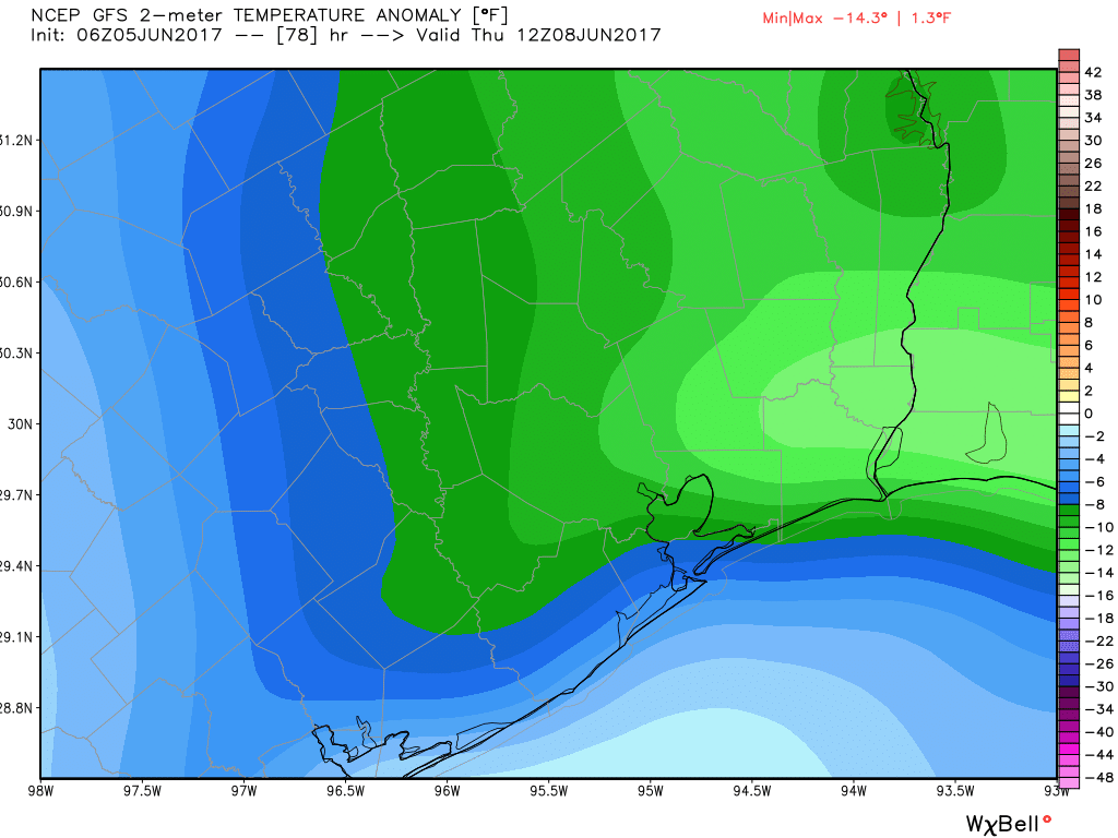
Wednesday through Friday
The sun returns. Although a few showers may be possible during the afternoon, for the most part dry air should shut down rain chances. This is largely the result of what’s known as a “backdoor” front, in which some drier air backs into the region from the northeast, rather than a classic front that moves down into the area from the northwest. It’s June, so it’s not going to be cold. Indeed, daytime highs should be around 90 degrees. But the air should be noticeably drier, allowing for lows in the mid- to upper 60s for inland Houston—and regardless of where you live mornings and evenings will be quite pleasant for early June.
Saturday and Sunday
Moisture will return by this weekend, and humidity along with it. This will push overnight lows back into the 70s, and could return a slight chance of rain to the forecast by Sunday—but right now I’d say most outdoor plans for next weekend should be A-OK.
Posted at 7:25am CT on Monday by Eric
Nice shelf cloud!