This morning will feel several degrees warmer across Houston, with temperatures in the mid- to upper-60s across the region, and this is pretty typical weather for early- to mid-May. We’ll now warm up some.
Tuesday and Wednesday
Atmospheric moisture levels are starting to recover, and as a result we’re going to see rising humidity levels during the next couple of days, but high temperatures should remain moderate in the mid-80s. While there is enough moisture to squeeze out some showers, I think they’ll probably remain isolated today and Wednesday, with the best chances south and west of the Houston metro area.
Thursday and Friday
By Thursday morning enough moisture will have moved inland that we could see some scattered showers, likely during the morning hours. But this rain will be nothing to write home about—I’m not expecting significant accumulations. Otherwise, Thursday should be a partly to mostly sunny day with highs in the mid-80s.
(Space City Weather is sponsored this month by Jetco Delivery)
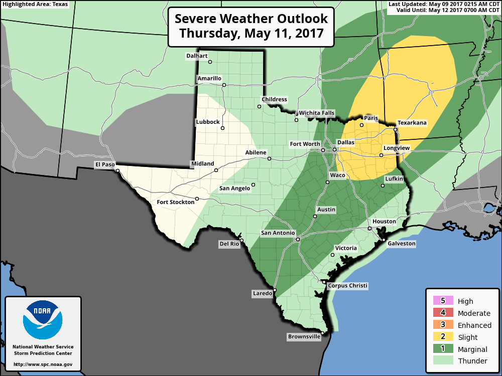
Rain chances will increase again late Thursday night and Friday as a cool front approaches the area. However, as we discussed Monday, the dynamics for storms remain most favorable north of the Houston area, and indeed for many a frontal passage on Friday morning—around sunrise north of Houston, and off the coast around noon—will probably produce spotty rain showers, or no rain.
Saturday and Sunday
This front won’t have the oomph of last weekend’s but it still will bring a welcome splash of cooler nights and drier weather into the region in mid-May. Look for sunny skies, highs in the low- to mid-80s, and overnight lows in the 60s. It won’t be cold, but it will be a bit drier, and the mornings and evenings will be spectacular. Rain chances begin to return to the area late next week.
Posted at 6:55am CT on Tuesday by Eric