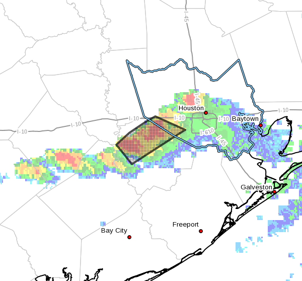
A line fairly strong thunderstorms has developed this evening to the west and southwest of Houston, bringing locally heavy rains, intense winds and dime-sized hail. These storms are moving slowly to the east-southeast.
The area of heaviest storms as of 9pm is indicated below:

So far bayous are holding up fine, but there is some localized street flooding beneath the heaviest rains.
Some of the latest modeling suggests these storms may intensify for the next couple of hours, before weakening later tonight. If they’re going to present an ongoing threat we’ll update the site later.
Posted at 9pm CT Thursday
What happened, Eric? I thought we weren’t supposed to get hit REALLY HARD until Sunday.
What happened is that a pretty stout capping inversion broke.
Yeah, Eric. And why are these strong thunderstorms always aiming for SOUTHWEST Houston? What is there about that side of town, anyway?
I guess storms just like to be fashionable.
I guess we’ll get socked again like this on Saturday. And I don’t imagine you even want to THINK about what’s going to happen on Sunday, Eric.
Nothing around Ellington at all.
Nope. Probably 75 percent of the metro area saw nothing. But where the storms did develop last night they were pretty intense.
The fireworks were beautiful lighting up the night sky. The scent of cool rain permeated the air. The frogs chirped especially loud. It was a lovely night in SW Katy. And, I didn’t have to evacuate!
Hah!