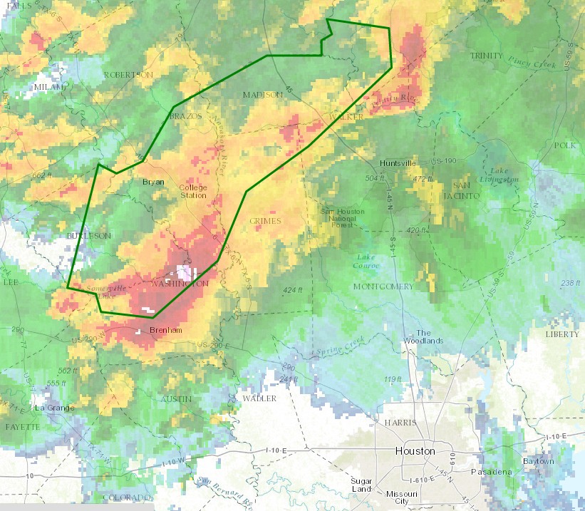
A very serious flooding event has been developing this afternoon to the northwest of the Houston metro area, primarily from Brenham through College Station to an area north of Huntsville. The National Weather Service has issued a flash flood warning for the following area until 6pm CT Thursday.
Flash flood warning is in effect until 6pm CT. (National Weather Service)
It’s a summer-like morning across the Houston region, with temperatures only falling down to around 80 degrees and humidity of about 90 percent. With Memorial Day weekend upon us, such is life now in Houston for the next few months.
TODAY and FRIDAY
Clearly there’s a lot of moisture in the atmosphere, but to produce showers and thunderstorms we’re going to need some disturbances in the upper-levels of the atmosphere to produce lift. And we’re like to see those during the next two days in Houston. I think the region will remain quiet this morning, but by this afternoon and again on Friday I think we’re going to scattered to widespread thunderstorms. These will have the capability to produce locally heavy rainfall, hail and damaging winds.
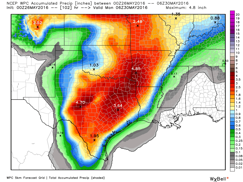
The forecast models suggest these systems will be most organized to the west and north of Houston during the next couple of days, and that’s borne out in the rain accumulation forecast from NOAA shown below. If you click on it you’ll see coastal areas may well see less than 1 inch of rain, with considerably higher accumulations inland.
NOAA rain accumulation forecast for Thursday morning through Sunday. (Weather Bell)
Well, it was close. And with the humidity it sure felt a lot hotter than 90° out. But the official weather site at Bush Intercontinental Airport peaked at 89° this afternoon and now appears to be cooling off slightly as evening comes upon us.
It seems likely that a combination of cloud cover and scattered to widespread showers on Thursday and Friday will limit temperatures to the mid-80s. We’ll then have to concern ourselves with highs approaching 90° during the Memorial Day weekend, but I’d say at this point there’s a decent chance we’ll get out of May without the mercury hitting 90. That hasn’t happened since 1970 in Houston.
Houston has yet to hit 90° in 2016, and the city hasn’t gone all the way through May without such a temperature since 1970. But first we’ve got to get through today and that will be no easy thing.
TODAY
We’ll continue to see moist and humid surface conditions today, but with moderate high pressure in place we shouldn’t see too many showers develop as a result—perhaps just a few scattered storms with daytime heating. Depending on how much sunshine we see temperatures are going to rise into the upper 80s to possibly 90°. Houston’s first 90° day typically comes at the end of April.
THURSDAY
As an upper level storm system moves into Texas it’s likely to bring heavy rain across the central part of the state, including from San Antonio north through Dallas. Light rain is possible in Houston beginning Thursday morning, but the heavy rain will probably remain west and north of the metro area.
FRIDAY
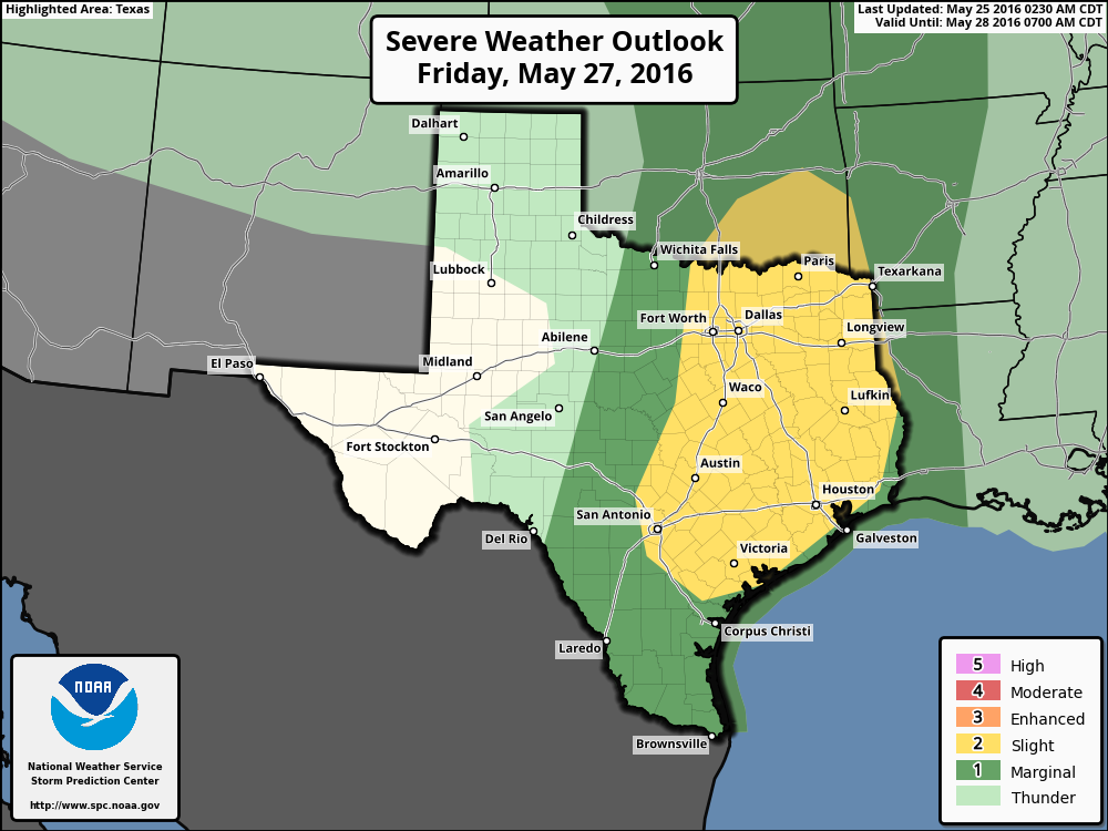
As the upper-level system moves directly over Houston on Friday things could get a little more interesting. It still looks like the storm pattern will be more active over the northern part of the metro area, say from Montgomery County on north. Whereas central Houston might see 1 inch of rain, or less, these northern areas might get 2 to 3 inches, or more, along with some severe weather. Additionally the entire area is at risk for a “slight” chance of severe weather according to NOAA’s Storm Prediction Center.