Houston likely to record its first 90-degree day today

Well, the party probably ends today. We’ve made it five months and six days into the year 2016, but Houston will likely finally reach 90 degrees today.
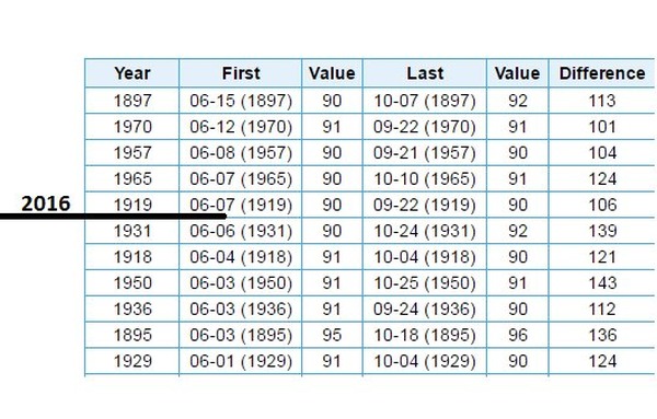
Latest dates in the year when Houston has recorded its first 90-degree day. (Matt Lanza)


The forecast beyond this data point is pretty straight forward.

TODAY through THURSDAY

Partly to mostly sunny skies. Drier air should allow highs to reach around 90 degrees. Lows in the low- to mid-70s. A slight chance of afternoon and early evening showers and thunderstorms along the sea breeze. There’s not much more to say than that.

FRIDAY through SUNDAY

We’re going to see more moisture returning from the Gulf of Mexico by this weekend, which should allow for a greater possibility of rain during the afternoon and evening hours. The European model suggests accumulations of a few tenths of an inch of rain for the weekend, which seems about right. I would not expect any kind of a washout.
After the rains, summer comes to Houston this week

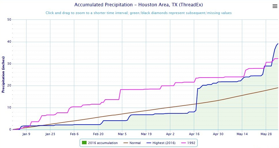
Well, it’s been quite the start to the year 2016. We’ve had floods west of Houston, northwest of Houston, north of Houston southwest of Houston, east of Houston—pretty much all over the city. This most recent rain event, during the second half of last week, was enough to push the city above 1992 for the wettest year to date, through June 5.

The city has officially recorded 39.67 inch of rain at Bush Intercontinental Airport (blue line below). This is all the more remarkable because, only about six weeks ago, the city was actually below normal for total rainfall for this year:

(Victor Murphy/National Weather Service)

See full post

Finally, clearing skies, goodbye to monster rain storms

Good morning. How pleasant it is to wake up to a clear radar and partly sunny skies!

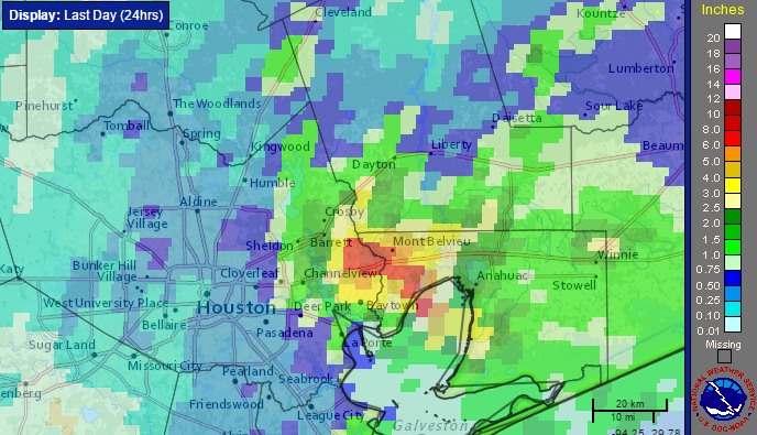
Low pressure is moving away from the upper Texas coast, and as a result so the likelihood of organized storm activity is fading. And thank goodness. I’ll have a more comprehensive wrap-up on Monday, but even yesterday, when most areas saw less rain, parts of the eastern Houston metro area near Mont Belvieu saw in excess of 10 inches of rain in six hours. This was a nasty system and I’m glad to see it go.

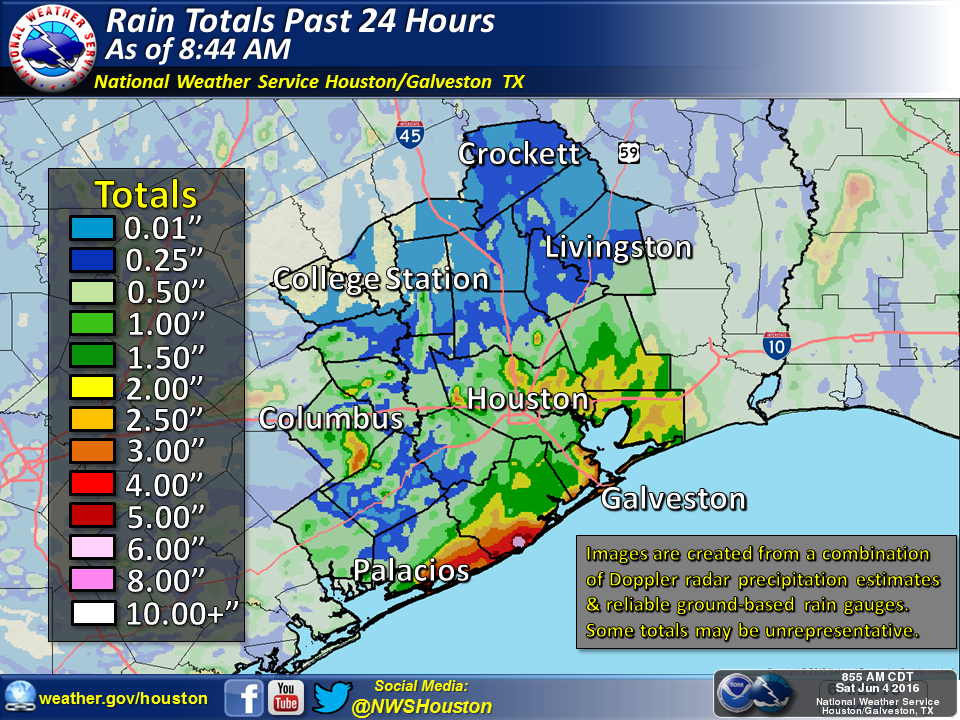
Rain totals from early Saturday morning to early Sunday morning. (NOAA)

See full post

Not done yet with this mess, but Houston can see the light at the end of the tunnel

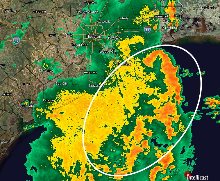
As the upper-level low pressure system has slowly moved south-southeast during the last 24 hours we’ve seen the focus of the heaviest rains move closer to the Texas coast and offshore. This is borne out both in the radar image this morning, and 24-hour rain totals.

Only light to moderate rain is falling inland this morning. (Intellicast)
Only light to moderate rain is falling inland this morning, at 9:30am CT. (Intellicast)


When we look at total rain accumulations during the 24 hours preceding 9am CT on Saturday morning we can see, too, that the heaviest rains shifted from north of Houston to closer to the coast, and east of the area.

24-hour rain accumulations. (National Weather Service)

See full post