A few stray showers possible, but “high” summer is coming to Houston

Good morning. We’re a day away from July, and it’s as if Mother Nature knows this. After a relatively cool late spring and early summer, we’re about to jump into Houston’s heat and humidity with both feet.

Today through Saturday

Some storms that have developed offshore early this morning are likely to work their way inward to the southern half of the Houston metro area later this morning, and during the afternoon hours. I’m not expecting anything more than brief, isolated to scattered thunderstorms, however. This pattern of a few stray storms should continue for both Friday and Saturday. Highs should climb into the mid-90s, with lows in the upper 70s. And if you think this is bad, just wait until next week.

Sunday and Beyond

As high pressure stamps its authority on the region Houston will descend deeper into summer. As most long-time residents know, high pressure during high summer means temperatures in the mid- to upper-90s, mostly sunny skies, only a very slight chance of rain and the potential for heat advisories.

High pressure builds over Texas next week (this map shows the Wednesday morning forecast from the GFS model). (Weather Bell)


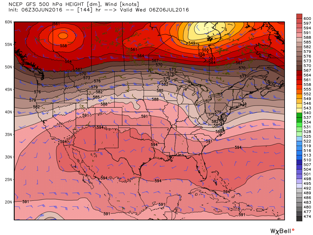
There’s just no way to sugar coat what is coming, I’m afraid. Sorry to say, but I don’t see much relief from this pattern at any point next week.

Posted at 7:55am CT on Thursday by Eric Berger

Scattered storms possible for a few days high pressure clamps down on Houston

Some fairly heavy storms rolled into Houston on Tuesday, and as boundaries collided during the afternoon hours the region picked up 0.0 to 2.5 inches of rain with some heavy thunderstorms. After two weeks of mostly dry weather the rain and some of its outflows offered a brief reprieve from summer. This morning, with a weak front offshore, it feels almost pleasant out there for late June. But it won’t last.

Rain totals for Tuesday. (National Weather Service)

Today

The main area of instability remains offshore this morning, which means we’re unlikely to see any rain before some daytime heating. However we could see development of some scattered showers this afternoon with the sea breeze. Rain chances appear to be highest for coastal counties and areas to the east of downtown Houston. Further inland, for Montgomery county and areas west and northwest of the city I’d rate rain chances as very low (although not non-existent.) Highs in the low- to mid-90s.

See full post

Storms developing across Houston, should persist into the early evening

As the sea breeze and a weak front collide over Houston we’re starting to see widespread development of showers and thunderstorms over the metro area. It appears that storms between 2:30 and 4:30pm CT will probably be heaviest for the central and northern parts of Harris County.

A flood advisory has been issued for the following areas until 4:30pm CT:

Area of flood advisory in effect until 4:30pm CT. (National Weather Service)

These storms will be capable of producing moderate to heavy rainfall with the potential to flood some low-lying streets. However we do not expect these storms to produce widespread flooding. Strong wind gusts and lightning are also a threat. These storms will probably die out for good by, or shortly before sunset.

Rain likely today, but real heat looms in the distance

Good morning. The second half of June has been pretty dry for Houston, so all things considered the region could use some rain as we head into the warmest 10 weeks of summer. Fortunately much of the region should see just that today.

Tuesday

A weak front will sag into Houston today, meeting up with air moistened by the Gulf of Mexico. This should lead to some fairly widespread showers and thunderstorms developing before or by around noon, and sliding southward toward the coast. The most likely time for rain is between noon and sunset. I’m not expecting anything too extreme in terms of rainfall totals, and am hopeful half or more of Houston will pick up 0.25 to 1.0 inch of rainfall. Highs should climb into the low 90s.

HRRR model forecast for rain at 3pm CT on Tuesday. (Weather Bell)
HRRR model forecast for radar conditions at 3pm CT on Tuesday. (Weather Bell)

See full post