Unsettled weekend, but real winter lurking

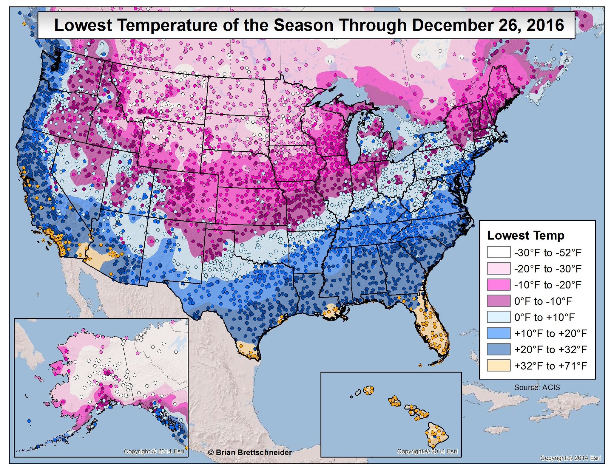
Unsettled weather is going to be the story of the next several days. We have a lot to discuss, so let’s break it down.

Today & Weekend

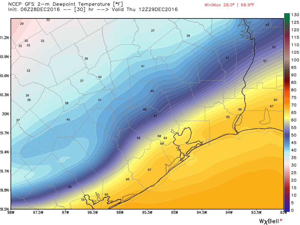
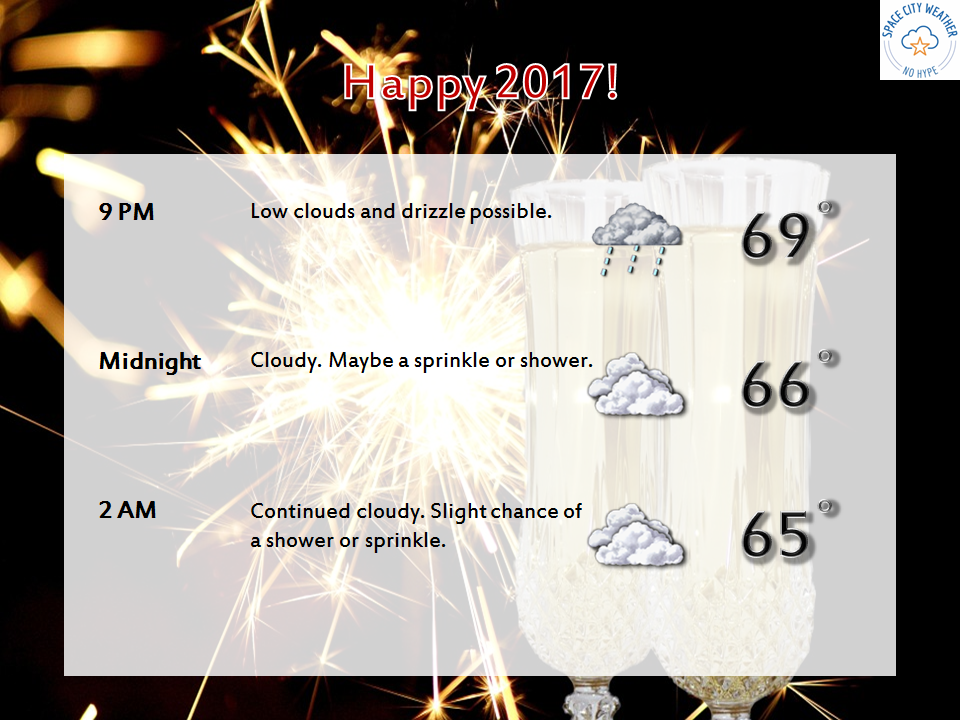
No big issues for Friday, as we’ll see clouds thicken and seasonably cool temperatures. There could be a sprinkle later today, but steadier light rain won’t begin to break out until probably after Midnight. Rain may become steady to heavy at times on Saturday morning. Here’s the good news though: Rain will likely end early to mid afternoon Saturday, and the bulk of New Year’s Eve night will be dry. If you have outdoor plans, don’t cancel them, but I encourage you to follow the forecast just to be safe.

We’ll ring in 2017 the same way we spent much of 2016: Milder than usual and a bit damp.

While there will continue to be a slight chance of showers Sunday, I think the majority of the day will be dry. It will continue to be mild, with temps in the 70s.

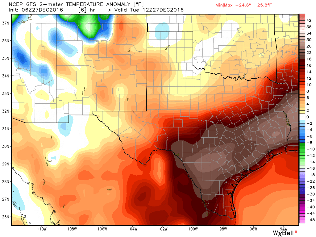
For Monday, the weather gets a little more interesting. A vigorous upper level disturbance will arrive, bringing renewed showers and thunderstorms. There are a lot of details that are TBD with this one, but it could potentially produce some strong to severe thunderstorms, especially north of I-10. We’ll keep you posted if this becomes more than just a “potential.”

See full post

Taking stock of how cold it’s been in Houston this winter

As of 7 am CT a cold front has swept through most of the Houston area, bringing an end to the warmest late December streak of weather in the city’s history, an unprecedented five days of 80-degree weather during the Christmas to New Year’s period. As we swing back toward colder weather here’s a look back at the coldest temperatures across the region this season, so far.

Map of the lowest temperatures so far this winter. (Brian Brettschneider)


Notably a few parts of Texas, Louisiana and the southwestern United States have yet to experience a freeze this year. Now let’s zoom in on southeast Texas, where you can really see the effect of warmer waters in the Gulf of Mexico and Galveston Bay on land temperatures. A small slice of the coast has yet to freeze, and that’s unlikely to change in the next week or 10 days.

Lowest temperature of the season for the greater Houston area. (Brian Brettschneider)

See full post

Houston going for a record fifth consecutive 80-degree day in December

The heat continues. Tuesday marked the fourth straight day of high temperatures of 80 degrees or greater in Houston, and the third record high in three of the last four days. According to data from Matt, That has happened five times before in the city in December (1933, 1956, 1995, 1998 and 2012), but all of the previous streaks came before Dec. 20. Today we’re likely to get our fifth—which has never happened in more than 120 years of records—before some cold weather sneaks into the region.

Today

You know the drill. Foggy morning, partly to mostly cloudy skies, and warm with highs around 80 degrees. Houston will experience one more very un-winter-like day before change finally arrives on Thursday. Looking outside, it dawns on me that for Houston, a White Christmas means fog rather than snow.

Dewpoint temperatures at 6am CT on Thursday morning. The front finally arrives. (Weather Bell)

See full post

Houston ties its second warmest December day on record

This month’s anomalously warm weather continued on Monday, with a record high of 84 degrees. How abnormal is that? Just one day—one single day—has been warmer than that in all of the Decembers in more than a century of weather records of the city (Dec. 3, 1995, 85 degrees). The average temperature on Monday, 78 degrees, was 25 degrees above normal. Fortunately, this can’t, and won’t, continue for much longer.

Today

After a foggy start this morning (a dense fog advisory remains in effect until 9am CT), highs today should max out in the upper 70s. Mostly cloudy skies, and some scattered showers, should limit temperatures more than anything. A front will approach the region from the northwest, but should stall out before pushing into the city itself. This should help lows fall into the mid-60s tonight.

High temperatures on Tuesday morning are about 25 degrees above normal for eastern and southern Texas. (Weather Bell)

See full post