Storms likely again Wednesday before a cooler end of the week

After a mild Saturday and Sunday—a storm system that raked Oklahoma and northern Texas Sunday evening stayed to the north of Houston during the overnight hours—we may see more storms later this week.

Monday

It’s a warm start to the day, with low temperatures only falling to about 70 degrees. Under partly to mostly cloudy skies today, highs will probably climb into the low- to mid-80s this afternoon. Some lower pressure in the atmosphere may provide for a chance of rain showers later this afternoon, but any accumulations should be slight, and I think shower development will be pretty spotty.

Tuesday

Skies clear some, and we’ll again see highs in the low- to mid-80s. The dominant feature Tuesday will be southerly winds, gusting to 20 mph or above. This will herald rising moisture levels, and a good chance of rain on Wednesday.

Wednesday

In combination with an upper-level disturbance, rising moisture levels will combine to produce a healthy chance of rain and the possibility of severe weather on Wednesday. While the instability in the atmosphere looks marginal for tornado formation, we can’t rule them out, along with the possibility of damaging winds and hail.
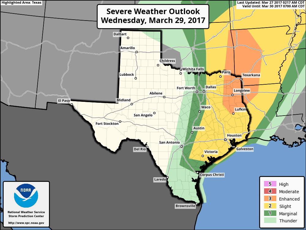
Storm outlook for Wednesday. (NOAA)

(Space City Weather is sponsored this month by an anonymous donor)

The storms should be fairly progressive, continuing to move from west to east, so I’m not too concerned about the potential for flooding—I think most areas will see less than 1 inch of rain. But some locally heavy rainfall is definitely a possibility, like we saw Friday night in parts of Houston.

Thursday and Friday

Some light rain may linger into Wednesday night or early Thursday morning, but the upper-level low will also usher a cool front through the area, bringing some relief from the humidity. There’s some question as to how much cooler it will get, but for now I’ll peg highs to end the week at about 80 degrees, with a chance for most of the region to see nighttime temperatures in the 50s on Thursday, and especially Friday, morning.

Next weekend

By Saturday—or more likely Sunday—healthy rain chances return to the forecast. Along with high temperatures around 80 degrees next weekend, we’re going to have to consider the possibility of some rain showers, as the region may pick up another inch or so between Saturday afternoon and Monday. Precise timing and amounts are still hazy this far out, however.

Posted at 6:55am CT on Monday by Eric
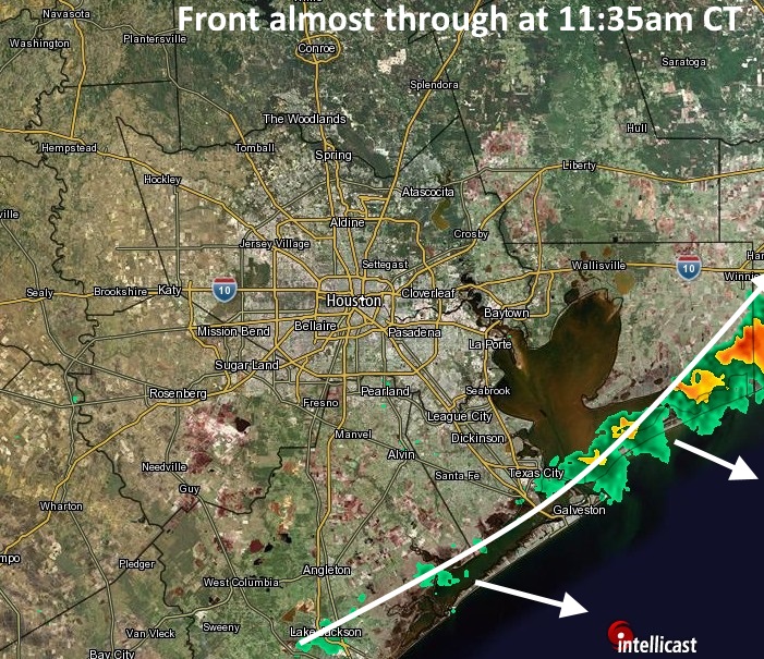
 

After a front, sunny for Houston this weekend, first part of next week

Friday night’s storms were pretty dramatic in terms of thunder and lightning for some areas of Houston, including rodeo goers. I’ll admit that I didn’t think the capping inversion would break that dramatically, but it did, allowing some scattered, but severe thunderstorms to form. There were a few pockets of heavy rain, as well, with some parts of south Houston and Clear Lake picking up 2.5 inches of rain.

The good news is that the cool front associated with the upper-level low pressure system has moved to the coast, and should move offshore shortly after noon. For Houston, then, the rain is over and we should see a couple of mostly sunny days this weekend, with high temperatures in the low 80s.

(Intellicast/Space City Weather)

I’m not ready to 100 percent rule out the chances of some stray showers Sunday night, but I think for the most part we’re going to see pleasant weather from now through about Tuesday, with continuing mostly sunny skies and highs in the low- to mid-80s. A chance of storms returns to the forecast on Wednesday, perhaps later in the day. But whereas the dynamics for severe weather and some heavy rain in Houston once appeared to be pretty favorable next Wednesday, for now I think the threat of these is diminishing a bit. We’ll be back with a full update on Monday.

Posted at 11:45am CT on Saturday by Eric

After some dynamic weather Friday, a pleasant weekend in Houston

We’re almost to the weekend! Houston may experience some potentially dynamic weather this afternoon. But after that the region should see a mostly pleasant weekend.

Friday

The much talked about upper-level system has now moved out of the Rocky Mountains, and is pushing a line of showers and thunderstorms to the east. As of 6:30am CT these storms were still well west of Interstate 35, so they won’t reach the Houston area until this afternoon.

(Intellicast)

My thoughts remain much the same as they’ve been this week—this should be a fairly fast moving line of storms, and while there is the potential for some thunderstorms, I think the bulk of the severe weather should remain to the north-northeast of the Houston metro area. In terms of rainfall, accumulations for most areas should be around 0.5 inch, or less, as the storms continue to move at a good clip through the region. They’ll probably reach the region at some point after about 1pm and then exit this evening. Some rain, frankly, would be helpful in dissipating the heavy pollen.

(Space City Weather is sponsored by an anonymous donor this month)

See full post

Storms possible Friday before a slightly cooler, pleasant weekend

The warmth continues, and we’ll have to watch for the possibility of storms on Friday.

Today

We’ll see another day a lot like Wednesday—which is to say a chance of early morning fog and then warm, with highs in the low- to mid-80s. Temperatures will again be near record highs for late March, especially for the southern half of the region. (Houston’s Hobby Airport, for example, has already tied two records this week).

Conditions tonight will be quite warm, perhaps only falling to around 70 degrees for areas closer to the coast. A more noticeable change will come with the winds, which will pick up in response to a potent upper-level system moving into the central plains states, and pushing toward the eastern United States. For Houston, this means winds will increase to about 20mph by Friday morning, with higher gusts.

Friday

We’re continuing to watch for the possibility of severe weather in Houston from the late-morning period through the late afternoon hours. As that upper-level system moves across the plains, it should produce a fairly potent line of storms at the surface. As this line moves from west to east across Texas, its southern boundary could pass through the northern Houston area, bringing the threat of strong thunderstorms and damaging winds, especially for areas around Conroe and points north.

Storm chances on Friday will be best to the northeast of Houston. (NOAA)

(Space City Weather is sponsored by an anonymous donor this month)

See full post