Wednesday & Thursday to bring nicer weather back to Houston before a chilly weekend

Good morning! We expect nicer weather today after yesterday’s dreary outcome. Before getting to that, Emma Balter over at Chron.com had a fun conversation with me about food that you can check out if you’re interested!

Also, a number of you pointed out the fairly loud “boom” on Monday night, right around Midnight. No one has really come up with a satisfying answer, so the truth is, we don’t know for certain what it was either. The suspicion is that it was a meteorite, but that’s speculative. I suppose the noise may have been enhanced by the fact that a temperature inversion (temps warming as you go up in the atmosphere) was in place right around 5,000 feet up (with a second one around 10,000 feet up). That, plus the insulation provided by Monday night’s cloud cover could have acted to enhance the sound, which may explain why it was so loud. This is about 80 percent speculation on my part though, and I freely admit that this may be completely wrong. Whatever the case, we’re aware of it, and if there’s any follow up we find out, we will share it with you!

Temperatures will be a good 15 degrees warmer today than they finished yesterday. Gradually increasing sunshine is likely as well. (Pivotal Weather)

Today

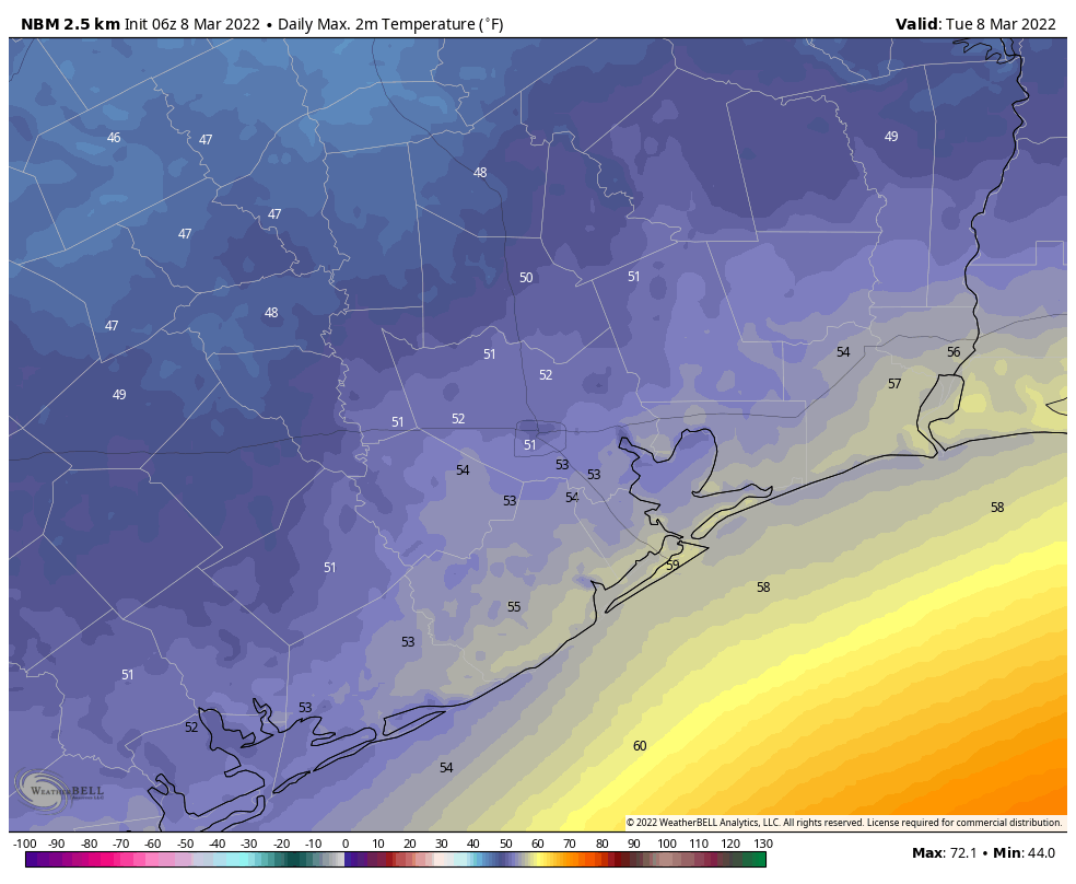
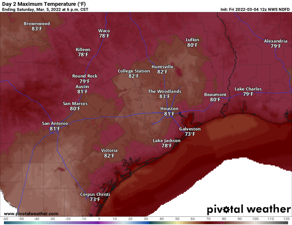
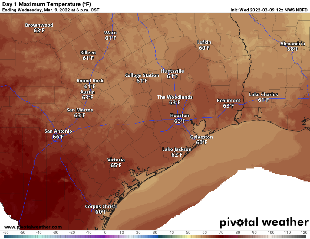
It will be a much nicer Wednesday than it was Tuesday. Yesterday’s rain and mid-40s are behind us, and today we’ll see decreasing clouds and temperatures poking up above 60 degrees in most places.

The weather will definitely be one thing right for Kane Brown tonight at the Houston Livestock Show & Rodeo. Look for pre-show temperatures in the upper-50s, cooling back closer to 50 degrees on your way out. Chilly but certainly not awful.

Thursday

Tomorrow looks fantastic. Expect sunshine, morning lows in the 40s and daytime highs a bit above 70 degrees, and a light southeast breeze. This will front run any significant humidity returning to the area, so it’s going to be delightful.

Friday

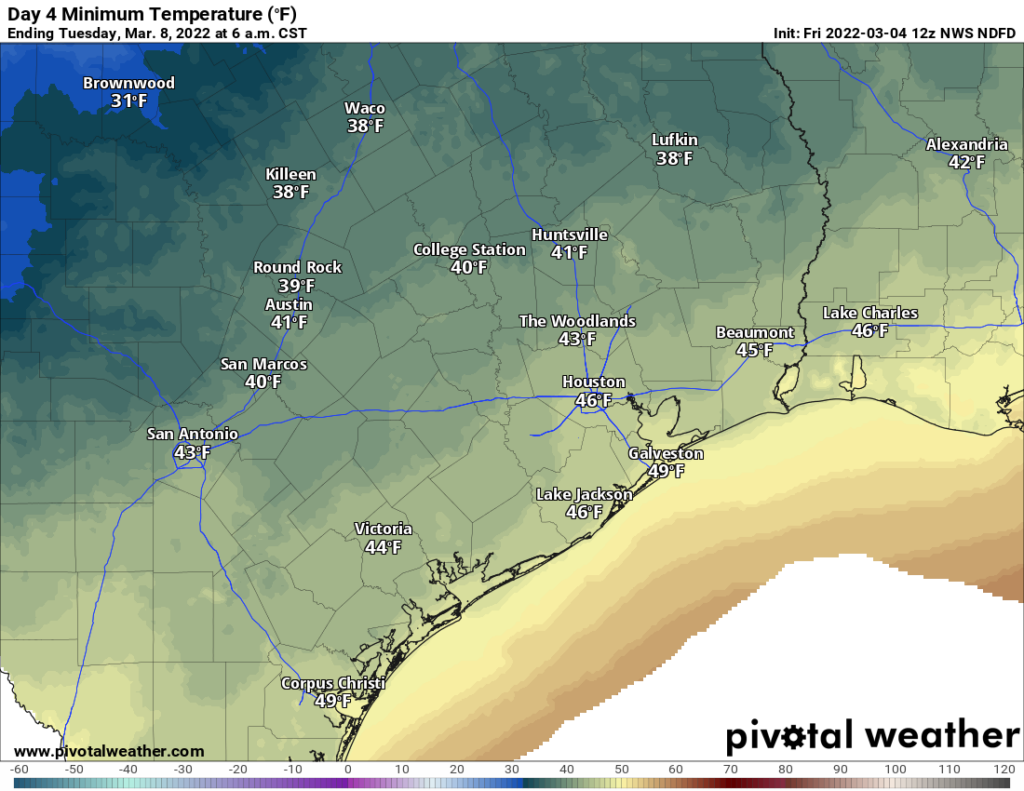
The week will end on an interesting and much colder note. After Thursday’s stellar weather, look for a strong cold front to plow through with scattered showers and thunderstorms. The exact timing of the front is a little sloppy, but in general the showers will be in the morning through early afternoon and the major temperature changes are expected during the later afternoon hours. Once the front comes through, you will know it, as temperatures will plunge from the 60s into the 50s and 40s. Winds are also going to howl out of the north, sustained around 20 mph, gusting to 25 or 35 mph on land and near 40 mph around the bays and coast. The signal on the models for gusty winds has been locked in since late last week, so while the cold will be the story this weekend, the winds late Friday into Saturday morning will be another notable element.

Weekend

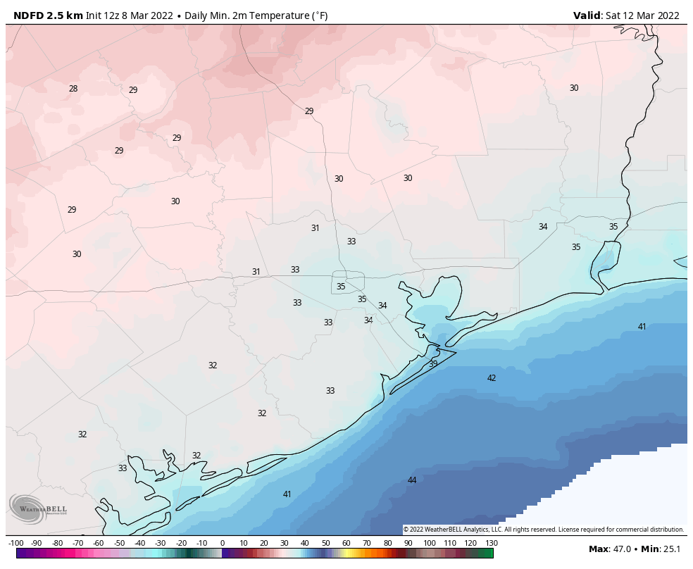
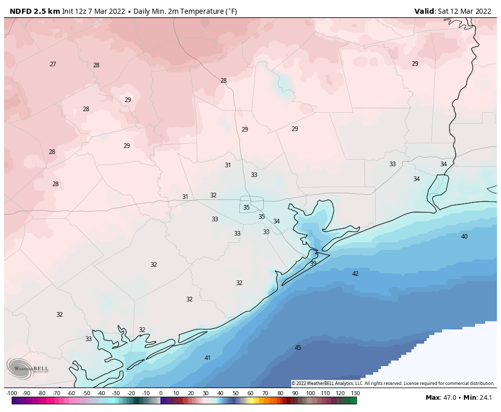
We will have our first shot at a late season freeze on Saturday morning, depending on how quickly skies clear out and winds calm down. It will be a close call, but the best chance for sub-freezing morning lows Saturday will be north and west of the Houston city limits.

Freezing temperatures are likely in parts of the area on Saturday morning, mostly away from the coast and outside the city. (Pivotal Weather)

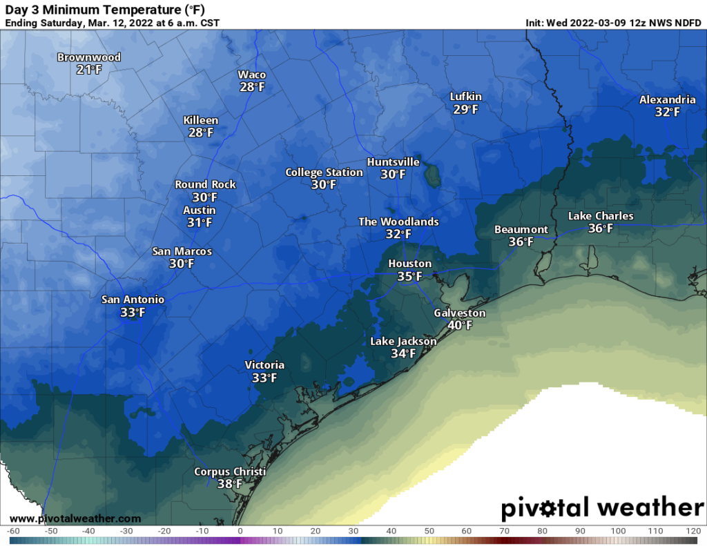
After a sunny, chilly Saturday with highs in the 50s and diminishing winds, look for another cold morning Sunday. I think the odds of a freeze are a little lower on Sunday than on Saturday, but they’re still reasonably elevated for parts of the area, mainly outside the city of Houston and coast once again. Sunday will also be sunny with highs back into the 60s.

Next week

Eric covered Spring Break week (for many) yesterday, and there’s not much more to add today. Look for a generally benign, somewhat warmer week. There may be a front in the cards, aiming for the back half of the week, but it’s too soon to get into specifics. For now, the week still looks mostly fine!

After winter-like weather this week, most of Spring Break looks nice

Good morning. It’s cold, dreary, and rainy out there this morning, and we’re not going to warm up much today. And just as temperatures finally start to push back toward 70 degrees at the end of the work week, and even stronger front will arrive on Friday to plunge us back into deep winter this weekend. A freeze will even be possible for some locations. But looking ahead to next week, when most area kids will be on Spring Break, the weather takes a turn to the more moderate side. It looks, dare I say it, quite nice?

The high temperature forecast for Tuesday is not particularly high. (Weather Bell)

Tuesday

As expected, we’re seeing warmer air above thin layer of cold air at the surface, and this lifted moisture is generating light to moderate rainfall across much of the metro area. A few thunderstorms will also be possible this morning before we transition to more scattered, lighter showers this afternoon.

Overall, most areas probably will see about one-quarter to one-half inch of rain, but we can’t rule out some higher amounts for isolated areas. With gray skies, temperatures won’t warm much today, likely topping out in the upper 40s to low 50s for most areas. Lows tonight, generally, will drop into the low 40s, with any lingering showers ending.

If you’re headed to the Houston Livestock Show and Rodeo this evening to see Maren Morris, there is the possibility of some very light rain during the late afternoon and early evening hours, but at this point it looks like even these showers will move off shortly after sunset. Temperatures will be in the upper 40s on the way into the show, and only a degree or two colder afterward.

Wednesday

Skies should start to clear out on Wednesday, with this sunshine helping to warm temperatures to around 60 degrees. Lows Wednesday night should drop into the 40s for all but coastal areas.

Thursday

As stated Monday, this day will be the pick of the litter for outdoor activities this week. Expect sunny skies, highs in the mid-70s, and relatively light winds. Overnight lows drop into the 50s.

Friday

Friday should start out fairly warm, with temperatures rising into the 60s for most of Houston. Then we’ll be on the lookout to the northwest, for the next frontal passage. I still don’t feel great about pinpointing the timing of this one, which could pass through Houston anywhere from late morning to early evening. The front will likely have some rain with it, and while it looks like these will be fairly light, scattered showers, we cannot yet rule out the potential for some briefly heavier rainfall. After the front passes winds will quickly turn to come from the north, with gusts likely above 30 mph. Skies, too, will clear out pretty quickly allowing temperatures to plunge into the 30s by Saturday morning, with a freeze possible for some locations in and around Houston. We probably won’t have a clear idea of where the freezing line will be for a few more days.

Current low temperature forecast for Saturday morning. (Weather Bell)

Saturday and Sunday

The weekend looks chilly and sunny, with highs in the 50s on Saturday, another cold night in the 30s, and then highs in the 60s on Sunday.

Next week

This will be Spring Break for many children in the Houston area, including my own. The good news is that much of next week should feel like a really nice spring week. I’m betting on partly to mostly sunny skies for most days, with highs in the upper 70s, give or take. There’s also not too much in the way of rainfall, at least through the first half of the week, if not longer. Enjoy!

After a spring fling, winter returns for a dramatic encore this week

Good morning. Following a warm and humid weekend in the 80s, a cold front has moved through most of the Houston metro area overnight, and will soon push off the coast. This will set the stage for much colder weather this week. Then, just as we’re warming up, an even stronger front arrives on Friday. A freeze is probable for part of the Houston area, and possibly even the city itself.

Sunrise temperatures are much colder on Monday morning for most of our region. (Weather Bell)

Monday

Temperatures have fallen to about 50 degrees for inland areas this morning, and this colder air is moving south. Temperatures should stay in the 50s today for most of the region. Light rain is possible through the morning hours, but any showers should end by this afternoon as drier air moves into the region. The story for today will be gusty northerly winds, with brief bursts possibly exceeding 30 mph before conditions calm down somewhat this evening. Overnight lows should drop into the upper 40s for most of Houston, but not much further as skies remain overcast.

If you’re headed out to see Luke Bryan tonight at the Houston rodeo, wear something warm. Temperatures should be around 50 degrees before the show this evening, but winds probably will still be somewhat gusty. I don’t think precipitation will be an issue, however. Temperatures will be about the same after the show.

Tuesday

Tuesday won’t be much nicer. Highs will probably only reach the mid-50s or so, and we’ll add rain to the mix. Essentially there will be a thin layer of colder air at the surface, with warmer air riding up on this thin layer. This warmer air should lead to the development of fairly widespread showers, and a few thunderstorms, on Tuesday morning. Accumulations will probably range from 0.25 to 0.75 inch for most, but a few areas may see somewhat higher totals during the late morning and afternoon hours. Lows Tuesday night will drop into the mid-40s for most.

Wednesday

We can’t rule out some additional rain showers on Wednesday, but for most of us this should just be a partly to mostly cloudy day, with highs around 60 degrees. Clearing skies will allow overnight lows Wednesday night to drop into the low- to mid-40s.

Thursday

This should be a warmer day, with partly to mostly sunny skies and highs perhaps around 70 degrees. If you had to pick one day this week for outdoor activities, Thursday is definitely the day.

Low temperature forecast for Saturday morning. Temperatures subject to change. (Weather Bell)

Friday

Friday will start out warm, but at some point a strong cold front will barrel through. At this point I’d guess the timing is around noon, but there’s definitely some wiggle room in that. Some brief showers are possible with the front, but as dry air blows in any rain chances should quickly end as skies clear out. Lows Friday night will plunge, possibly into the mid-30s in Houston, possibly to freezing. It’s going to be fairly close, and at this point it’s impossible to say where the freezing line will be.

Saturday, Sunday, and beyond

Saturday should be sunny and cold, with highs likely in the 50s. Expect another cold night, with temperatures probably similar to Friday night. But by Sunday we should be warming back up, with highs in the 60s. Most of next week, in fact, should be in the 70s give or take.

Warm weekend for Houston, as we check up on drought across Texas

I’m going to open today’s post with a few comments about drought that’s been developing or festering across Texas. The updated Drought Monitor data came out yesterday, showing almost 57 percent of Texas in severe drought or worse.

The coverage of drought is expanding in Texas, with over half the state deemed to be in “severe” drought or worse. (US Drought Monitor)

Three months ago, less than 20 percent of Texas was in drought that excessive. We did see some improvement in early February across the state, but things have turned back worse again. Locally, things are not too bad just yet, with mostly the outskirts of Greater Houston even classified in drought at all. But rainfall is expected to average at or below normal the next 2 weeks, so this story will be one to watch in the weeks ahead. We are still technically in a La NiƱa (cool tropical Pacific Ocean), which tends to favor drier weather in Texas. As that has been in place over the last year or two, we’ve managed to get bailed out before things got too severe. We will see if we can pull that off again this spring.

Friday

As temperatures warm up and humidity gradually flows back into the Houston area, we continue to see some patchy fog in the area.

The rest of the morning will see gradual clearing, though Galveston and the Bay Area could see fog emerge at any point today. Otherwise, expect partly sunny skies and temperatures making a run toward the upper-70s. A few locations could even eclipse 80 degrees. There will be a noticeable southeast breeze through the day.

It’s Ricky Martin’s turn at the Houston Livestock Show & Rodeo tonight, and if you’re going, you’ll be livin’ la vida buena. Look for temperatures around 70 degrees initially, only dropping into the mid-60s after the show. No weather woes are expected, though there will be that fairly steady southeast breeze.

Weekend

This weekend will see fairly similar weather on both days: Fog, clouds, some sun, a gusty southeasterly breeze, warm temperatures, and higher humidity. Fog will be a little tougher to pinpoint due to the winds, but at times, we’ll likely see some fog along the coast and near the bays, especially in the morning. By afternoon, virtually everyone should just see clouds and sun. Look for highs in the 80s.

Saturday’s high temperatures will be quite warm, with 80s almost everywhere away from the coast. (Pivotal Weather)

Morning lows will generally be in the 60s. Any rain chances this weekend are likely to be limited to a few showers or some sprinkles, nothing that should interfere with any plans you may have.

Monday

Our next cold front will likely cross the region on Monday morning or afternoon. I would expect at least a broken line of showers and thunderstorms as it pushes through, which should give many of us some rain. Behind the front, temperatures should drop from the 70s into the 60s or 50s. We may warm up with some clearing in the afternoon, as well as drier air. But then look for 40s by Tuesday morning.

The 40s should return by Tuesday morning (Pivotal Weather)

Rest of next week

The forecast gets a little trickier after Monday with a couple quick moving systems and cold fronts in the offing. This should allow us to have a generally cooler week but perhaps an unsettled one as well. We’ll fine tune the details on that for you on Monday.