Good morning. The big (bad?) news this week is that we’ll probably see our warmest weather of 2022, with highs of 90 degrees possible on Tuesday and Wednesday. But fret not, a nice front arrives on Wednesday to bring drier air and seasonable weather into the region through at least part of the weekend.
Monday
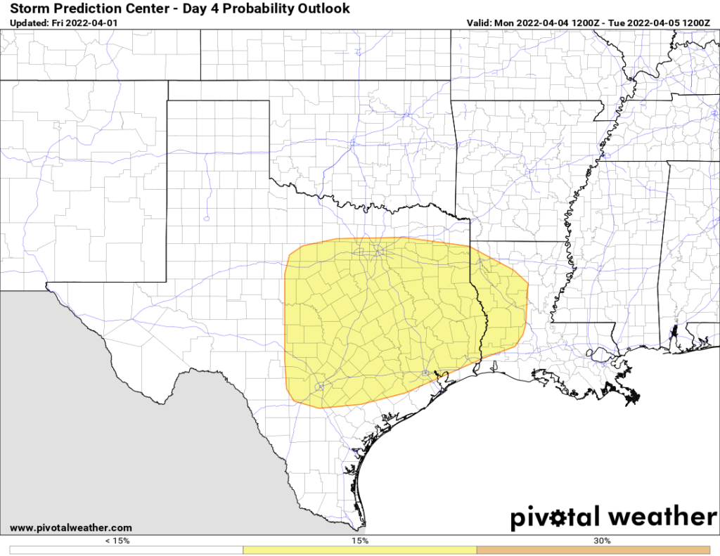
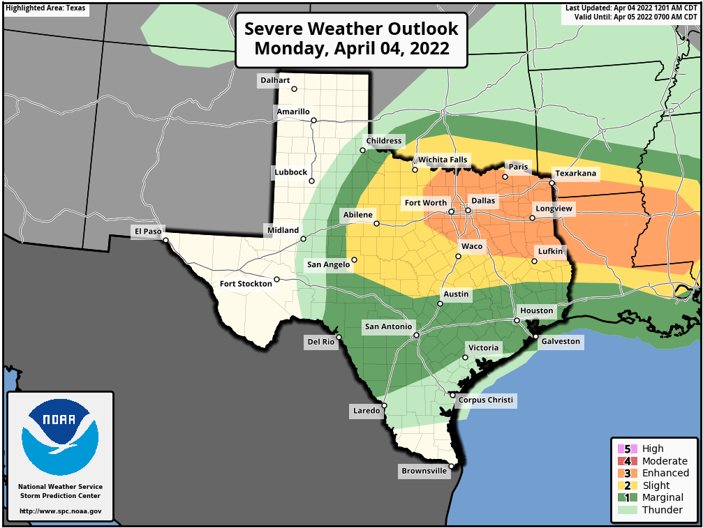
Increasing atmospheric moisture levels will combine with and upper-level disturbance to bring a chance of showers into the region, probably 20 percent today, and 50 percent tonight. While we cannot entirely rule out a thunderstorm or two, by far the better chance for this lies well north of the Houston region, including Montgomery County. (Dallas and Fort Worth may well be affected, so bear that in mind if you’re traveling north). For those who do see a stray shower today or tonight, accumulations will probably be on the order of a tenth or two of an inch. Highs will reach the upper 70s beneath cloudy skies, with lows only dropping to 70. Winds will be out of the southeast at 10 to 15 mph, with slightly higher gusts.
Tuesday
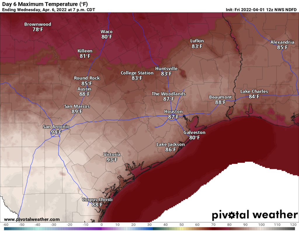
Some light rain is possible Tuesday morning before skies clear out. This sunshine should allow temperatures to really pop, likely reaching the upper 80s to potentially 90 degrees. Overnight lows will drop to the upper 60s. Look for warm south or southwest winds of 10 to 15 mph, picking up a little bit more on Tuesday night.
Wednesday
Highs on Wednesday will depend on the timing of the front, which bring cooler and drier air. (It looks like there will be no rain with the front’s passage). For now I’ll peg the front’s push into central Houston around noon, which should help limit highs, especially for areas inland of Highway 59-Interstate 69. However, where the front doesn’t make it by early afternoon, look for highs again in the upper 80s to 90 degrees. The front will shift winds to come from the northwest, with gusts of 20 to 25 mph. Lows Wednesday night should drop into the 50s.
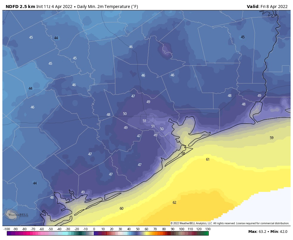
Thursday and Friday
Both Thursday and Friday look fairly breezy, with highs in the 70s to go along with the influx of drier air from the north. Nighttime temperatures should drop to around 50 degrees both nights, with upper 40s possible for inland areas. These days will be quite sunny.
Saturday and Sunday
At this point, and things could change, but at this point Saturday looks to have exceptional weather. We’re talking highs in the range of upper 70s to low 80s, with lots of sunshine and winds dropping off some. The air will still be dry. As the onshore flow gets going, Sunday will probably see the development of more clouds, with highs around 80 degrees, and increasing humidity levels. Next week probably will see this ongoing trend of warmer, and fairly humid weather.