Bulk of the weekend looks great in Houston, though some will see storms Saturday evening

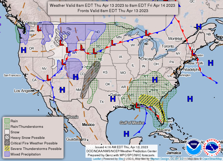
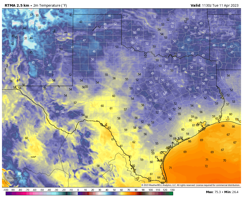
For mid-April, it has been really nice here in Houston. The last several days have been just a few degrees below normal, which in April usually isn’t too bad. Those of you craving something more summery may get a chance to celebrate today and tomorrow. So as to not bury the lede, for those of you with parties or weddings or plans on Saturday: The vast majority of the day looks fine. There is a chance for a few showers in the morning. But the best chance for storms will be in the evening and probably highest to the south and east of Houston. More details below.

Today

Sun will give back in to cloud cover this afternoon. Onshore flow will send the humidity upwards through the day today. So it will feel a little hotter than it has most of this week. Highs top off in the low-80s.

Rain chances are not high, but they are not quite zero, with the best chance of a stray shower or two west of the Houston area late today.

Saturday

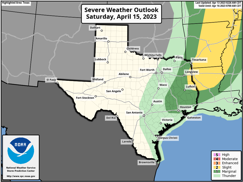
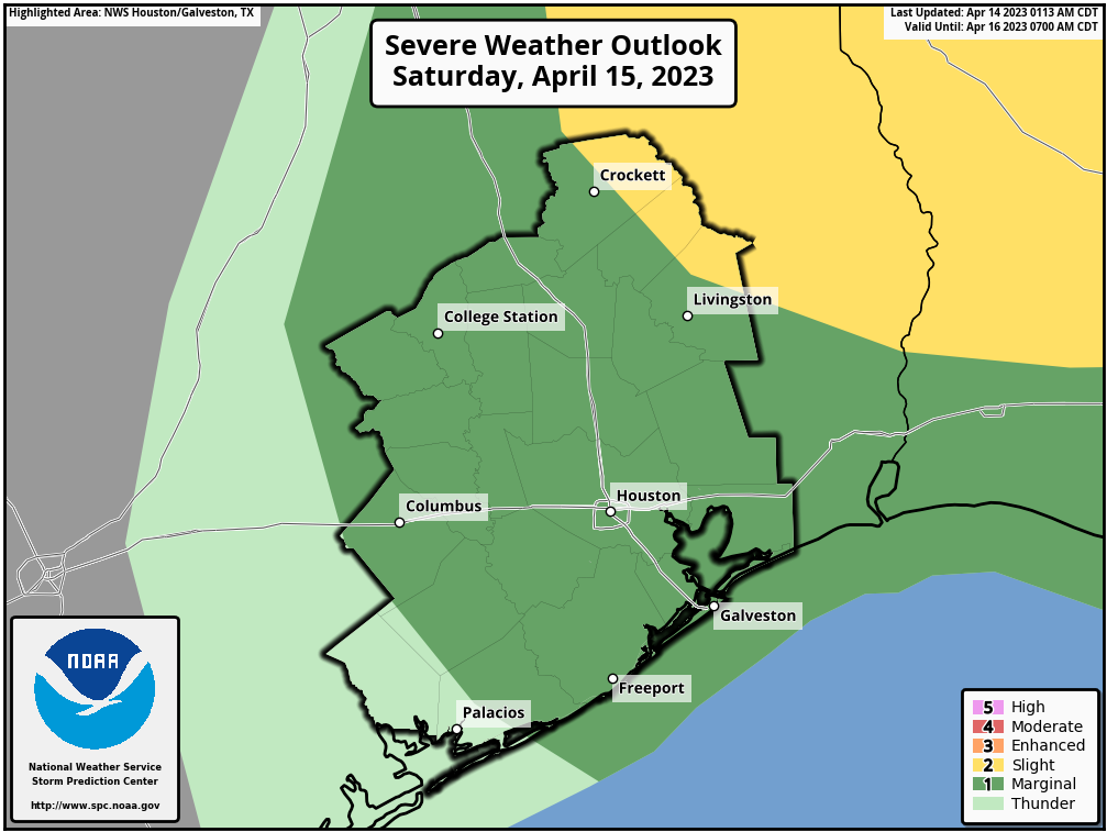
Starting with the rain and storms chances: First off, the Storm Prediction Center has us in a marginal (level 1/5) risk of severe storms tomorrow. So, there is a very minor chance that we could see some strong to severe storms tomorrow evening. Just something to keep in mind if you’ll be outdoors for any evening events. Chances of severe weather are not high, but they are not zero.

The SPC has the Houston are in a marginal (1/5) risk of severe storms for Saturday, with higher chances to our north and east. (NOAA)

So when could it rain? Well, the chance is low (not zero) for the majority of the daylight hours. You’ll most likely be fine. But, a few showers will probably pop up in the morning, especially along or north of I-10, and we could have some pockets of light rain or drizzle elsewhere. The morning may be a bit dreary in spots but probably no reason to call off your plans.

I think Saturday afternoon looks mostly fine at this point. Sure, there’s a chance of a shower, but the vast majority of the area will probably be ok. More on temperatures below.

It’s Saturday evening when the window opens for a better chance at quick hitting storms. Many of you may not see any rain. But the chance is there for the entire area. However, whatever hits Saturday evening will probably be quick (think 30 to 45 minutes mostly). That said, if you have plans for Saturday evening, have a safe spot to retreat to in case lightning comes into play for 45 minutes or so.

Radar on Saturday evening should resemble something similar to this HRRR model forecast, where some of the area sees little to no rain and other parts of the area get quick moving, noisy storms. (Weather Bell)

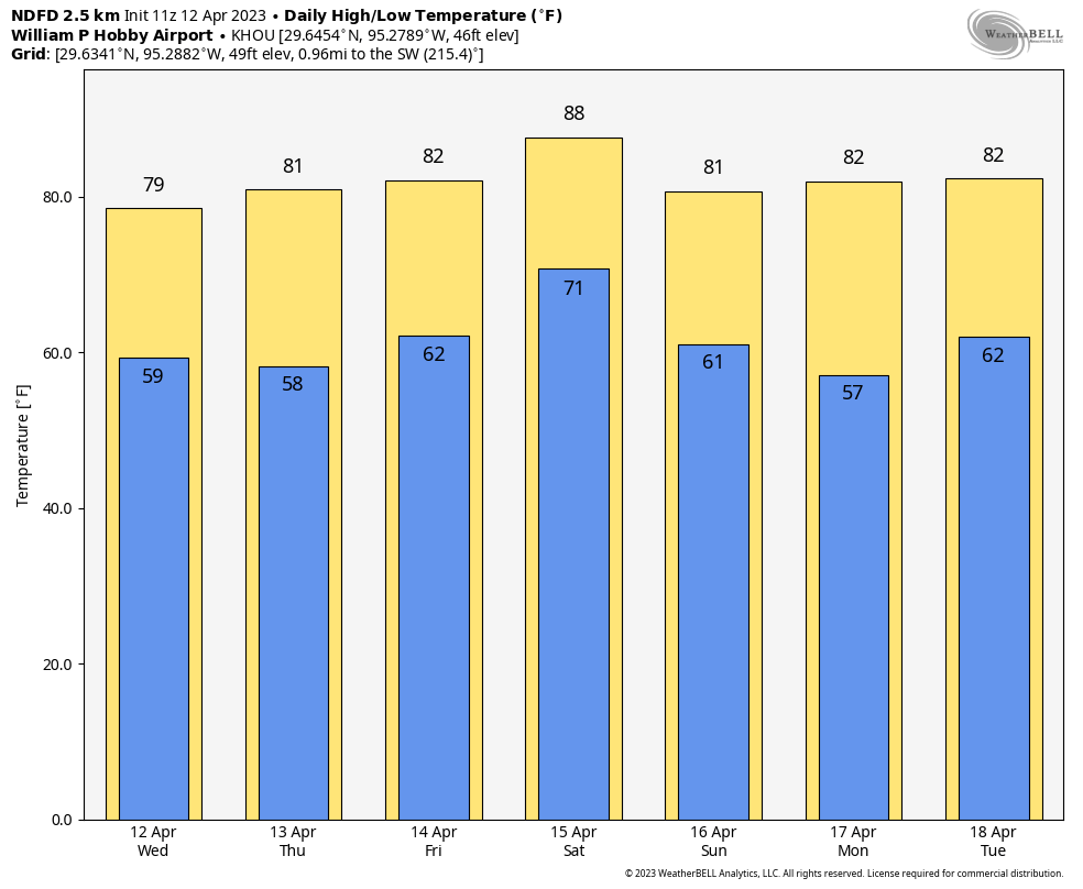
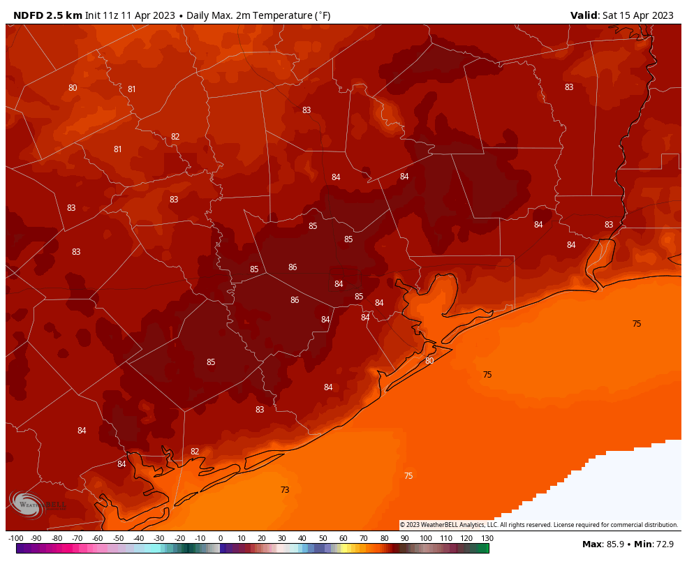
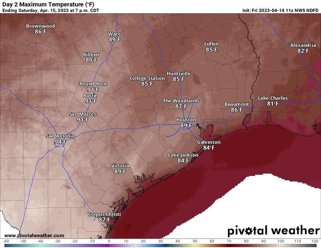
As far as temperatures go, after a morning near 70 degrees, we’re going to surge deep into the 80s I think, with a chance for a few 90s in spots, depending on how much sun shows up.

High temperatures on Saturday will be rather warm, though cloud cover may take some of the edge off. Look for 80s to even near 90 in a couple spots. (Pivotal Weather)

For Saturday evening plans, temps will cool off some, but we probably won’t notice anything really significant until Sunday morning.

Sunday

Humidity will plunge while most of us are asleep Saturday night, and by Sunday morning, it will feel somewhat refreshing outside, with temperatures around 60 or in the upper-50s to start the day. We’ll warm into the 70s with sunshine and a breezy north wind that may gust to 20 or 25 mph at times.

Monday and Tuesday

The week starts off lovely with lots of sunshine and highs in the 70s, lows in the 50s.

Morning lows on Monday will be in the 50s or even 40s in most spots. (Pivotal Weather)

Clouds should begin to build in on Tuesday, and there’s at least a chance of showers Tuesday afternoon and evening.

Mid to late next week

Confidence in the forecast details will drop off pretty dramatically after Tuesday. All I can tell you right now is that there is a chance of showers and storms for the mid to late week period. There may be another front in the weekend timeframe but that is not exactly locked in on the modeling. Whether we see just isolated activity or more numerous, scattered, or heavier storms is an open question right now, something we will effort to have an answer on by Monday.

2023 hurricane season

The crew at Colorado State University unveiled their forecast for the 2023 Atlantic hurricane season yesterday. It calls for an average to below average season this year, something we haven’t seen in preseason forecasts in several years. That’s great news, however it’s important to note that last year was considered an “average” hurricane season, yet it produced the third costliest hurricane in American history in Florida. 1983 was an extremely below average hurricane season, and it produced Hurricane Alicia here in Houston. We know everyone loves these seasonal outlooks, so we share them willingly, but it’s important to prepare for this hurricane season as you would any other.

One of the main reasons they are anticipating average or below average activity is because of a developing El Niño in the Pacific Ocean. The last three summers have been neutral or La Niña driven, so the expectation has been for active seasons. The atmosphere will be much different this summer. In fact, if you look under the surface of the Pacific Ocean, you can see how much warm water is building.

The very top of this image is the ocean surface in the equatorial Pacific. The bottom represents a depth of 450 meters. We are looking west to east (left to right) across the equatorial Pacific here, and you can see a *lot* of warm water lurking under the surface, indicative of El Niño. (NOAA)

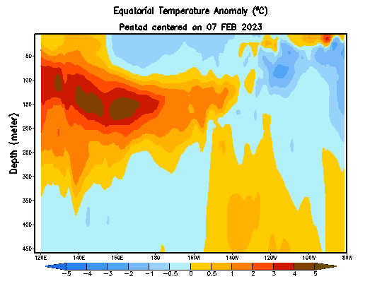
You can decipher the image above in the caption, but the takeaway: El Niño is forming and it’s forming fast. That should aid wind shear in the Atlantic basin this hurricane season, which should hopefully cut down on the ability of storms to organize as easily as they have in recent seasons. That said, the Atlantic Ocean is very warm right now too, as is the Gulf.

Water temperatures in the Atlantic are very warm right now. The Gulf is extremely warm for April, and the Caribbean is average or cool. These will change by May or June, but they are impressive for April. (Weather Bell)

So under the right conditions, it could be favorable for storm formation. Obviously, it’s April and a lot can change between now and August, so for now let’s just be grateful that the initial call for the season is quieter than normal. This El Niño is also likely to eventually impact our weather here in Texas. There’s no magic wand that tells us when or how that will happen, but we will probably notice some wetter periods across the state, more so than we have the last 2 or 3 years.

After a spell of drier air, humidity and some warmth return to Houston through Saturday

Good morning. After a final flirtation with the 50s this morning we are going to see gradually warming temperatures through Saturday, when parts of Houston may hit 90 degrees for the first time. A front on Saturday night will put an end to that. We should see some showers and thunderstorms ahead of, and along with the front, but the overall chance of severe weather now looks fairly low. Sunny and pleasant weather will follow.

Thursday

Houston has enjoyed several days of a northeasterly flow, but all good things must end and this will too, today. As the onshore flow gets going we will see gradually rising humidity levels and temperatures through Saturday. Highs today will reach about 80 degrees with mostly sunny skies, with relatively light southerly winds this afternoon. Low temperatures tonight will drop into the low-60s. Rain chances are near zero.

No rain today as a low pressure system moves away, toward the northeast Gulf of Mexico. On Wednesday night this system brought historic, torrential rainfall to Fort Lauderdale, Florida. (National Weather Service).

Friday

As the southerly flow intensifies, we’ll see stronger winds, perhaps gusting to about 20 mph. The increased moisture in the atmosphere should lead to partly to mostly cloudy skies, and this should help to limit high temperatures into the low-80s. Overnight lows won’t fall very far, likely only to around 70 degrees.

Saturday

The first half of the weekend will be hot, with partly sunny skies and highs generally in the upper-80s. A few areas will probably hit 90 degrees with the warm southerly air. Some showers and thunderstorms will be possible on Saturday afternoon, evening, and night, but the models have backed off accumulations a fair amount. This means that overall rain chances are now about 50 percent, and totals will likely be on the order of an tenth of an inch, or two. The best chance for rain and severe weather, with the front, look to be northeast of the Houston metro area.

Storm outlook for Saturday and Saturday night. (NOAA)

Sunday

Skies will clear out on Sunday morning, with breezy northerly winds. Look for highs in the upper-70s and chilly conditions overnight as lows drop into the low-50s for most of the area. Aside from some occasionally gusty winds—which should be perfect for flying a kite—this will be a fine day to be outside.

Next week

Monday should be another sunny and fine day, with highs in the upper 70s. After that a southerly flow returns to Houston, setting the stage for some rain showers on Tuesday and Wednesday, and warmer days in the mid-80s through the weekend. Overall, April will be doing April-like things.

Houston’s not too hot and not too cold weather continues for awhile

Good morning. A low-pressure system in the Gulf of Mexico will wobble a bit closer to the Texas coast today, bringing a chance of showers to coastal counties this afternoon and evening. Otherwise our weather looks to be fairly calm, with a warming trend heading into the weekend before a front arrives on Saturday night. This system may bring a more widespread chance of showers and thunderstorms.

Wednesday

Winds are light this morning, out of the north, and we should continue to see a light northeasterly flow for much of the day. This should help to hold temperatures in the upper 70s despite mostly sunny skies. We should start to see the development of some scattered showers by mid-afternoon due to the Gulf low, and these will remain possible through the late evening hours. A few thunderstorms are possible. Rain chances are still only about 30 percent, with the most likely locations along and south of Interstate 10. Lows tonight will drop into the upper 50s in Houston, with cooler conditions inland.

Houston will see a pleasantly cool night on Wednesday evening. (Weather Bell)

Thursday

This day will be a lot like Wednesday, albeit with highs a few degrees warmer, about 80 degrees. Rain chances also will be near zero as the aforementioned low drifts away. Expect one more cool-ish night in the upper 50s to around 60 degrees in Houston.

Friday

As the onshore flow resumes, Friday will be more humid with highs in the low 80s and a mix of sunshine in the morning and clouds building in during the afternoon. Overnight lows will only drop to around 70 degrees.

Saturday

The first half of the weekend will be warm, likely in the mid- to upper-80s, with mostly cloudy skies. Shower and thunderstorm chances will increase during the afternoon and evening hours, but again we don’t quite have enough information about the atmosphere to really say whether some strong storms will develop. So for now, the best I can say is that there is the potential for these storms ahead of the front, which will move in late Saturday night.

Houston’s weather for this rest of this week: Not too hot, and not too cold. (Weather Bell)

Sunday and beyond

Sunday and Monday should be pleasant, sunny days with drier air and high temperatures around 80 degrees. Lows should be in the upper 50s. Any outdoor activities look just fine.

By Tuesday the onshore flow will be bringing clouds and humidity back to the area, and this may combine with an atmospheric disturbance to bring a healthy chance of rain to Houston by as early as Tuesday night. Temperatures during the second half of next week look reasonably warm, in the mid-80s for the area with fairly humid air. So it goes as we get into the second half of April.

Pleasant, dry air for two more days before the Gulf low spins away

If you check a radar this morning you can see showers offshore in the Gulf of Mexico. These are associated with a low pressure system in the Gulf. If this were a few months later in the year we would be tracking this closely, but in April? Not so much of a concern. However, a few of these showers may migrate onshore into coastal counties today and Wednesday. We’re also tracking the as-yet uncertain possibility of storms on Saturday in association with a passing cold front.

Nearly all of Texas is seeing a pleasant springtime morning on Tuesday. (Weather Bell)

Tuesday

Mostly the Gulf low will send us a drier northerly flow, as our region lies on its western edge. For today, that means a mostly cloudy morning with some clearing skies later this afternoon. Highs will reach about 75 degrees, with light northerly winds. With dewpoints in the 50s, humidity levels will be reasonably low for mid-April. As mentioned above, areas near the coast may see a passing shower due to the Gulf low. Overnight low temperatures will drop into the upper 50s.

Wednesday

This day should be rather similar to Tuesday, with highs in the mid-70s, and another chance at a passing shower for coastal areas. Lows on Wednesday night will again drop into the upper 50s.

Thursday and Friday

As the low pulls away, we’ll start to see a more southerly flow. If you’ve lived in Houston for any time period at all, you’ll well know that means warmer and more humid air. Highs will reach about 80 degrees on Thursday, and into the low- to mid-80s on Friday under partly to mostly sunny skies. By Friday night lows will only drop to around 70 degrees.

Saturday’s highs will be warm ahead of the next front. (Weather Bell)

Saturday

The weekend will start out warm, with partly sunny skies and highs climbing into the mid- to upper-80s for much of the area. Far inland parts of the region may not get that warm, depending on the timing of a cold front. But wait, there’s uncertainty beyond the timing. While the atmosphere looks to be rather unstable, an important factor for storms, there may not be enough shear to really get strong thunderstorms going. We probably won’t know what is going to happen for another day or two, until we get into the realm of higher resolution models. Until then, you need to at least account for the possibility of showers, thunderstorms, and possibly severe weather on Saturday afternoon and evening in Houston. It is by no means a slam dunk, but it is certainly a possibility.

Sunday

The second half of the weekend looks drier, cooler and calmer, with highs in the vicinity of 80 degrees and mostly sunny skies. Overnight lows should drop into the mid-50s, or thereabouts. So, pretty darn nice.

Next week

The cooler air will stick around for a couple of days before we start to warm up next week. There are hints in the models about more rain in the Tuesday and Wednesday time frame next week. But at this point, who knows? Not this forecaster.