I have been waiting to write this post for four months.
For four very, very long months.
The four hottest months of summer in Houston on record, in fact. This summer was absolutely brutal in terms of daytime highs, overnight lows, and a drastic drought. So yeah, I’ve been waiting to write that the greater Houston region is going to see some meaningful rainfall, to be followed by the season’s first bonafide cold front. Relief is coming, and boy oh boy, is it going to be sweet. Look for high rain chances on Tuesday through Thursday, followed by a frontal passage on Friday. And then? Low humidity and cool nights!
As long as we’re writing about happy tidings and Houston, I’d also like to congratulate the Houston Astros and Texans. Like many of you, we’re big fans of the hometown teams, and Sunday was a big day. The Astros came from behind to sneak past the Texas Rangers to win their division, and set themselves up nicely for the playoffs. And behind the stellar play of their new rookies and head coach DeMeco Ryans, the Texans won their second game in a row. For the first time in a long time they look like a bonafide pro football team with great leadership. So, good tidings all around.
Monday
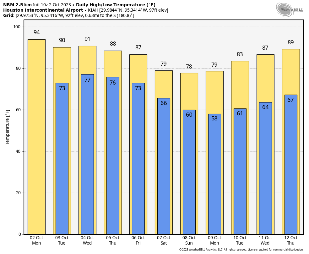
Today will see a continuation of this weekend’s weather, which is to say hot, sunny, and summer-like. Look for highs generally in the mid-90s, with an easterly wind that will at times be a bit gusty, and plenty of humidity. Lows tonight will drop only into the mid-70s for most of the area. Rain chances are near zero.
Tuesday, Wednesday, and Thursday
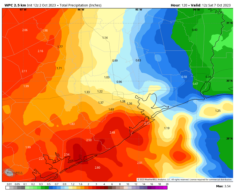
By Tuesday the pattern will begin to change, as the ridge of high pressure that has dominated our weather begins to back away. This will start to open up our region to tropical moisture that will move north from the central Texas coast. Rain chances will increase starting on Tuesday, and remain fairly high through Thursday. Most areas will at least see some light showers each day, with total accumulations likely between 1 to 3 inches over the three day period. A few areas will see more than this, possibly leading to some brief street flooding. Rain chances will be highest to the southwest, near Matagorda Bay, and lowest to the northeast of Houston.
Skies will turn partly to mostly cloudy and this, in concert with the on-and off-again showers should hold high temperatures to around 90 degrees, or slightly above, for much of the region. Expect plenty of humidity, with generally easterly to southeasterly winds.
Friday
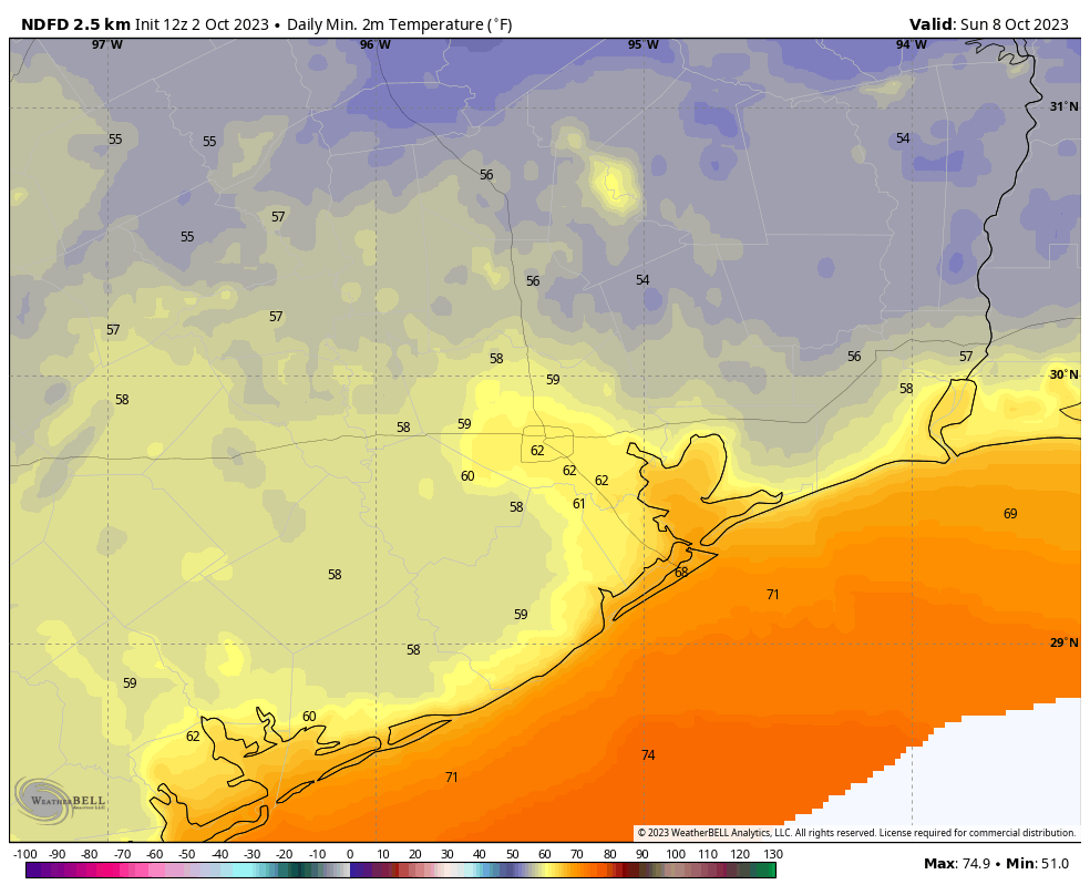
We’re now fairly confident in the passage of a cold front on Friday, and this should bring an end to the showers later in the day. Highs on Friday will be highly dependent on your location, but generally we should be in the 80s, with drier air steadily moving in during the afternoon and overnight hours. Lows should drop into the 60s for all but the coast.
Saturday and Sunday
These look like a fine pair of sunny days with highs of around 80 degrees with drier air. Lows will drop to around 60 degrees in Houston, with some 50s for inland areas. We’ll work out just how cool things will get as we get closer to the weekend, but Sunday and Monday mornings are going to feel absolutely fall like for everyone.
Next week
The cooler weather will hang around at least into Tuesday or so, but after that we’re probably headed back into the upper 80s. As for this mid-90s nonsense we’ve been experiencing of late in Houston, I think we’re done with that for the year.

