In brief: Will Houston manage another freeze this winter? We discuss what’s been in the news. Rain totals this weekend seem to have backed down some but there will still be some serious temperature and humidity changes into Monday before the coldest air of winter so far arrives next week. A light freeze is possible by Thursday morning outside the city.
Will Houston see a serious freeze this winter?
In the news lately has been ERCOT’s reported prediction of a “greater than average” chance of an extreme cold event this winter. Full disclosure: I know Chris Coleman personally, and he’s a solid forecaster and a good guy. ERCOT uses the fact that 5 of the last 8 winters have seen an extreme cold snap in Texas, as well as the fact that the majority of our extreme cold events since 1950 have occurred in La Niña winters. Interestingly, many of those cold snaps have occurred in otherwise mild winters, including 2016-17, our warmest Texas winter on record! So are these events indeed happening more frequent, or is this perhaps the law of averages catching up with us?
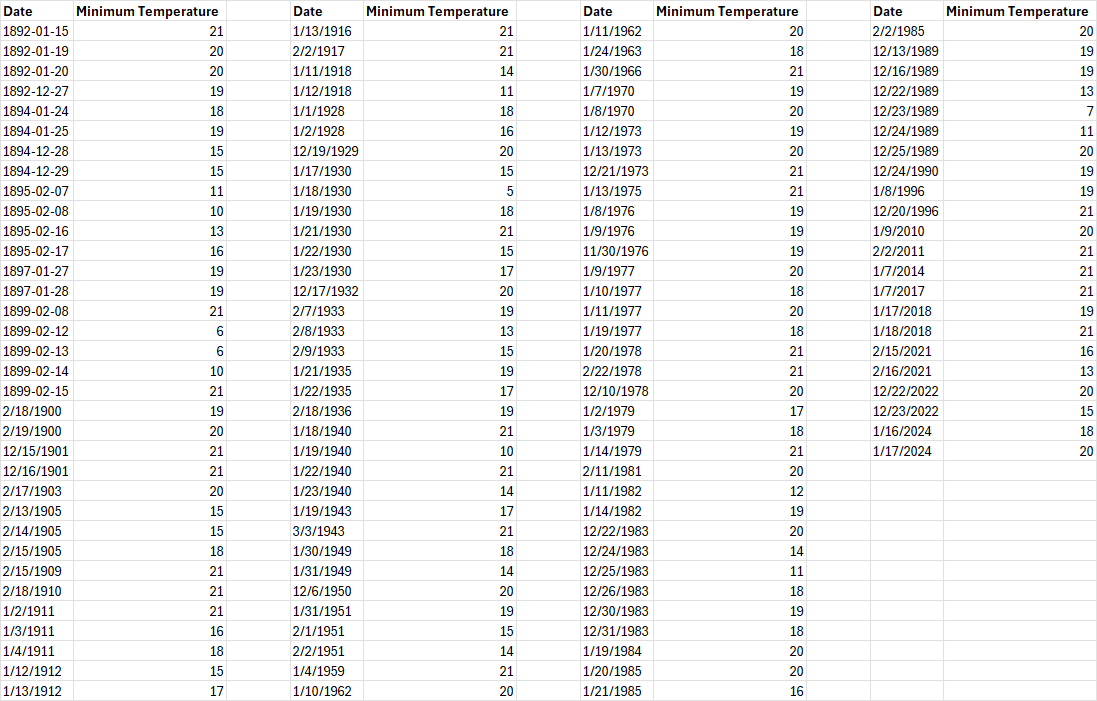
Going back to the 1800s, Houston has officially hit 21° or colder a total of 124 times. As noted, we’ve done it in 2024, 2022, 2021, 2018, and 2017. So it’s been a busy stretch, in addition to a few other instances in 2014, 2011, and 2010. But prior to 2010, we had last done this in 1996. So we went 14 years without hitting it once before racking up a bunch. The only real comparable stretch to that gap was 1918 to 1928, when we got shut out of sub-21° nights. You’ll notice from the data above that while the quantity of years seeing extreme cold seems to have revved up some in recent years, the duration of these cold spells seems to have shortened. And you see fewer winters with multiple extreme cold spells. Some of that is urban heat island effects due to Houston’s enormous growth. Some of that is the warming Gulf of Mexico in our backyard and/or climate change. But mostly, it’s actually kind of typical to have this type of cold in Houston every few winters. Yes, it’s been busy in recent years. But I think that’s more a consequence of having experienced few major cold snaps between 1996 and 2018 more than anything.
So what are we saying? It probably makes sense to prepare every winter for a pop of extreme cold. It may only last a few days, but it can obviously cause problems. And to the original point about this winter: Given the La Niña in place, there should be an ample reservoir of cold built up in Canada by later January and February. It’s a weak La Niña to be sure, but it should still allow for more Canadian cold than in a typical winter. If the wrong setup comes along to dislodge that into the Plains, that’s when we could experience a pop of extreme cold this winter. Putting all this together, it’s not at all illogical to state we have a greater than normal chance of experiencing a brief extreme cold outbreak this winter. Coleman also mentioned in his ERCOT presentation that for cold weather, “This is like a tornado watch. Doesn’t mean a tornado is going to happen. It means conditions are there.” And I think that’s the key takeaway from all this. And it’s also something Eric noted in our commentary on winter back in early November.
On to the weather, of which there is a good bit to discuss this weekend.
Today
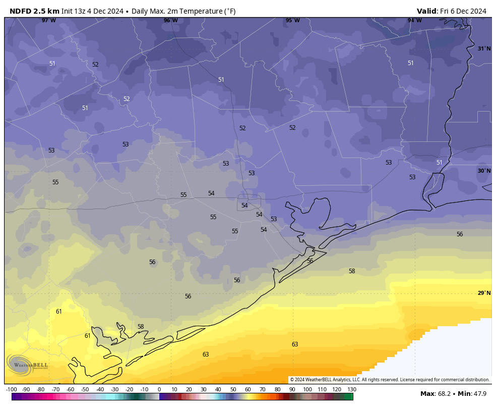
We should close the week out on a cool but benign note. There are some clouds pushing northward across Matagorda Bay, toward Wharton and west out toward perhaps Columbus or Sealy. But aside from that, sun and some clouds rule the day. A chilly morning in the 40s should warm deep into the 50s this afternoon. I would not entirely rule out a passing shower before the end of today, primarily between Matagorda Bay and Columbus or perhaps up toward College Station. Nothing big, just don’t be shocked if you feel some raindrops.
Saturday
Tomorrow will be our transition into a temporary warm pattern, priming us for a wet Sunday. Look for clouds and kind of damp, raw weather on Saturday as humidity levels increase. We’ll manage the mid-50s or a bit milder for highs but between a few showers, the cloud cover, and that rising humidity, “clammy” may be an appropriate descriptor. Look for some low clouds or drizzle in spots in addition to passing showers here or there.
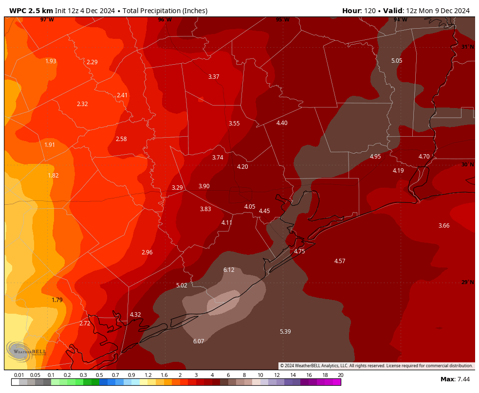
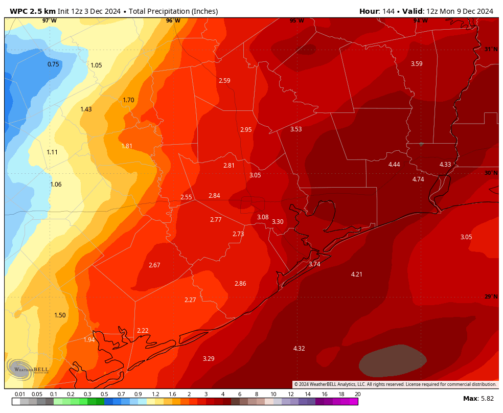
Sunday
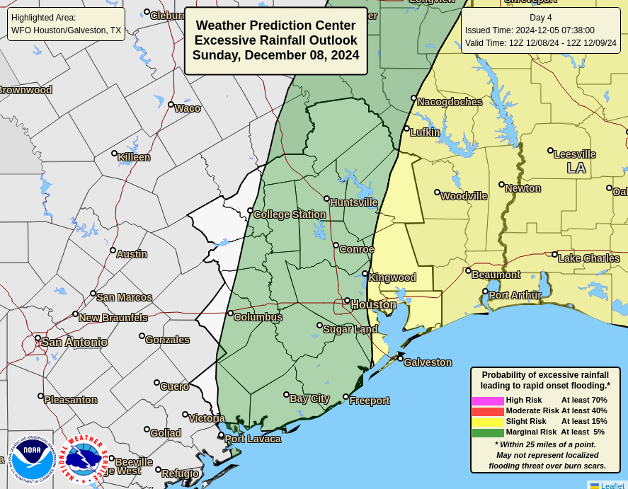
More numerous showers seem likely on Sunday across most of the region. The area is in a marginal risk (level 1/4) for excessive rainfall. At this point we think that the only flooding would be typical ponding issues on area roadways (ex: frontage roads) or in small areas that see brief street flooding due to downpours. Modeling seems to have backed down on the amount of rainfall to expect and rain totals have generally been cut as a result.
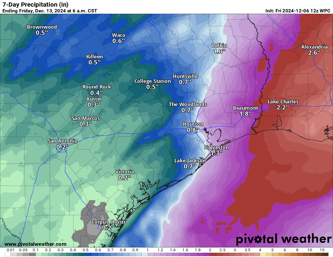
The best ingredients to sustain rainfall will be to our east, so places like Beaumont or Lake Charles will be more apt to see more rain it seems. Temps will surge on Sunday though as warm air floods in off the Gulf, along with breezy conditions. Look for highs well into the 60s.
Next week
There will be a disconnect between this weekend system and the incoming cold front, so Monday falls firmly in the warm category. We’ll manage highs into the 70s with a good bit of humidity. The cold front hits Monday night, which as of now looks fairly dry. It appears a secondary front arrives Tuesday afternoon. The combination of the two will allow for Tuesday’s temperatures to drop into 60s for highs and allow for the coldest air of the season Wednesday night.
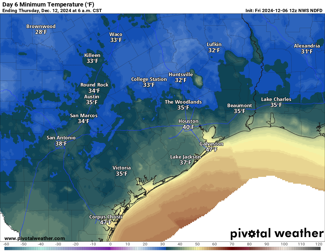
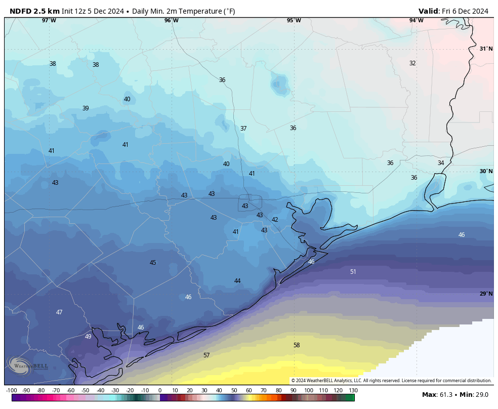
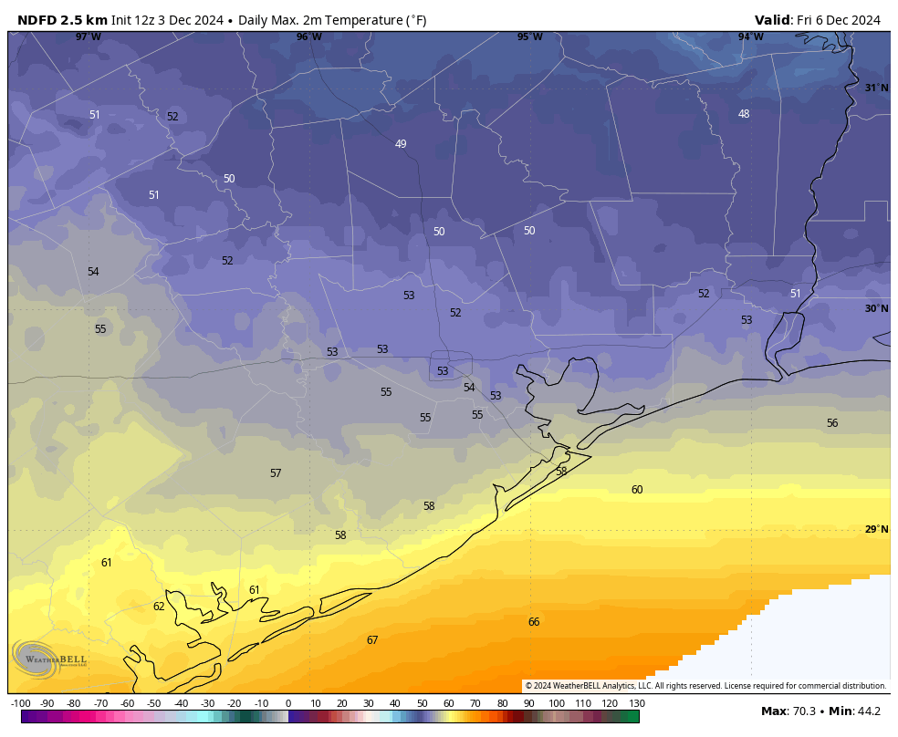
Some places will approach freezing Wednesday night and Thursday morning, primarily north of Houston and outside the city. Daytime highs on both Wednesday and Thursday will limp into the upper-50s or low-60s at best. A somewhat more sustained warm up may follow next weekend and into the week of the 16th. More to come.