Finally, some tranquil weather comes to Houston for a few days before rains return this weekend

Summary: Under the influence of high pressure, the Houston region will see calm weather this week. We’re going to see some seriously nice conditions before the onshore flow returns by Thursday or so. Unfortunately the weekend will be marred by increasing rain chances. Saturday looks especially wet at this point.

It’s a chilly morning across the state of Texas. (Weather Bell)

Monday

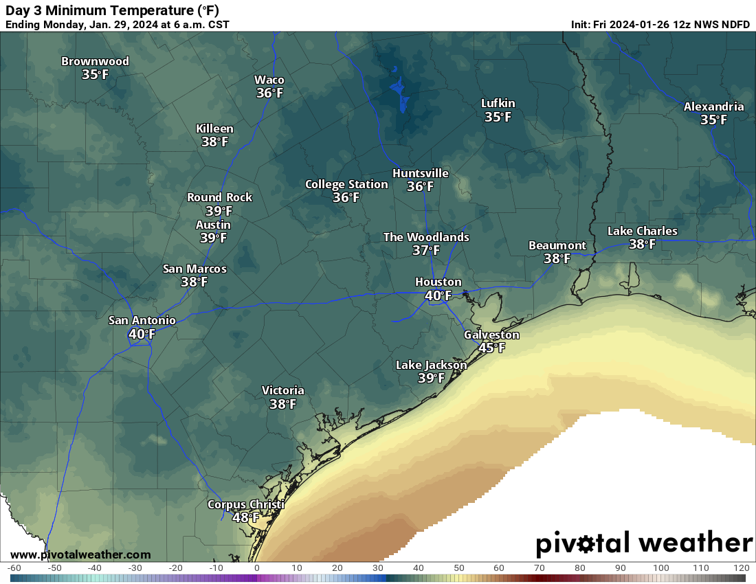
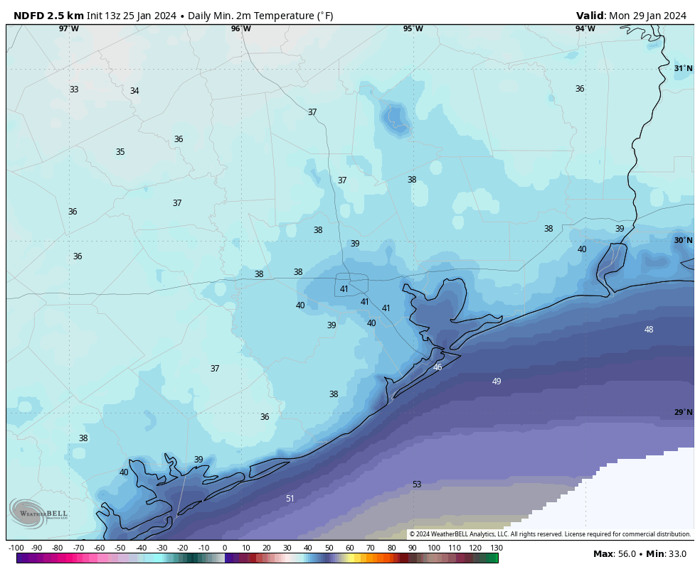
It’s chilly outside, with lows dropping in the upper 30s to around 40 degrees in Houston this morning. These will be the coldest temperatures of the week, as we’ll see a gradual warming trend heading into the weekend. Skies today will be mostly sunny, with light winds from the northwest, and then the west. Low temperatures tonight will be a bit warmer, generally in the mid-40s in Houston.

Tuesday and Wednesday

These will be a pair of partly sunny days, with highs near 70 degrees, and plenty of dry air. Winds will be light. Lows will drop into the upper 40s for most locations. This will be seriously nice winter weather for Houston.
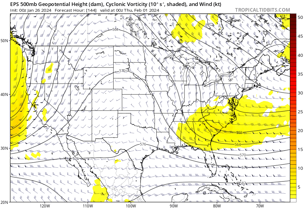
Thursday and Friday

The pattern will begin to change, slowly, with the return of a more pronounced onshore flow by Thursday. We’ll start to see humidity levels rise some, and winds will be a little more noticeable from the south at about 10 mph. Highs both days will be around 70 degrees, give or take, with partly sunny skies. By Friday night we may only see lows drop into the upper 50s, with a slight chance of rain in response to rising moisture levels.

Saturday and Sunday

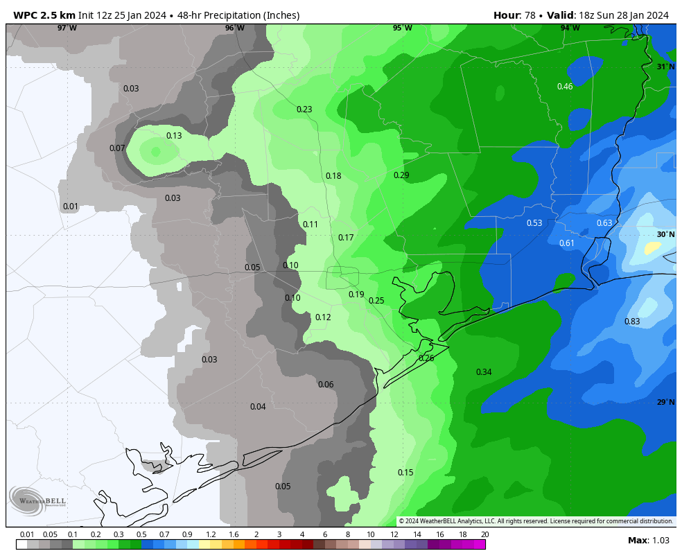
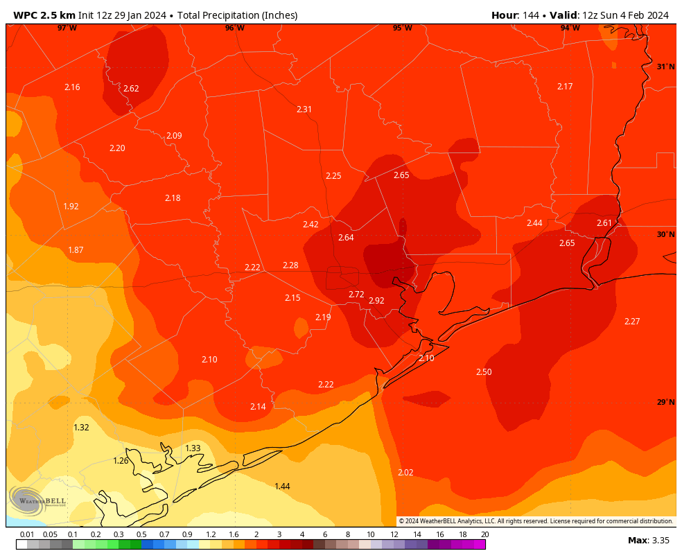
In response to an upper-level disturbance we are going to see increasing rain chances from Saturday morning into Sunday morning. The precise contours of this rain are yet unclear, but it’s likely that we’ll see 1 to 3 inches with the best chances during the daytime on Saturday. Highs will be in the upper 60s on Saturday, and then cooler on Sunday in the wake of the cool front, perhaps only 60 degrees. Sunday, probably, will be mostly sunny. Lows on Sunday night will drop to around 40 degrees.

NOAA rain accumulation forecast for now through Sunday morning. (Weather Bell)

Next week

The start of next week should see the continuation of sunny skies, with days in the 60s and nights in the 40s. All in all, things look fairly mild and dry.

Last gasp of rainfall later today in Houston, for now at least

Summary: We have one final round of rain showers to get through today, although this will be a mere drop in the bucket compared to what fell earlier this week. We then have an extended stretch of dry weather through probably next Thursday or Friday before rain chances re-enter the forecast. Temperatures will be fairly temperate, with a couple cooler days through the period.

Rainfall summary

For Houston, this will officially be at least our 8th wettest January on record. Bush Airport has picked up 8.28″ of rain this month so far. Hobby sits at 7.48″, making it the 6th wettest January. Galveston is at a more meager 5.20″ of rain officially at Scholes Airport, though a rain gauge near The Strand is up over 9 inches this month.

A sampling of rain so far this month as of last night across Harris County and the immediate surrounding areas. It’s been a soggy, soggy month. (Harris County Flood Control)

Many larger rivers remain in moderate to even major flood (West Fork of the San Jacinto & Trinity). The National Weather Service has an interactive map with gauges across the region that you can check out for more details.

Today

Watch for some dense fog around the area this morning which could slow you down a bit heading out the door. Otherwise, we will just see clouds through midday. Scattered to numerous showers should crop up this afternoon, after about 1 or 2 PM. The good news is that rain totals are expected to be less than a half-inch and probably closer to a quarter-inch in most cases. Thus, we do not anticipate any flooding concerns today. Showers will exit the area by about midnight or so tonight.

It will be a bit cooler today with highs in the mid-60s, after we hit 71 degrees yesterday officially.

Weekend

Saturday looks like a cooler sort of day with temperatures warming from the low to mid-50s into the upper-50s to low-60s and a good deal of cloud cover. I wouldn’t be shocked to see a few spotty (inconsequential) showers or some light rain for a brief time in spots, especially north and east of Houston. Otherwise, just mostly cloudy.

We dip into the 40s in most spots on Saturday night and Sunday morning before a very nice day Sunday, Sunshine and mid to upper-50s are on the menu.

Monday morning should be the coldest of the next several days, with 30s in much of the area to near 40 in the city of Houston. (Pivotal Weather)

Monday through Wednesday

Monday will be the coldest morning of this batch of days, with lows in the 30s over a good chunk of the area and around 40 in Houston proper. We’ll have another nice day Monday with sun, some high clouds, and highs in the lower half of the 60s.

Tuesday and Wednesday should see sunshine, although high clouds may spoil that at times. Remember early December, when we had all those spectacular sunsets and an almost permanent deck of cirrus clouds streaming by? We may be setting up in a similar sort of pattern again. Either way, expect highs in the mid-60s Tuesday and upper-60s Wednesday, with lows in the 40s.

Late next week

The pattern begins to change later next week, as another vigorous disturbance emerges out of the Pacific Ocean. This one should crash ashore in California, move through the desert, and emerge over the Southern Plains around next weekend.

A map of the forecast about 20,000 feet over our heads between next Wednesday night and Sunday showers a disturbance hitting California and working eastward toward Texas. This will bring increasing rain chances back to the area, though we cannot pin down details yet. (Tropical Tidbits)

The exact intensity, timing, and orientation of this upper level system will determine exactly how significant our rain chances will be. But there is good model agreement on something barging through here next weekend with a round of rain. Ahead of it, probably continued 60s, lows in the 40s and 50s, and perhaps some coastal sea fog.

Finally, some quieter weather lies ahead for Houston

Summary: January often yields fairly placid weather in Houston, but this year we’ve had a wild ride. The last 10 days have brought sub-freezing temperatures, a light dusting of ice on area roadways, and most recently some fairly heavy rainfall and thunderstorms. Can we just get a break? Fortunately, the answer is yes.

Thursday

After the final round of storms moved through last night, we’re seeing slightly drier air filter into the region along with a weak front. Skies will eventually clear out some, so we should see partly sunny skies this afternoon to go along with highs of about 70 degrees and lower humidity. Lows tonight will drop into the 50s.

NOAA rainfall accumulation forecast for Friday and Friday night. (Weather Bell)

Friday

As I mentioned, it was a weak front, so it’s not going far. We’ll see the return of a southerly low as soon as Thursday night, so clouds will start to build by Friday morning. Some fog development is also likely. Highs again will be around 70 degrees, but this time with some more humidity. As a stronger front approaches we’re likely to see some rain showers on Friday afternoon and evening, especially across the eastern half of the metro area. The good news is that accumulations look to be fairly low, perhaps one to two tenths of an inch for most locations. Lows on Friday night will drop into the 50s.

Saturday

We’ll see sunny and breezy conditions on Saturday as much drier flow follows the front’s arrival. We may see some gusts up to 25 or 30 mph (closer to the coast) during the daytime, with highs likely in the mid-60s. Lows on Saturday night will drop into the mid-40s in the metro area, with cooler conditions for outlying areas.

Sunday

This will be a sunny day, with a high temperature of about 60 degrees. With lighter winds, expect overnight temperatures on Sunday night to bottom out at about 40 degrees in Houston, with outlying areas seeing the upper 30s.

Monday morning should be the coldest of the upcoming forecast period. (Weather Bell)

Next week

We’ll experience sunny to partly sunny skies through around Wednesday, with highs in the 60s and lows generally in the 40s. After that time we should see the return of a southerly flow, with highs working their way toward 70 degrees with milder nights toward the end of the week. Some rain chances may return by Friday or Saturday, but nothing too significant looks to be in the cards.

Enjoy the quieter weather. I know I need a break.

Are you sick and tired of the rain, Houston? We’re almost through after one more stormy night

Living in Houston is such a weird trip. We’ll go through an event like Hurricane Harvey and never, ever want to see another rain drop again. Then we’ll go through something like last summer, with its heat and drought, and the first decent rain of the fall will feel so damn cathartic. I don’t know about you, but after this week my pendulum has swung back toward not wanting to see it rain for awhile. I could do with some sunshine.

The good news is that the Sun will rise again. The bad news is that we have to get through tonight. Here’s a quick look at the forecast for the rest of today and tonight.

Wednesday night and Thursday

There have been plenty of rain showers across the metro area today, but accumulations have been manageable with most areas picking up 1 to 2 inches. We should see a few more hours of on-and-off showers before they become more scattered in nature this evening. This lull will be short lived however, as a weak front pushes through during the overnight hours.

HRRR model depiction of a line of storms at 3 am CT on Thursday morning. (Weather Bell)

What can you expect? Sometime between about midnight and 4 am, a broad line of showers and thunderstorms should push from west to east across the Houston region. There will be plenty of sound and fury, but the good news is that these storms should keep moving. I expect they will have cleared the area by around 4 to 6 am, so I don’t anticipate them posing a problem with getting out and about on Thursday morning. (Getting solid sleep on Wednesday night might be a problem, however, for those light sleepers among us.) In terms of accumulations overnight, I expect we’ll see some heavy rainfall, but due to storm motions I’d only anticipate accumulations of 0.5 to 1.5 inches.

We should see partly sunny skies on Thursday, with highs of around 70 degrees and some drier air—so pretty darn nice out. The region will see another chance of showers (likely with minimal accumulations) later on Friday ahead of a stronger front. This will usher in several days of sunny skies and much drier air. So by Saturday morning we’ll be done with the rain for awhile.