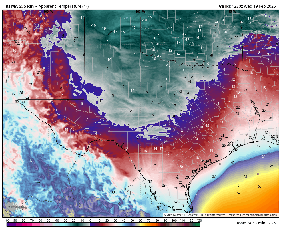
In brief: After a very cold period over the last 12 days, much milder weather is on the way for Houston. And with March just around the corner, I’m confident enough in the forecast to predict that the Houston metro area is done with freezes for the remainder of this winter and early spring.
February, a tale of two halves
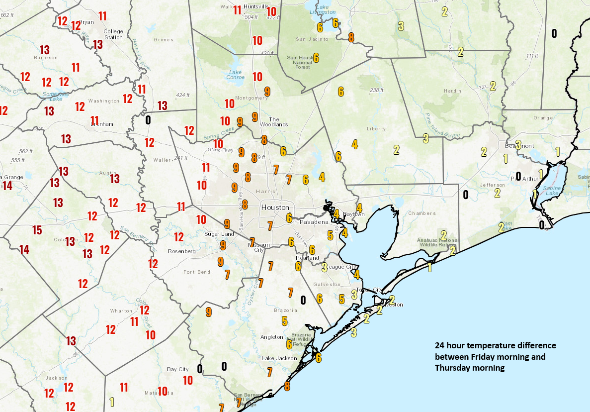
The first 12 days of this month were incredibly warm in Houston, with several days of record high temperatures. Since then we have been mostly below normal for the region. So far this month, because of the blistering start to February, the average temperature is running about 2.5 degrees above normal.
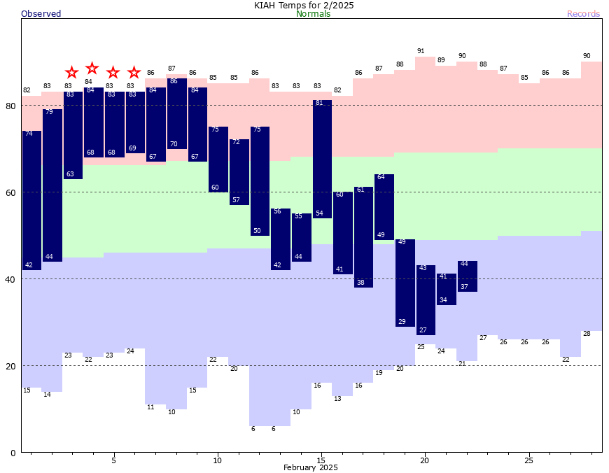
It may have felt like spring had arrived at the beginning of the month, but if you’ll recall we warned you three weeks ago that winter was not yet over. And so it wasn’t. Well now, my friends, we can pretty confidently say that we’re not going to experience another cold spell like that again this season. From a climatological perspective winter does not end until March 1, but from a practical point of view, winter in Houston appears to be over.
Will it freeze again?
Probably not. In the Houston metro area, historically, there is about a 30 percent chance of a freeze after this point in the year. (It drops to 10 percent by March 18). However, because we can safely say there is not going to be a freeze at least over the next 10 days, I would say we are most likely done with freezes this season. So unless you live north of Conroe or in College Station, I’d feel pretty confident planting your gardens and setting tropical vegetation outside.
Monday
The moderate to dense fog we’re seeing this morning is one sign of warmer temperatures coming. Air temperatures and dewpoints this morning are virtually the same, in the upper-40s across the metro area. The fog will dissipate as temperatures rise, and we’re going toward highs in the upper 60s today. After the fog lifts we’ll see sunny skies, with light winds. Lows tonight will drop into the upper 40s again for most of Houston, with partly cloudy skies. We’ll likely see the development of some additional fog early on Tuesday morning.
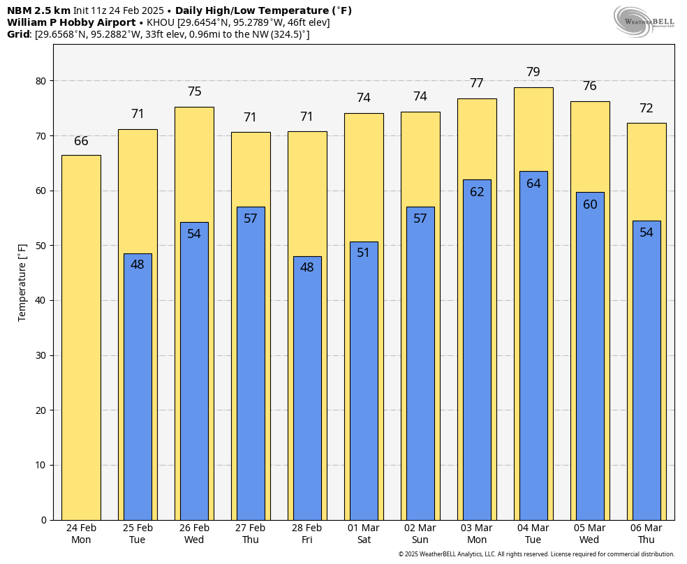
Tuesday and Wednesday
These will be a pair of mostly sunny, pleasant days with high temperatures in the low 70s on Tuesday, and mid- to upper-70s on Wednesday. Both nights will see partly to mostly clear skies, with lows in the 50s.
Thursday and Friday
A weak front arrives to cool us down slightly for the end of the week. Although I think the frontal passage will be dry, I cannot guarantee it. Anyway, we should see partly sunny skies on Thursday in association with the front before sunny skies arrive on Friday. Highs will be around 70 degrees both days, and I expect slightly cooler nights in the upper 40s.
Saturday and Sunday
The weekend looks mild. There should be plenty of sunshine on Saturday, with highs in the low- to mid-70s, and a mild night in the 50s. (It should be nigh on perfect weather for Mardi Gras, so come see us in Galveston). By Sunday we’ll see an increasing chance of rain, but overall chances are probably less than 50 percent. We’ll see.
Next week
The first half of next week could be warmer as we slide into March, possibly with some highs reaching 80 degrees. A modest front likely cools us off by Wednesday or so, but again it may be the kind of thing where lows just drop back to around 50 degrees. We’ll see.