In brief: We’ll see a reasonably warm day today, and beginning later this morning and running through this evening there will be the possibility of showers and potentially a few thunderstorms. That changes overnight as drier and sharply colder air moves in. You’ll want to bundle up on Wednesday and Thursday mornings.
Bundle up heads up
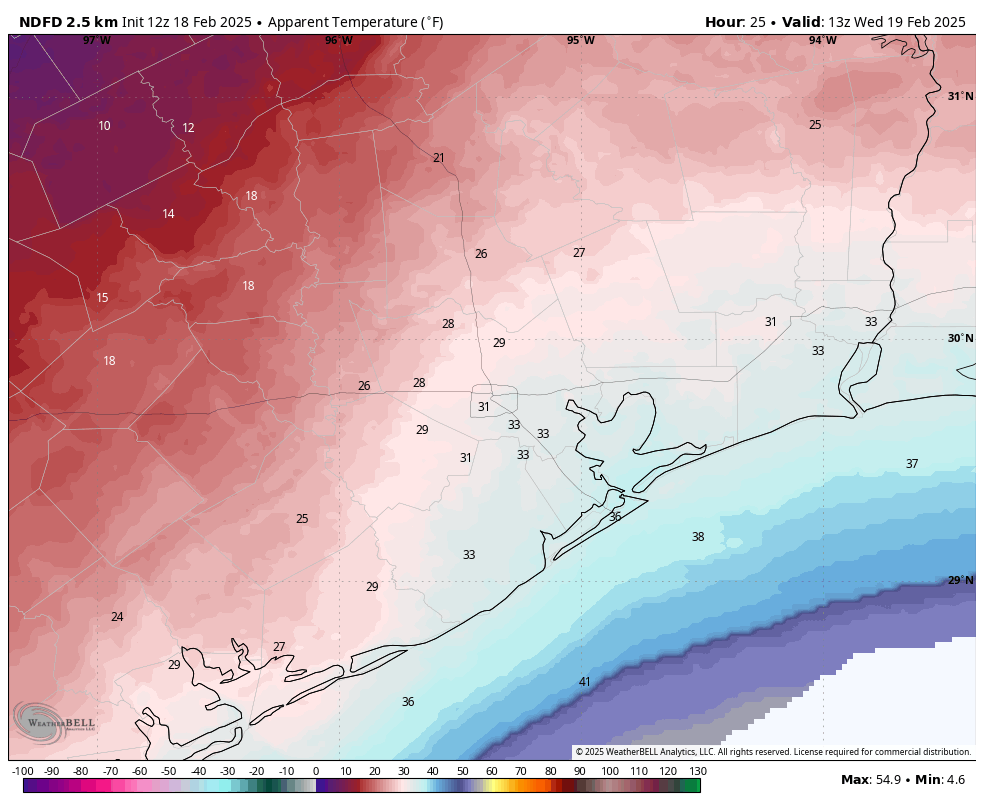
Don’t let today’s mild temperatures lull you into thinking winter is over. Even when you go to bed this evening, especially for coastal counties, you won’t feel like anything particularly cold is in the cards. But during the overnight hours a potent front will sweep into the area. By sunrise on Wednesday morning air temperatures will have fallen into the low 40s. However, with northerly winds of about 20 mph and noticeably higher gusts, it will feel much colder outside, especially for areas north and west of downtown Houston. So when you’re packing the kids off to school, or dressing for work, make sure to wear an extra later to ward off the cold and wind.
Tuesday
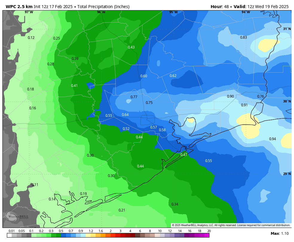
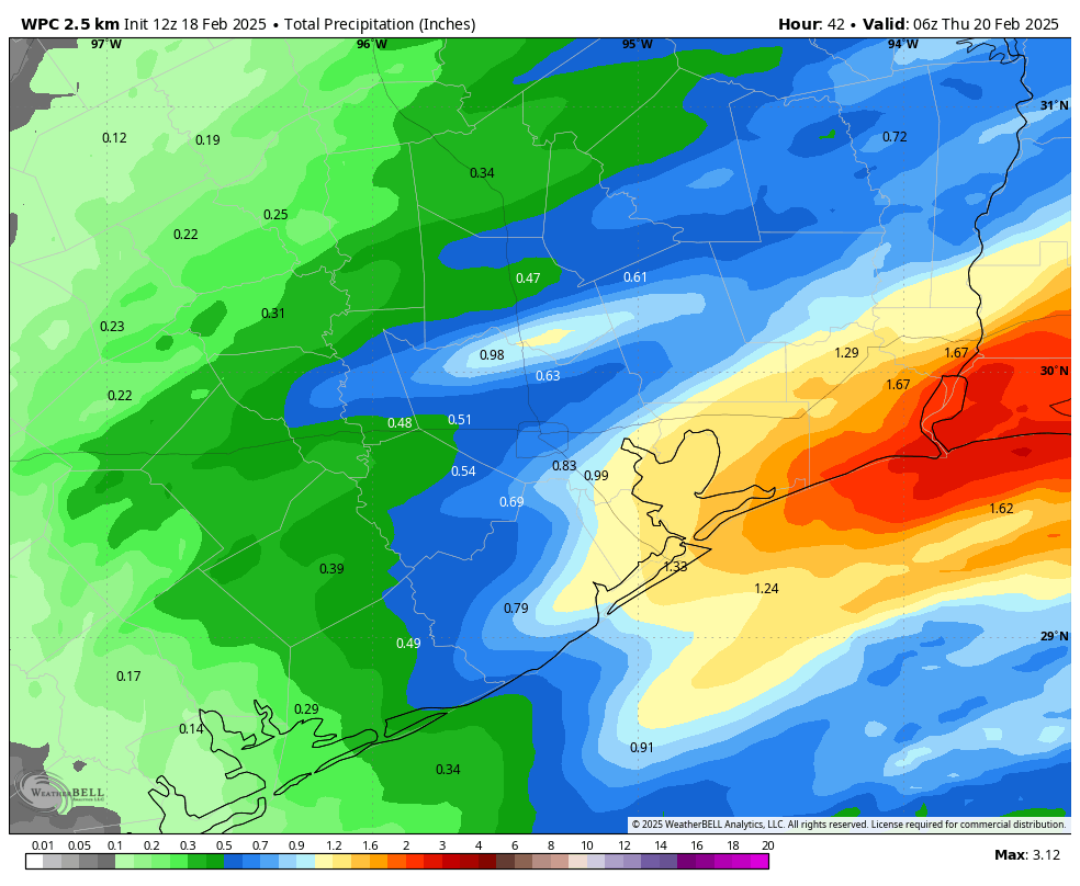
As noted above, the weather today will be rather mild for mid-February. We are going to see high temperatures in the mid-60s beneath cloudy skies. The warm weather will hang around all day before a cold front pushes through during the overnight hours. In addition to warmer air, we’re going to see scattered showers and thunderstorms this afternoon, with the peak potential between about 6 pm and midnight. I don’t believe these storms will be too impactful, but you may need to dodge some showers. Accumulations look greatest to the east of Interstate 45, where 0.5 to 1 inch of rain is possible.
Wednesday
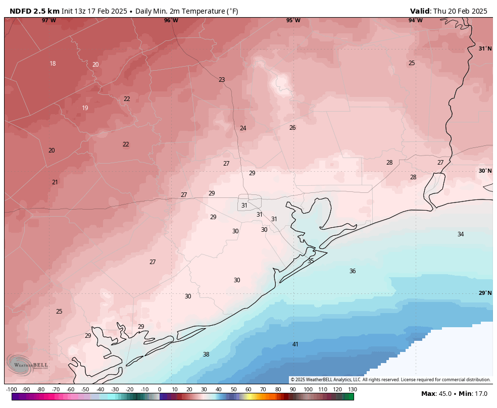
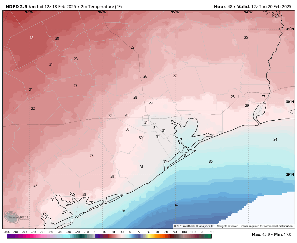
Temperatures will begin to plummet after midnight across Houston, and we’ll wake up to a gusty, cold morning. Winds will peak at 20 to 25 mph sustained on Wednesday morning, with higher gusts. With clearing skies we should see highs in the mid- to upper-40s, but the winds will make it feel cold all day. With partly cloudy skies, we’ll see favorable conditions for cooling on Wednesday night. I expect lows to fall to about 30 degrees in the urban core of Houston, and for coastal counties perhaps a degree or two warmer, at or just above freezing. Inland areas should drop into the mid- to upper-20s.
Thursday
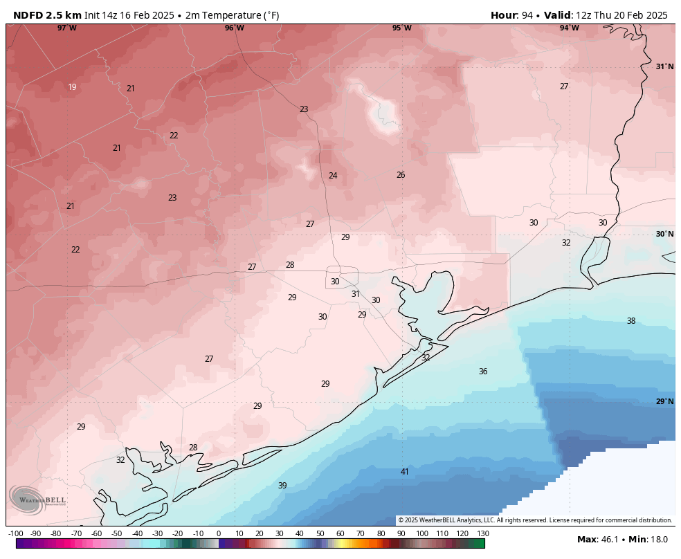
Winds will not die off entirely on Thursday morning, and with gusts of 15 to 20 mph there will be a distinct chill in the air. It will “feel” well below freezing across the metro area, so this will be another morning to bundle up. Highs on Thursday, with mostly sunny skies, will top out in the mid-40s. Another night of freezing temperatures is possible for inland areas, although conditions should be 1 to 4 degrees warmer for most locations.
Friday
A cloudy and cold day, with highs in the low 40s. Friday night will be chilly, with lows dropping into the upper 30s for most of the region, and some light drizzle possible.
Saturday and Sunday
A coastal low pressure system will help provide a surge of moisture into the atmosphere on Saturday, so we’re going to see a healthy chance of light-to-moderate showers during the daytime, with decreasing coverage during the evening hours. Expect high temperatures in the low 50s, and overnight lows in the mid-40s. Sunday looks more spring-like, with partly to mostly sunny skies and highs in the lower 60s to mid-60s.
Next week
The majority of next week looks mild, with high temperatures in the 70s, lows in the 50s, and a fair amount of sunshine. Hello, spring?