Stalling boundary will bring heavy rain to parts of Houston metro area today

In brief: A line of showers and storms has moved into the central Houston region this morning, and this activity should sag down to the coast throughout the day. After another chance of showers on Wednesday, most of the rest of this week looks warm, humid, and partly sunny.

Easter Sunday rains

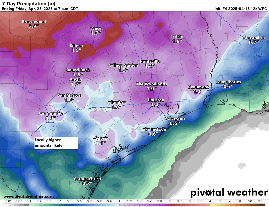
Most of the western half of the region saw rain on Sunday and Sunday night, with upwards of 3 inches in some locations near Katy and The Woodlands. However, many areas closer to the coast remained dry overnight. That is likely to change today as the slow-moving front continues to sag into Houston and moves closer to the coast. Thus the areas most likely to see moderate to heavy rain over the next 24 hours will be south and east of Houston.

Houston radar just before 7 am CT on Monday. (RadarScope)

Monday

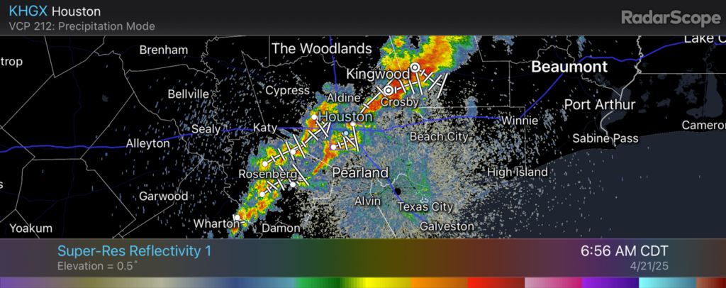
At sunrise this morning a line of storms is present from Sugar Land through Houston and into Kingwood. These showers and thunderstorms are moving very slowly to the east in response to the boundary. For areas inland of these showers, the rain is likely done for today. But for areas south and east, there is a high potential for moderate to heavy rain today. Accumulations will likely be on the order of 0.5 to 2 inches, with higher isolated totals. Rain chances should slacken, area-wide, this evening. Temperatures today will likely max out in the vicinity of 80 to 85 degrees, with the potential for partly sunny skies for inland areas. Lows tonight will only fall to around 70 degrees, with cooler temperatures far inland due to the retreating front.

Tuesday

This should be a partly sunny day with temperatures in the low- to mid-80s. Some scattered showers and thunderstorms will be possible, but overall chances are probably 30 percent, or less.

Wednesday

A passing disturbance should spark a higher chance of rain on Wednesday, so expect a mix of light to moderate rain with a few scattered stronger storms during the daytime. This should help to limit high temperatures to about 80 degrees. Nights will remain warm and humid throughout the week, and Wednesday night will be no exception.
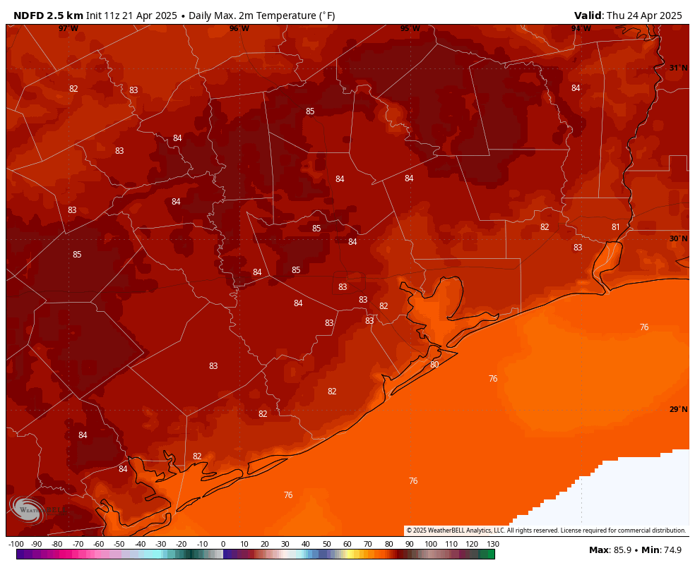
Most of this week will see highs in the low- to mid-80s. (Weather Bell)

Thursday and Friday

These should be a pair of partly sunny days with highs in the mid-80s and warm nights. Winds will continue to come from the south, perhaps gusting to about 20 mph during the afternoon.

Saturday and Sunday

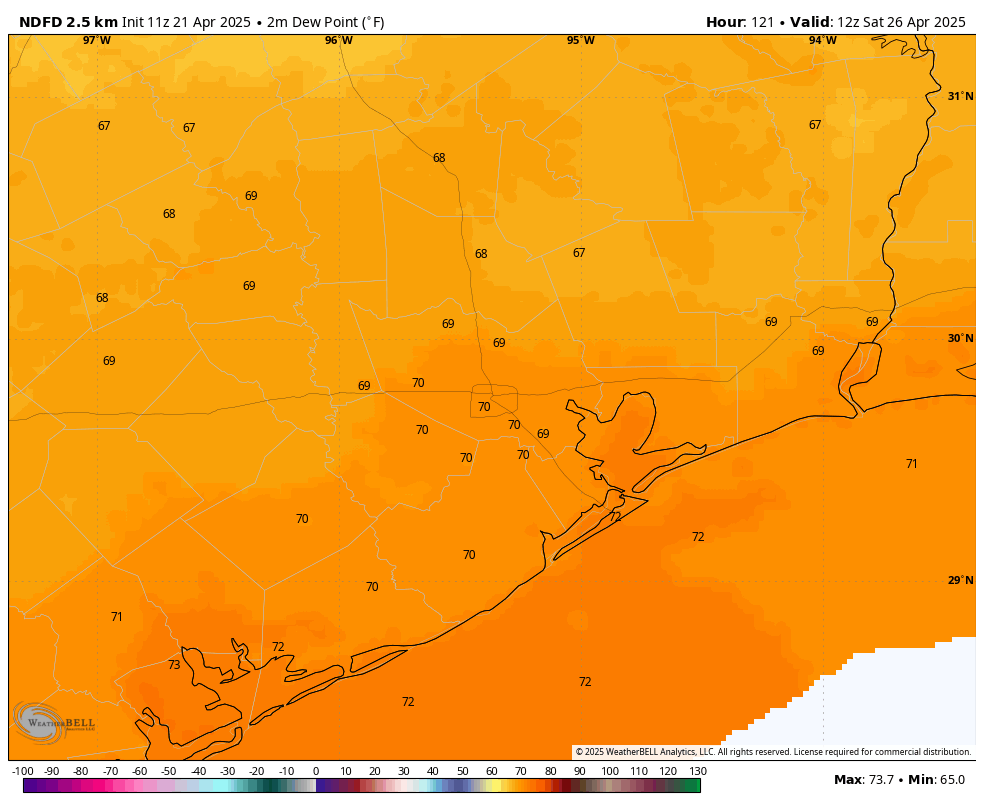
If you like warm and humid weather, have I got a deal for you! This pattern will persist through the weekend. As skies likely become a bit more sunny, we can expect high temperatures in the mid- to upper-80s for most of the region. It may be a pretty good beach weekend. For the MS-150 riders you can likely expect a tail wind on Saturday and a cross-tail wind on Sunday. All in all, the only hazard will likely be UV rays, so be sure to wear some sunscreen. Unfortunately for the IRONMAN competition in The Woodlands, while I’m not concerned about rain, dewpoints around 70 degrees will make for very difficult conditions for the long run.

Dewpoints at sunrise on Saturday will be sticky. (Weather Bell)

Next week

This warm and humid pattern will likely persist into next week, although there is a chance of a cold front pushing all the way through the area by the following Wednesday or Thursday. I don’t want to over-promise, since that is so far away. However I do have a bit of hope that we are not yet quite done with dry air in Houston

The Easter bunny may bring storms later this afternoon, and especially overnight into Houston

In brief: Happy Easter to all who celebrate. Wanted to jump in with a quick holiday post so people are not surprised if thunderstorms pop up today, and by the possibility of some stronger storms this evening and during the overnight hours.

The remnants from a line of storms over Central Texas are currently approaching the Houston region this morning, and this will produce some showers and thunderstorms generally west of the city this morning, including in the Katy region. More isolated showers and thunderstorms will be possible through the late morning and early afternoon hours across Houston, but there’s probably at least a 50 percent chance you don’t see rain until later today or this evening.

Precipitable water levels will peak around midnight tonight across the metro area. (Weather Bell)

However, by this afternoon a weak front will sag into the region, stalling over the city of Houston. This will serve as a focus for the development of thunderstorms this evening, and during the overnight hours. Some of these thunderstorms could become severe, with the potential for damaging winds. Right now the dynamics are most favorable for thunderstorms north of Interstate 10, but I would not rule out thunderstorms anywhere in the metro area tonight and through at least Monday morning. On the Excitable Dogs Scale from 1 to 10, let’s call this a 7.5.

Rainfall amounts are going to be highly variable, but accumulations from this afternoon through midday on Monday could range from 1 to 3 inches for most locations, with the risk of higher totals. I would not rule out a few bullseyes of 5 inches or more somewhere in the metro area. This has the potential to cause some street flooding by the Monday morning commute. I’m going to hold off on issuing a Stage 1 flood alert, but this is something we’ll be watching today and update if warranted.

Easter Sunday forecast is finally coming into better focus

In brief: In this update we take a look at the forecast for Easter Sunday, which does not look too impactful for the greater Houston area. Nonetheless we are likely to see rain showers, and a few sporadic thunderstorms, on Sunday afternoon and evening.

Hi everyone, just wanted to jump in on this Saturday morning to provide a final look at the forecast for Easter Sunday (unless the outlook changes dramatically). We are still looking at a warm, mostly cloudy day today with temperatures in the mid-80s. Rain today and tonight is rather unlikely, so there are really no concerns beyond the relatively high (for April) humidity.

Severe weather outlook for Sunday and Sunday night. (NOAA)

The forecast begins to change some on Sunday, when a weak front will sag toward the area. Most of our high resolution modeling suggests that Sunday morning should be fine, aside from the slim possibility of a few stray, light showers. Chances for showers and few thunderstorms increase during the afternoon hours for the western portion of the Houston metro area, and then spreading into the entire region during the evening. It would not surprise me if the best chance of rain for most locations in Houston comes during the overnight hours, into Monday morning, as the front stalls over the city.

In terms of impacts, most of Houston can expect between 0.25 and 0.75 inch of rain on Sunday and Sunday night, with the possibility of some sporadic thunderstorms. In terms of severe weather, the primary risk is damaging winds. But truth be told, overall, this does not look like a particularly threatening event. I’m hopeful that most of Houston will be able to enjoy outdoor activities through the morning and, possibly, much of the afternoon hours on Sunday. One can never be quite certain with setups like this, however, with a slow-moving front moving into an atmosphere with a decent amount of moisture.

If the outlook changes significantly, we will update this evening or on Sunday morning.

A somewhat sloppy springtime weather pattern looks to set up over Houston beginning on Easter

In brief: The first part of the weekend looks good, but we do expect Houston to see thunderstorms on Easter Sunday. Some of those storms could be strong, and that will be followed by more storm chances next week. Springtime is in force.

Today & Saturday

If you like hot weather, you’re in luck! There’s a pretty good chance we’ll hit or exceed 90 degrees today. It will also be quite breezy with south winds gusting up to 30 mph or so. Other than that, expect a mix of clouds and sun.

Many parts of the area will hit the upper-80s to low-90s today. (Pivotal Weather)

Saturday will be a bit cloudier. We’ll have a very mild morning, with lows probably not much below 75 degrees, close to a record for warmest April 19th morning. The day should again be breezy, mostly cloudy, and not quite as hot (but plenty humid). Highs should get into the mid or upper-80s. Shower chances look minimal, but I wouldn’t be shocked if the sky squeezed out a few raindrops here or there. Better shower chances will exist back toward Hill Country.

Easter Sunday

Sunday morning will be at least a little interesting. There should be a line or complex of thunderstorms near I-35 and the Austin area around sunrise. As those cross I-35 and move toward southeast Texas, they *should* begin to fall apart. Thus, the morning should be mostly cloudy with a couple showers here or there. As the boundary from that decaying line of storms hits Houston in the afternoon, we should see new thunderstorms blossom across the area. Some of these storms could be on the stronger side, and the SPC has us partially in a marginal (1/5) risk for severe weather on Sunday. This could yet change some between now and Sunday.

A marginal risk (1/5) for severe weather is in place on Sunday for afternoon and evening thunderstorms, with gusty winds or hail a possibility. (NOAA SPC)

In addition to the potential for some strong to severe storms, atmospheric moisture levels will be more typical of mid-summer, so we could see some torrential downpours and localized street flooding crop up.

Eric and I will monitor this through tomorrow and have any updates for you on Sunday morning.

Next week

The cold front that will be responsible for the storms on Sunday is likely to stall out or wash out overhead. I would not be shocked to see the focus of thunderstorm activity on Monday to stay mostly east of Houston, closer to Lake Charles and Beaumont. But by Tuesday, that may swing back toward us, leading to scattered storms for Tuesday and possibly Wednesday or Thursday. This is the time of year where we can see afternoon storms blow up in portions of north or central Texas, organize into a cluster, and make their way toward us as complexes of storms called mesoscale convective systems (or MCS’s). I would not be at all shocked to see us have to wrangle that next week at least once. Bottom line: It looks unsettled.

Rain totals of an inch or more inland and at least a half-inch at the coast are likely through next week. There will be higher amounts peppered in as well. (Pivotal Weather)

It’s a bit early to get into potential specifics, but it does appear that next week will be active. The clouds and shower chances will hold daytime temperatures lower next week (more like low 80s), with warm nighttimes in the upper-60s to low-70s.