Late summer heat continues, with little change expected until next week

In brief: This is largely a persistence forecast. Houston will face temperatures in the low- to mid-90s this week before rising humidity levels bring highs down slightly this weekend. Bigger changes are possible next week, but we’re making no promises.

Tuesday

We are seeing mostly cloudy skies this morning due to a passing disturbance. If there were more moisture in the atmosphere this might spark some showers, but there’s just not much to work with. So we have overcast skies, and these should give way to sunshine later this morning or by early afternoon at the latest. Following this we are going to see temperatures rise into the lower 90s in Houston, with mid-90s possible for areas west and north of the city. Afternoon dewpoints will drop to about 60 degrees so this won’t be super sultry weather like summertime in Houston, but it will be hot for the end of September nevertheless.

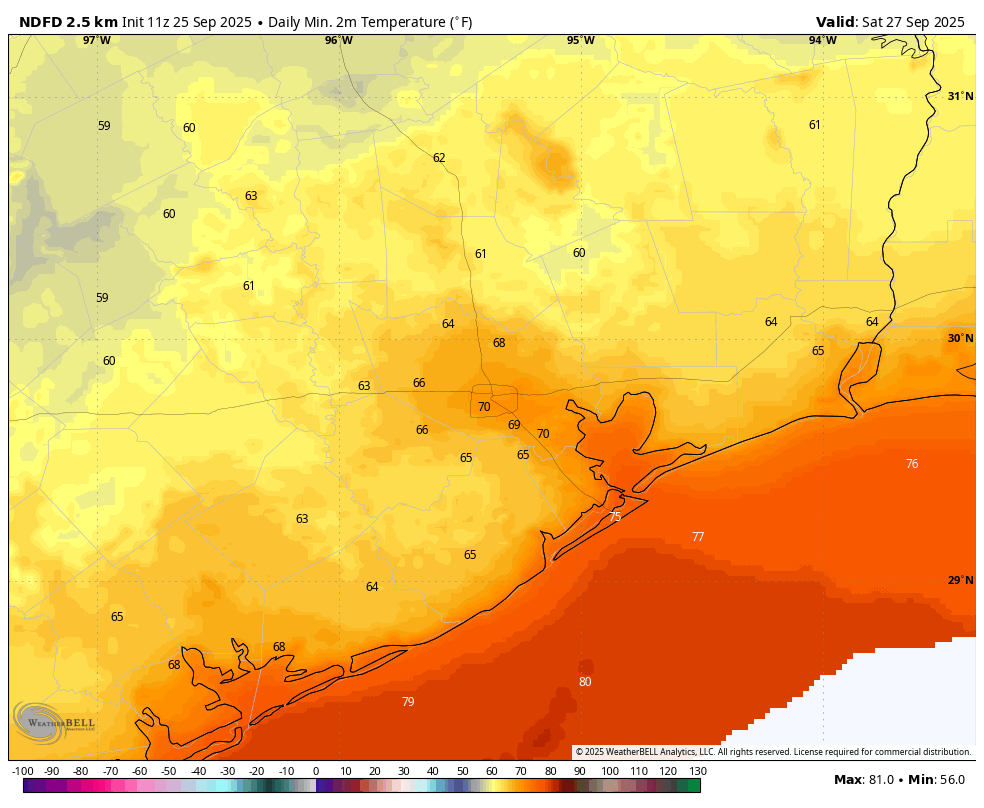
Winds will be light, from the north at about 5 mph today, shifting to come from the east tonight. Lows will drop into the lower 70s. With the slightly lower humidity, nights and mornings will continue to feel pleasant for a couple of more days before dewpoints rise a bit by Friday or so.

High temperatures on Thursday should be the warmest of the week. (Weather Bell)

Wednesday and Thursday

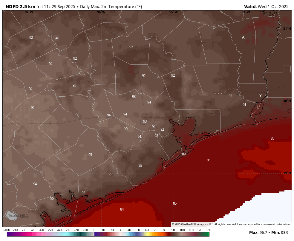
These will be hot and sunny days, with highs in the lower 90s in Houston, and possibly mid-90s for inland areas. Dewpoints will remain marginally lower to keep a bit of a lid on humidity. Rain chances remain near zero. Nights drop into the lower 70s for most except the coast.

Friday, Saturday, and Sunday

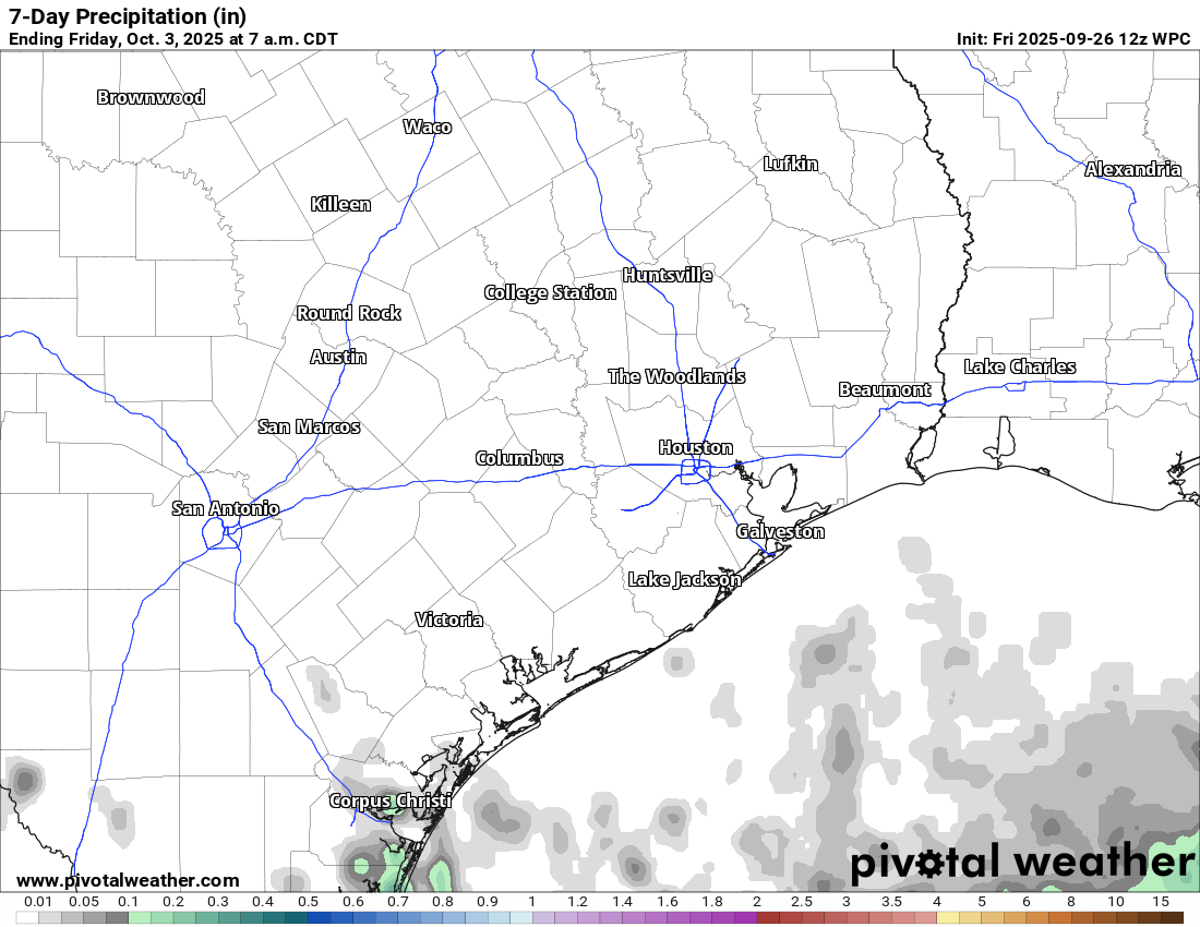
By the weekend the flow turns more southerly, so dewpoints will ramp up slightly. This increased atmospheric moisture should limit highs to around 90 degrees, and push overnight lows to the mid-70s. Each day should bring a slight chance of rain, perhaps 20 or 30 percent for areas near the coast, with lesser chances inland. Any accumulations should be very slight.

Temperatures next week continue to look hot as a heat wave grips the northeastern US. (Pivotal Weather)

Next week

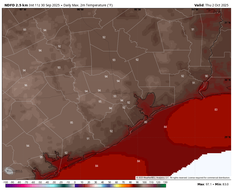
Most of next week will likely see a continuation of the pattern above, with highs in the vicinity of 90 degrees. Rain chances may start to look a little better by Monday or Tuesday, but we still probably are looking at overall low likelihoods and nothing serious in the way of accumulations. That may finally start to change toward the end of next week when a cool front could approach the area. But from this far out I would be a fool to make any promises. So I’m not.

Late summer weather to hold on this week: mid-90s possible for a few days in spots

In brief: In today’s update we discuss the upcoming heat for this week, which may relent slightly by the weekend. We also remain in a bear market for cool fronts, with nothing in the cards until at least the middle of next week.

There is a pleasant chill across the northern half of Texas this morning. (Weather Bell)

Heat, with October on the horizon

We’ve had a pretty typical September, in which we still have some hot days, but also get some slightly cooler nights from time to time. This week the calendar turns to October, but the heat is continuing. Inland areas may reach the mid-90s for a couple of days (Wednesday and Thursday). How normal is this for this time of year?

Well, it’s not normal, but we also probably will not set any record highs. The highest temperature recorded in Houston on October 1 is 99 degrees (1900) and on October 2 it is 97 degrees (1938). So yes, our highs are likely to run several degrees above normal this week, but we should fall short of record heat. And this week’s soaring temperatures serve as a reminder that although fall is clearly on the horizon, we’re still dealing with the remnants of summer.

Monday

High temperatures today should remain in the lower 90s for most of the area, with a nice amount of drier air. Skies will be mostly sunny. Dewpoints should drop into the 50s this afternoon. However nighttime temperatures should be several degrees warmer, perhaps dropping only into the lower 70s, as some clouds build overhead due to a passing disturbance.

High temperature forecast for Wednesday. (Weather Bell)

Tuesday, Wednesday, and Thursday

A few clouds may linger into Tuesday morning, but for the most part these days will be sunny and hot. Central and southern parts of Houston may remain in the lower 90s, but some inland spots will probably hit the mid-90s with sunny skies and a fairly dry atmosphere allowing for efficient heating. Nighttime lows will be in the lower 70s. This probably isn’t the way most of us wanted to begin October, but here we are.

Friday, Saturday, and Sunday

A slightly more humid flow should moderate daily high temperatures a bit, to around 90 degrees this weekend. I still expect mostly sunny skies, but we could also see some isolated to scattered sea breeze showers each afternoon. Overall, chances each day are probably about 20 percent. If you’re participating in the 2025 Komen Houston Race for the Cure I expect conditions to be fine on Saturday morning, with any showers (however unlikely) holding off until the afternoon.

Next week

I expect this pattern to mostly hold for next week, with highs in the vicinity of 90 degrees. There is some whiff of a front in the models during the second half of next week, but nothing so concrete as to have any confidence at this point. We shall see.

Tropical outlook for Monday morning. (National Hurricane Center)

Atlantic tropics

We have a busy scene in the Atlantic tropics, with Hurricane Humberto briefly ascending to Category 5 hurricane status on Sunday, but fortunately no direct threat to land. Tropical Storm Imelda also formed this weekend over the Bahamas, but due to interactions with Humberto it is likely to be pulled away from the southeastern United States, out to sea. And finally it is possible that a tropical disturbance develops in the southern Gulf at some point during the next week or so, but this seems unlikely to track north toward Texas and be a significant player in our weather.

A lengthy stretch of calm weather to close September for Houston

In brief: A lengthy stretch of quiet weather will settle into Houston. No rain is expected over the next week, and temperatures look warm for this time of year, albeit with tolerable humidity. Our next front is TBD. The tropics remain a non-concern for Texas.

We are heading into a lengthy stretch of pretty quiet weather in the Houston area. Just to give you an idea of how quiet, here’s the 7-day rainfall forecast from the NWS for our area:

Dry as a bone. (Pivotal Weather)

So, expect a lot of sunshine the next several days!

With that will come drier conditions and certainly more autumn-like humidity levels. This will keep things hot but relatively comfortable. However, each afternoon, relative humidity levels should dip below 40 or even 30 percent.

On several upcoming afternoons (Saturday shown here), relative humidity levels will drop below 40 or even 30 percent. (Pivotal Weather)

With light winds forecast for the foreseeable future and some ample rain in many spots of late, fire danger isn’t exactly high, but if you are going to be working with open flames, particularly in more rural parts of the region, you’ll want to exercise some caution given the drier air mass in place here.

We will probably see humidity levels rebound a little next week. Temperature levels will too. We’ll go from upper-80s to around 90 degrees the next few days into the firmer low-90s later next week. Nighttime lows will only increase slowly, back to perhaps near or above 70 by later next week.

We could see temps spike to the mid-90s for a couple days later next week. Our next front is TBD, but there are hints of perhaps another weak one next weekend.

Tropics

We continue to see the Gulf shut out of tropics risks, good news for sure. But folks on the East Coast will need to monitor the 90% development area. Potential tropical cyclone advisories could be issued on this as early as later today. The track forecast is coming into focus now, with a path toward the Carolinas likely.

Humberto will remain out at sea, while the disturbance moving into the Bahamas may keep moving into the Carolinas. (NOAA NHC)

There are still a number of questions on 94L moving into the Bahamas. But it looks like it will be a hefty rainmaker for parts of the Carolinas, hopefully east of the footprint of Helene last year. You can follow our coverage of this system at The Eyewall.

As a weak front moves into Houston, we believe the Texas hurricane season is probably over

In brief: Today’s update discusses the increasingly busy Atlantic tropics, but also explains why the threat of a hurricane striking Texas this year is falling rapidly. We also detail a weak front moving into the region today, and how that will bring us fine, dry weather for awhile after this morning.

Hurricane season heats up, but what of Texas?

After a quiescent period in late August and for much of September, the Atlantic tropics have woken up. We have seen Hurricane Gabrielle blow up into a major hurricane (far from land), we have newly formed Tropical Storm Humberto (which could threaten Bermuda early next week as a large hurricane), and Invest 94L, which is likely to develop near the Bahamas during the next couple of days. The latter storm will be worth watching for the United States, from Florida up the East Coast, although there remains a lot of uncertainty. We will have comprehensive, ongoing coverage on The Eyewall.

But what of the Gulf, and Texas? It has been an exceptionally quiet season for the state in terms of direct impacts from tropical storms and hurricanes. And looking ahead over the next 10 days, although there may be some tropical mischief in the Bay of Campeche, it is difficult to see anything too organized forming and moving north into Texas. We have reached the time of year when it becomes incredibly rare—although to be clear, not impossible—for a hurricane to strike the state during the remainder of the Atlantic hurricane season. Therefore we can say, with some confidence, that the 2025 hurricane season is probably over for Texas.

So what does this mean? It means that the odds of a hurricane striking the state are now less than 1-in-50 for the remainder of the year. It means that we still might see rains or moderate winds from a tropical disturbance or storm. The tropics don’t immediately shut off. But overall, the prevailing pattern will be one that steers storms away from Texas.

Thursday

Mother Nature is presently authoring a tale of two cities right now. For northern areas of our region, drier air is already filtering in, with some locations in Montgomery County enjoying dewpoints in the 60s. For areas closer to the coast, in places such as League City and Santa Fe, there are ongoing showers as the rains work their way slowly to the southeast.

Overall the pattern today will be one in which drier air slowly moves in from the north, pushing the warmer, more humid airmass and its rains offshore. As a result most of the region should see mostly sunny skies later today, with highs in the mid- to upper-80s. Winds will be generally light, from the northwest at 5 to 10 mph. Low temperatures tonight will fall into the upper 60s for much of Houston, with cooler lows further inland, and the coast remaining in the lower 70s.

Forecast low temperature for Saturday morning. (Weather Bell)

Friday, Saturday, and Sunday

Our forecast for the weekend is one of high confidence. We will see three sunny days with high temperatures generally in the upper 80s, with nights falling into the upper 60s for most of Houston, with cooler conditions further inland and warmer ones closer to the coast. With dewpoints in the 50s and 60s the air will feel fairly dry, and mornings and evenings should feel especially fine. It’s not exactly fall like, but after a long hot summer, it’s going to feel great.

Next week

In all likelihood not much is going to change next week. We are going to see highs around 90 degrees, lows around 70, with slightly higher humidity levels by Wednesday or so. Overall rain chances, after this morning, appear to be quite low until at least next weekend.