Storms possible later today as front moves in, ending our extremely sultry nights for a spell

In brief: In today’s post we recount the extraordinary humidity currently afflicting the region, and explain why it will soon end. Houston also faces the threat of storms and some heavy rainfall later this afternoon and this evening as a cool front moves into the area and eventually pushes off the coast.

Oh, the humidity

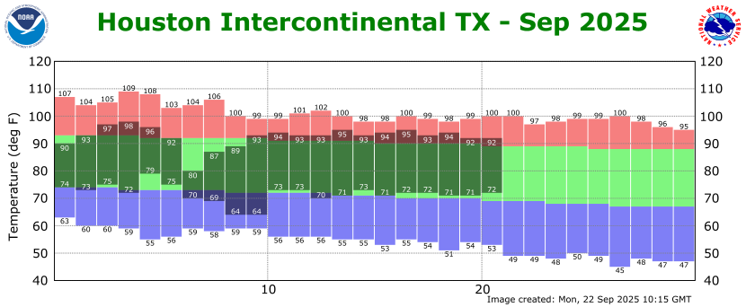
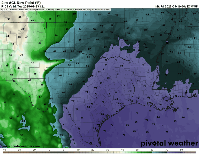
I don’t know if you’ve noticed, but the humidity the last couple of nights has been extraordinary. This morning, just before sunrise, the low temperature at Bush Intercontinental Airport has reached a low of just 80 degrees. This is solidly 2 degrees above the previous ‘record minimum’ temperature at the site of 78 degrees, set back in 1945. The dewpoint is 79 degrees this morning, so the air is nearly saturated, and humidity is very high. It feels like deep summer out there.

Houston’s temperatures just before sunrise on Wednesday are significantly above normal for late September. (Weather Bell)

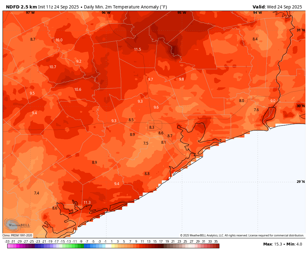
As you cans see above, the region’s minimum temperatures this morning are running 8 to 12 degrees above normal for the region. So yeah, it’s pretty yuck out there. For this reason, even though today’s front is not super strong temperature wise, it will eventually bring enough drier air to make things significantly more comfortable, and our nights and evenings quite a bit more pleasant.

Wednesday

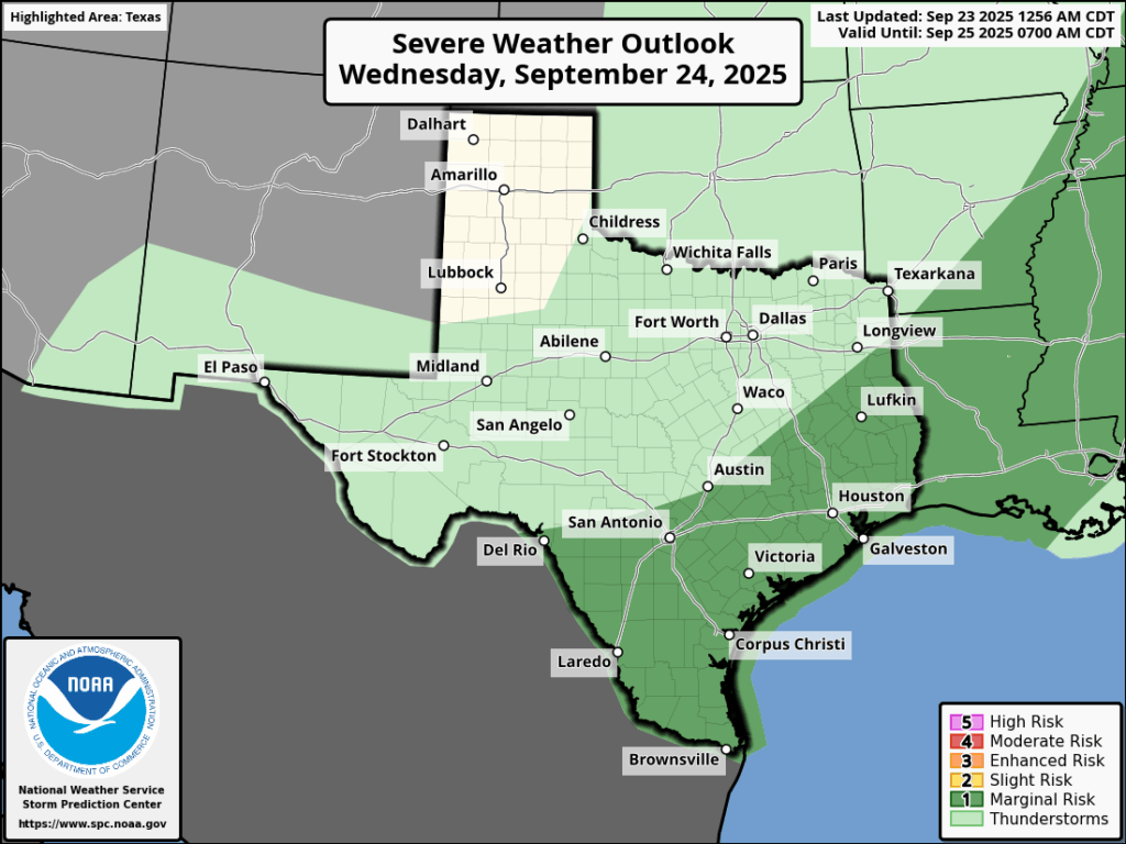
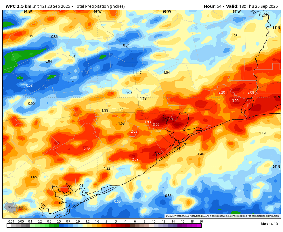
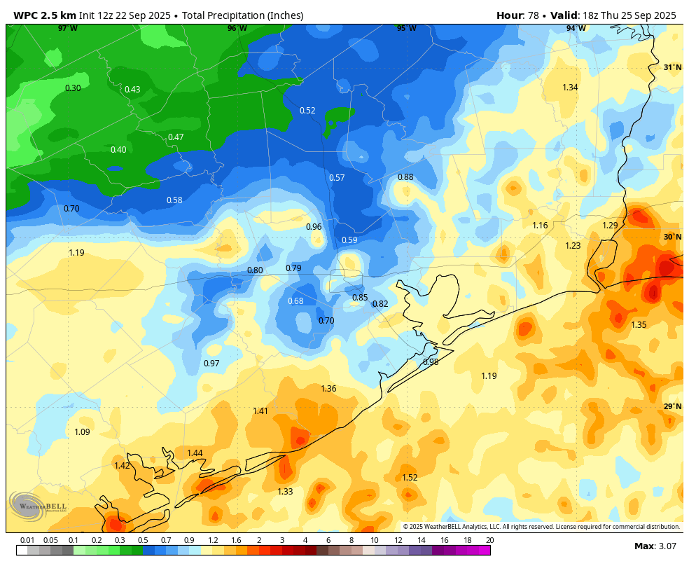
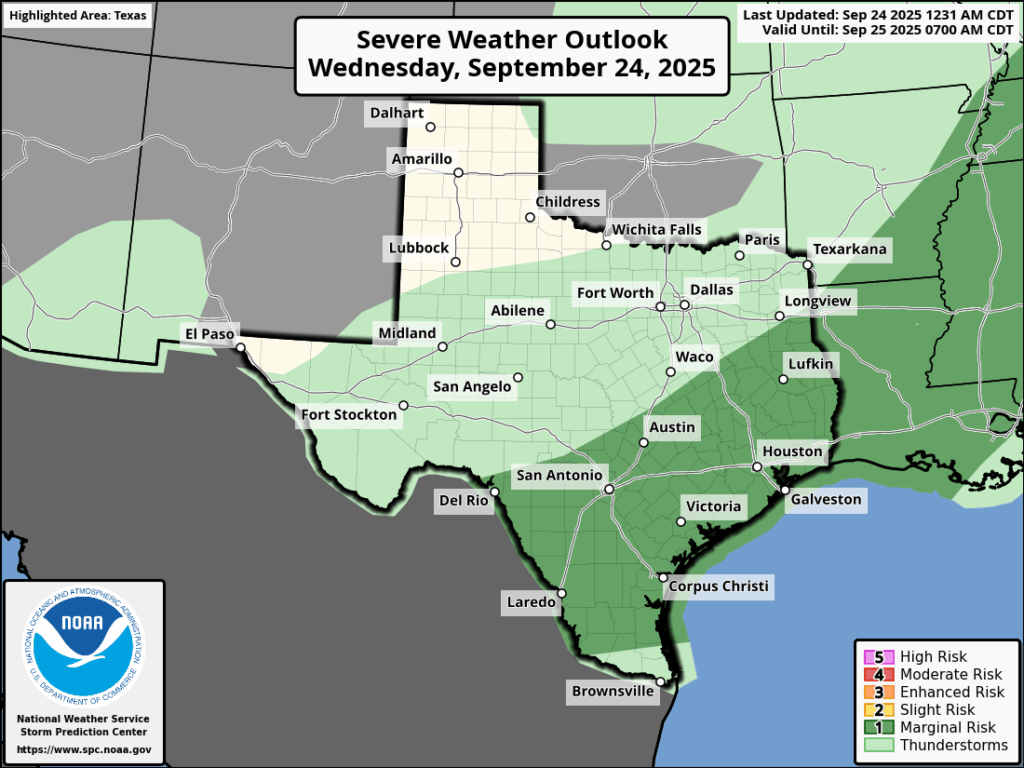
Our radar is quiet this morning, but that is likely to change as we get later into today and this evening, and a front slowly sags down into the region. Through this morning, to the extent storms develop, they probably will do so well north of the region, along and north of Highway 105 in Montgomery County. But this afternoon we are likely to see scattered showers and thunderstorms develop in coastal counties, ahead of the front. By late this afternoon or evening, a line of storms will likely coalesce to the northwest of Houston and move toward the coast, reaching offshore by around midnight or in the wee hours of Thursday morning. These storms will be capable of producing 2 to 4 inches of rainfall in spots, but I think most of the area will see less than this. Nonetheless, the threat of heavy rainfall (and possibly some damaging, straight-line winds) will be present from this evening and into Thursday morning. High temperatures today will generally be in the lower 90s, with lows tonight dropping into the lower 70s.

Houston faces a ‘marginal’ risk of severe weather later today and tonight. (NOAA).

Thursday

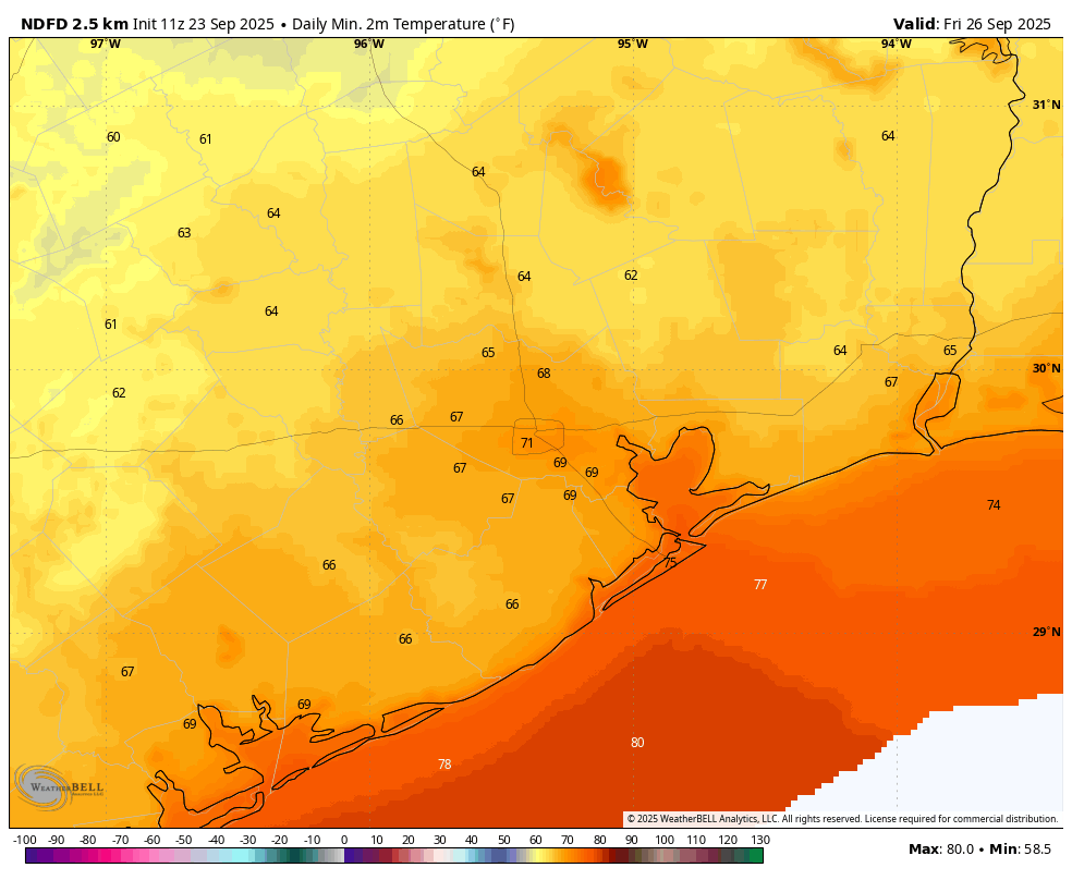
Some storms may linger on Thursday morning, and for the immediate coast there remains a possibility of showers into the afternoon. But for most of the region skies should be clearing as drier air slowly moves in. Expect highs in the mid-80s with northwest winds at 5 to 10 mph. Lows on Thursday night should drop into the 60s for most of the region away from the coast.

Friday, Saturday, and Sunday

This period should see sunny skies and modestly lower humidity. Daily highs will reach about 90 degrees, perhaps a degree or two lower or higher. Nights will be in the vicinity of 70 degrees, cooler for inland areas and slightly warmer for the coast. With dewpoints in the 60s the air will be somewhat humid, but not oppressively so. It should be a very fine weekend for outdoor activities. Enjoy!

Next week

I don’t see too much change next week, with highs remaining in the vicinity of 90 degrees and lows in the lower 70s. Humidity may creep back up a little, but I’m confident we’re not going back to the oppressive dewpoints we are experiencing this morning.
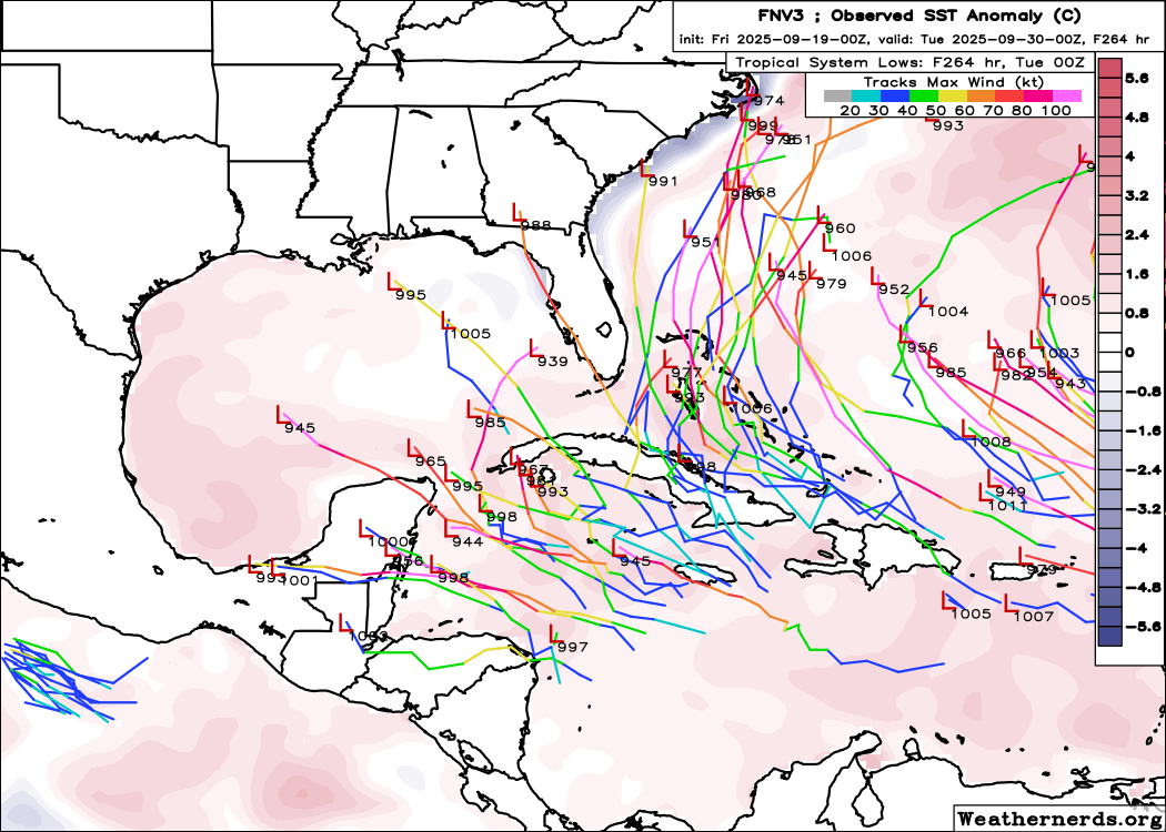
Coming soon to the western Atlantic Ocean: Two more named storms.

Tropics

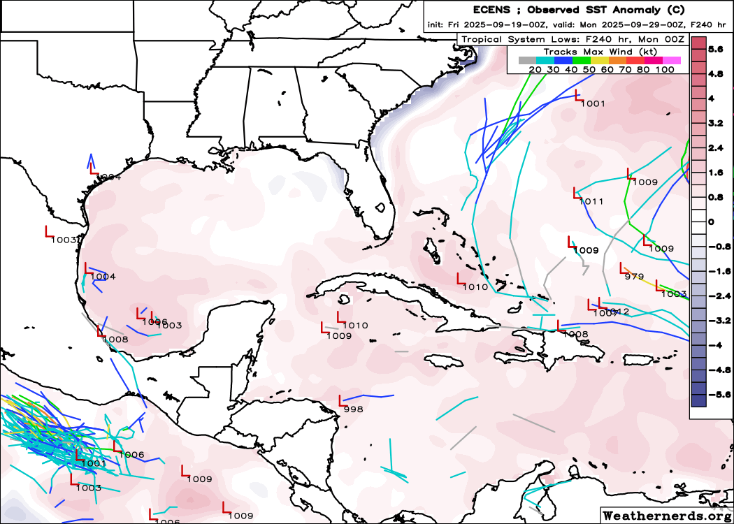
The tropics are heating up with two storms likely to form in Atlantic Ocean near the Bahamas in the coming week. It’s a confusing forecast to puzzle out, but fortunately none of that action is likely coming into the Gulf. Stay tuned for a special announcement about the Texas hurricane season in tomorrow’s update.

Chance of storms and heavy rainfall on Wednesday ahead of a modest cool front

In brief: Today will be hot with scattered showers, but Wednesday should be more dynamic as a line of storms pushes into the area ahead of a weak cool front. Some heavy rainfall is possible with the front, but rain totals look highly variable. After this we’ll see sunny and somewhat less humid weather.

Tuesday

It is rather warm and muggy out there, with much of the region just barely falling below 80 degrees this morning. Atmospheric conditions are trending toward better rain chances, but Wednesday still looks like the better day at this point for widespread showers. The likelihood of rain today should be about 50 percent for areas south of Interstate 10, with lesser chances inland. With dewpoints in the mid-70s it will be a very muggy day, as highs push into the lower 90s this afternoon. Rain chances fall back tonight, with lows again perhaps only briefly dropping to 80 degrees or below.

Severe weather outlook for Wednesday. (NOAA)

Wednesday

This should be the last really humid day for awhile. Showers will again be possible on Wednesday during the late morning and early afternoon hours, primarily near the coast. Later in the day a line of (broken?) showers and thunderstorms will advance from the northwest. The timing is fuzzy, but I generally expect these showers to hit the area during the late afternoon or early evening hours as a weak front advances into the area. There is a ‘marginal’ risk of severe weather, with the primary threat being thunderstorms and heavy rainfall. Overall I expect much of the area to pick up between 0.5 and 3 inches of rainfall, but higher isolated totals are possible. Highs on Wednesday should reach the lower 90s ahead of the rain.

NOAA rain accumulation forecast for now through Thursday morning. (Weather Bell)

Thursday

Rain chances will linger into Thursday morning, especially closer to the coast, as the front slowly pushes offshore. Skies should be clearing during the afternoon hours, with high temperatures likely reaching the mid- to upper-80s. Winds will be from the north at 5 to 10 mph. As modestly drier air moves in, much of the region should drop into the 60s by early Friday morning.

Low temperature forecast for Friday morning. (Weather Bell)

Friday

This should be a sunny day with highs in the upper 80s and lower humidity. Lows on Friday night should again drop into the 60s for inland areas.

Saturday and Sunday

Our modestly drier air should hold on through the weekend. With sunny skies expect daytime temperatures of about 90 degrees. Lows will fall into the 60s for inland areas, with central Houston and the coast probably dropping to around 70 degrees. It won’t be fall-like, but nights and mornings should be pleasant enough.

Next week

The drier air holds on for a few days before, I think, temperatures are likely headed back into the lower 90s for a few days. After this Thursday our rain chances appear to be quite low for awhile.

Tropics

The Atlantic tropics are heating up, and Matt has full details over at The Eyewall. The short story is that there is nothing imminent in the Gulf of Mexico and zero threats to Texas at present. We’ll have more on this tomorrow or Thursday.

Finally, a hint of fall in the forecast for Houston. And maybe some rain, too.

In brief: Today’s post discusses an upcoming pattern change what will bring some rain midweek, and then some modestly cooler weather through the weekend. It won’t feel like fall, precisely, but it won’t be August-like either.

Fall, finally?

It is fitting that the Autumnal equinox comes on Tuesday, when precisely at 1:19 pm CT the Sun will move directly over the equator. Why? Because some semblance of almost fall-like weather is on the way for the Houston region. The last 10 days, or so, have felt very much like late summer in the region, with a string of daily high temperatures at Houston’s official monitoring station hovering between 92 and 95 degrees.

The last 11 days have been a little hotter than normal for September. (National Weather Service)

We have a couple of more warm-ish days before a weak front arrives mid-week. This won’t bring that much cooler air—although it will bring some—but it will knock some of the humidity out of the lower atmosphere. As a result temperatures will feel a little more comfortable. We are likely to see more 90-degree days in the weeks ahead, but I don’t think we are going to see any more prolonged stretches of highs in the low- to mid-90s.

Monday and Tuesday

These days should be similar, which is to say high temperatures generally in the vicinity of 90 degrees to the lower 90s, with plenty of humidity. Skies will be mostly sunny. Areas along and south of Interstate 10 have perhaps a 40 percent chance of seeing a passing shower or thunderstorm, while areas further inland probably have a somewhat less (but non-zero) chance). Winds will be modest, from the south-southeast, and nights warm, with lows in the upper 70s. All in all, it will be pretty sticky outside.

Wednesday

A cool front will approach the area on Wednesday, and this combined with surging moisture levels in the atmosphere should produce widespread showers and thunderstorms. Most of the area probably will pick up 0.5 to 1.5 inches through the period of Thursday morning, but the majority of this rain probably will come on Wednesday and Wednesday evening. This will be another warm and humid day before some slightly drier air begins moving in over night.

NOAA rain accumulation forecast for now through Wednesday night. (Weather Bell)

Thursday

I think we’ll see some lingering showers on Thursday morning, as it will take some time for the front to amble off the coast. By the afternoon we should see clearing skies and high in the upper 80s. Lows on Thursday night should drop into the 60s for all but areas near and along the coast.

Friday, Saturday, and Sunday

We still have some questions about the details for this weekend, because it’s just not clear how much oomph the front will have, but we can be confident in the big picture. Skies this weekend should be mostly sunny, with highs in the upper 80s to 90 degrees, and modest humidity. Nights will be a bit cooler, probably in the upper 60s. Some very slight rain chances likely return to the forecast on Sunday or Sunday evening. All in all, it looks like a warm, but fine weekend.

Next week

Most of next week looks sunny, with highs around 90 degrees and nights in the lower 70s. It’s not exactly going to be summerlike in Houston, with slightly lower humidity levels, but it won’t exactly feel like fall either. For me it always feels like we’re sitting in the cold front waiting room at this time of year.

Houston’s late summer slog continues but some signs of a humidity front continue to percolate next week

In brief: Mainly quiet, pollen-ridden weather through tomorrow in Houston, followed up by more scattered-type showers and storms Sunday through Tuesday. A cold front that’s more like a humidity front continues to look plausible around midweek next week. The tropics remain quiet for us.

Today & Saturday

Our late summer slog continues with hot days, warmer than normal nights, and generally high humidity (though at times it feels decent outside at least). Isolated showers are possible today, and we may see isolated to scattered showers or a thunderstorm tomorrow. Overall, nothing too bad. Temperatures will be in the low-90s for highs.

An ozone action day is in effect again today. For most people this will not be an issue, but for those of you in sensitive groups, try to avoid being outside except early and late in the day. Also, for those of you (like me) that have had the sniffles lately, there’s a good chance that ragweed is the culprit.

Ragweed and mold spores are quite obnoxious right now. (Houston Health Department)

The typical autumn nemesis.

Sunday through Tuesday

Scattered showers and thunderstorms should be the name of the game beginning Sunday. While this will still be a patchwork type rain setup, a few more folks should begin to participate each afternoon. Expect continued highs in the low-90s but perhaps some slightly cooler afternoons at times due to the showers. Lows will remain mostly in the 70s.

Wednesday front!?

Eric has mentioned the potential of a cool front next week, nothing spectacular but a potential notable change for a couple days. That remains very much on the table today. The timing is a bit suspect, but sometime in the Wednesday or Thursday timeframe, it appears that a weak front will drop south into the area, bringing the potential for scattered to numerous thunderstorms for a short time. Behind the front, we’d turn a little cooler and a lot less humid to close out the week.

European model forecast of dewpoint between next Tuesday and Friday morning. (Pivotal Weather)

You can see the European model forecast of dewpoint for midweek, showing a distinct drop in dewpoint levels on Wednesday evening into Thursday and Friday. This is more of a humidity front than a cold front, though the lower humidity should translate into a chance at widespread lows in the 60s by Friday morning perhaps. With the Autumnal Equinox on Monday afternoon, we do see signs of fall sprinkling the forecast.

Tropics

Gabrielle is slowly building in the Atlantic, but that’s where it will stay. Another wave behind Gabrielle has some development risk, but that also looks to stay in the Atlantic. Is there anything to focus on for Houston? Nothing specific. There’s a general trend, particularly with AI models to try to spin something up in the northwest Caribbean in about 10 days, but that’s not supported much in the traditional physics-based models.

Use the slider to compare the much more active Google Deep Mind AI model to the much quieter European ensemble for the week of September 29th. (Weathernerds.org)

So this will be a good test for AI modeling: Are they capable of “seeing” a tropical genesis risk earlier than traditional models. In truth, earlier this season, when AI models were quite a bit spicier than traditional models at genesis forecasts, they tended to fail the test. This may also be a case of AI modeling being overzealous for some reason, but it’s something we’ll watch at least. Only 2 known hurricanes have had legitimate hurricane impacts on the Houston area after next week: Jerry in 1989 that hit Galveston and a storm that took a similar track to Beryl from last year that hit in 1949. History is on our side after next week, but as always, we will continue to watch.

For the record, come October we are more likely to be impacted by remnants of Pacific storms that bring heavy rain risk than a direct impact from the Gulf. That can bring its own set of problems, so forecasters stay vigilant deep into October.