Houston remains, for the most part, a warm, humid city this morning. But that will soon change.
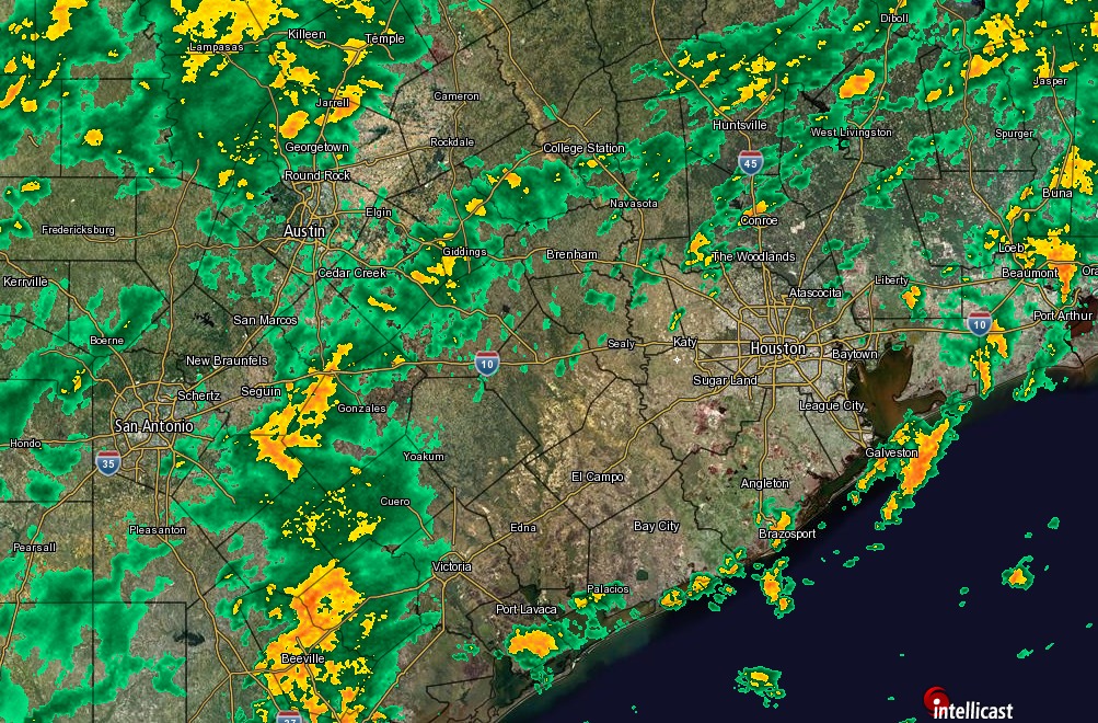
By around noon today much stronger winds will begin to bring drier air into the region, limiting highs this afternoon to the mid-60s with lower humidity. As the front moves in we may see some light- to moderate rain showers, but as I’ve been saying all week these rains are not going to produce any significant, widespread flooding. They also will not be continual, for hours on end. However they may be briefly intense. Some areas in West University Place received more than 2 inches of rain last night, while most of Houston saw little rain.
Any showers that do develop should taper off this evening, although very light rain will be possible closer to the coast until early Sunday morning.
A bigger issue today for any outdoor activities may be winds, which could gust as high as 25 mph this afternoon and tonight. Northerly winds will be lesser, although still strong, on Sunday.
Temperature wise, we’ll see lows in the low 50s on Sunday and Monday mornings, and after warming a bit during the middle of next week, another fairly strong cold front will move through on Wednesday.
Finally, I hope, we are done with humid nights in the 70s.
Posted Saturday at 7:50 a.m.
Very muggy on the morning walk today. But at least light at 6:30 and not as bad “humiture”-wise as yesterday.
By 1PM, the temperature here has dropped by 8 degrees.
Looks like there’s still a lot of rain out west. is it headed this way? we had one rainout today – I was hoping tomorrow would be better but it looks like there is a heck of a lot of moisture still out there.