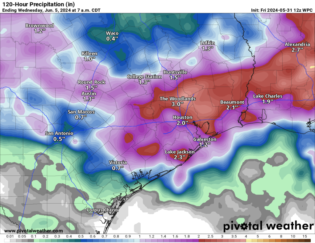
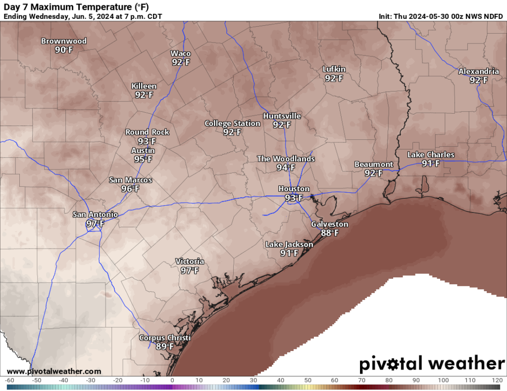
In brief: Strong to severe thunderstorms with gusty winds will push across the area through the morning. Street flooding and some scattered power outages are a good possibility. Additional storms are likely this weekend.
This morning
A squall line of strong to locally severe thunderstorms is moving into the area as we post this. Heavy rain, frequent lightning, localized street flooding, and wind gusts of 40 to 60 mph are a good bet as this pushes through.

While these storms are not quite as severe as what we saw back on Tuesday this week, this will likely set the day off on the wrong foot. It wouldn’t be the worst idea to delay your morning commute until these pass. Most wind gusts have been 35 to 45 mph recently as these pass, which is relatively standard for strong storms here. Still, given the area’s sensitivity of late, some scattered power outages may occur in parts of the area.
This afternoon
The morning storms will clear off to the south and east. Since the timing of these storms clearing occurs in the morning hours, the atmosphere may not have enough time to recover this afternoon. While I wouldn’t rule out additional showers or thunderstorms in spots this afternoon, the worst of the action will hopefully be confined to the morning. After a rain-cooled morning, temperatures should recover into the 80s this afternoon. Eric will update later today on any changes.
Tonight & Saturday
Look for additional rounds of showers and thunderstorms tonight or Saturday. The exact timing and location remain frustrating to us in terms of predicting. But we are not done yet, that much we know. Some model guidance has a fair bit of storm activity tonight and Saturday, though mostly not severe and rain-focused. But this will be a period we continue to watch for storminess.

Sunday
Support for thunderstorms should be about ready to exit starting Sunday. I still think there’s enough juice and disturbances left to fire off another round of storms around the area, along with heavy rain and perhaps gusty winds. But the hope is that these will become a little less frequent. Highs in the 80s to near 90 degrees, lows in the upper-70s.
Next week
Storms have tended to move around the periphery of a ridge of high pressure over Mexico that has provided them with absolutely punishing, extreme, record heat this month. As that ridge expands a little next week, we should see storms lift back to the north some each afternoon or evening. So favored areas will be north toward Huntsville or even north of there. We’ll see an uptick in temperatures with low-90s possibly shifting toward mid-90s by mid to late week.
The more noteworthy item for next week will be a disturbance or even some kind of cool front that arrives later in the week. If that happens and pushes off to our south and east as shown, there is the chance that we set the stage for much, much nicer, less humid weather for a couple days next weekend. I would not rule out a morning low in the 60s in the Houston area at this point next Friday or Saturday. It’ll still be plenty hot each afternoon, but the mornings may be refreshing. Maybe. We’ll see!


Thanks for the update. We appreciate your work. Is it me or do storms of late have more of the derecho bow-like shape even if they aren’t technically derechos?
You aren’t dreaming. The interesting thing about derechos is that they’re just these types of squall lines — except far stronger. That’s why the storms two weeks ago were so unique. But the same sort of processes produce “normal” strong t’storms like today and historic ones like 2 weeks ago.
That is very interesting. Thank you!
Make it stop. I can’t keep stressing about power outages every damn day. lol
Me too Pete. 7days without power from the 1st storm. Every time the wind blows I start checking my supply of batteries. I haven’t even put away my lanterns and battery fans yet.
Please make it stop!
How many times is my power going off this morning and for how long?
This is so stupid and ridiculous worrying about power outages every single day! I’ve absolutely had it with this nonsense.
Agreeing w Adam
Or the damn roof going AGAIN
Thanks for the update. Kids need to drive back to San Antonio today. Does it look like they will be safe to do so after this initial storm system passes this morning?
The squall that passed through League City between 6:15 and 6:45 west of Gulf freeway had a bit of hail.
Who needs coffee when they can just have an absolutely harrowing morning commute instead. bout lost my life 4 separate times out there
I am not a meteorologist but I believe the term used is “persistence”. We seem to be stuck in a pattern that keeps bringing us storms. On the bright side last summer we were stuck in a pattern that keep bringing us highs in the 100’s…
Better to have storms now than an early drought
Quite a bit of hail on the East side of League City near Kemah. Pea to walnut-sized. It dissipated quickly when the driving rain came it
you had me at……..cool front…..morning lows in the 60s….
I’ll believe that when I see it.
Wow. I’m well beyond ready for the stormy weather to be gone for good. So ready, that I would prefer heat and high pressure for a while. I don’t like the heat, but it would be better than the storms.
I’ll take the other side of the coin: I’d take daily rain and cloud cover to keep down the heat.
But, the rain should be of the milder variety. No hail, no huge winds, no power outages.
I always see something at the end of your post saying to get Jetpack. What is that?
I never see that, so it must be something particular to the way you read posts.
Is this the new normal?? Derechos looking storms?? What is going on with the lights?? It comes and goes.
Once again, Derechos are widespread and much larger/stronger than what we experienced today. Today was winds 40-60, but we were gusting near 100 during the Derecho a few weeks ago that blew out windows downtown and toppled high voltage towers… lest we forget.
Hail, Derechos, tornados and floods… It’s been like the opening scenes from the movie “The Day After Tomorrow” around here. There is a new paper out in the Journal Of Climate entitled: “Long-term climate impacts of large stratospheric water vapor perturbations” (Hunga Tonga eruption) and this type of weather may be a little more common for our area if the authors are correct.
Cycles. Matt pointed out the intense ridge and devastating heat down south in Mexico. This is probably why we are getting these storms. I recall last year when we were under the dome, the folks on the periphery of the dome of High pressure were getting the storms while we got the dry intense heat. Matt, when will that dome in Mexico ease? I vacation down there to escape this heat, but I might have to wait till that ridge moves out.
I may be wrong, but I think it is because we are still transitioning from El Nino. Am I correct in thinking that everything is moved farther south in an El Nino summer? Because usually these heat domes park themselves over the central US and we receive easterly flow in summer; but last summer, it stayed right over us.
What I can say is this: I think as summer arrives and El Nino dissipates the high will first move over us and then lift to the northwest and allow tropical moisture to reach first Mexico and eventually us by July. The models have pretty consistently been predicting a dry June and a wet July and August. We will see.
I think now more than ever we should be reconsidering what kind of trees we plant around the Houston area. With the exception of the northeast Houston area where we touch the Piney Woods, and some areas immediately next to the bayous, most of Houston was a tall-grass prairie. Trees were largely non-existent in most places here. The threat of windstorms and hurricanes in particular are going to continue to topple some of our largest trees like water oaks, loblolly pines, and sycamores, which developers planted in many of our yards. While they are beautiful trees, I strongly believe that we and these neighborhood developers need to consider trees that don’t get so towering, things that top out around 20-30 feet that can still offer some shade but wont be dropping hundreds of pounds of branches on our rooftops. Hollies, Hawthorns, Redbuds, Mexican Plums, Hophornbeams, Gum Bumelias, Viburnums…. all good trees native to the forested parts of southeast Texas.
I heartily agree. I have wondered for years why so many pines and oaks were chosen to be planted here in our ‘burbs, so close to houses and power lines. (Some of these trees were planted right under power lines! Why??) I love the trees, but there are so many other choices that would be less of a danger to causing damage, and they need to be planted strategically. I have a water oak in my backyard very close to my house and I know I really should bring it down before it comes down on its own… on my or a neighbor’s house.
Water oaks seem to have weak root systems. Live oaks, on the other hand, did not suffer much damage from the storms as far as I could tell. In other words, there are certain large tree species that can handle this kind of weather.
My three water oaks came down – one on my house, but the 60 year old live oak just keeps growing.