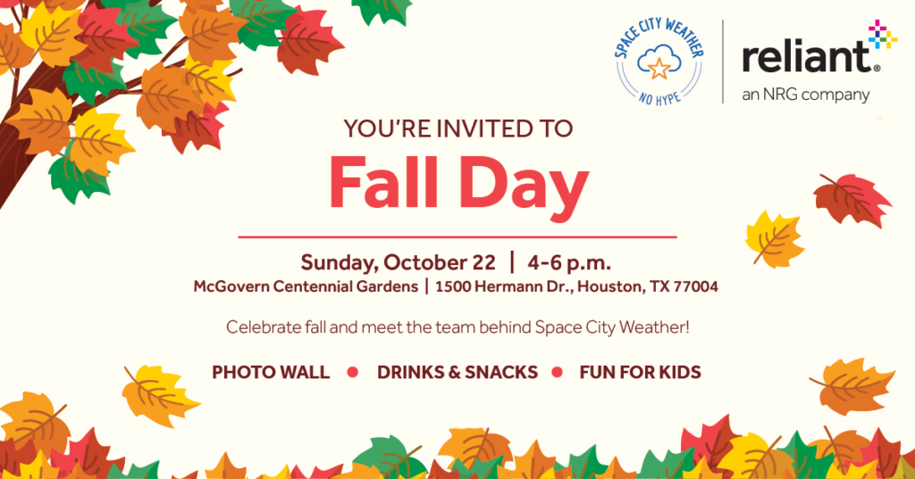
Good morning. I want to begin this post with a couple of notes. First of all, I’m thrilled to say we’re working with Reliant to bring you our second Fall Day celebration this weekend. This year we’re going to be gathering at McGovern Centennial Gardens, which is located at the northern end of Hermann Park. Please join us between 4 and 6 pm on Sunday, October 22, for a festive meet-and-greet and fall activities for all ages—face painting, photo opportunities, seasonal treats and more! Admission is free. It’s not mandatory, but if you’d like to tell us you’re coming, please do so here. It will help us with planning.
Second, we’re going to publish our review of summertime temperatures later this morning. In this long post we will look back at the hottest summer on record in Houston, and just how bad it really was. Spoiler alert: Really really hot. OK, now onto the forecast.
Tuesday
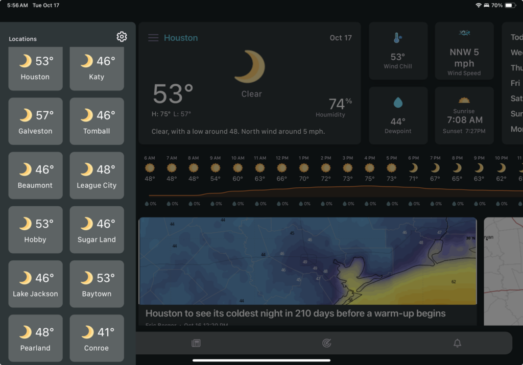
How cold is it outside this morning? Much of the region has fallen into the 40s this morning. As of 6:30 am, Houston’s official monitoring station has reached 48 degrees, and this is the first time since March 20 that temperatures have dropped below 50 degrees in the region. Here’s a look at other locations in the Houston area this morning, courtesy of the Space City Weather app.
This will be the bottom of temperatures for awhile, however, and we’re going to warm back up later this week. Highs today will reach the mid-70s, with dry air and sunny skies. Light, northeast winds will shift to come from the southeast later today or tonight. Lows will drop into the mid- to upper-50s, so about 10 degrees warmer than Tuesday night.
Wednesday
Highs will reach about 80 degrees on Wednesday, with mostly sunny skies. Light Southerly winds will herald the return of the onshore flow, and this will start to push humidity levels up some. Lows on Wednesday will drop only into the mid-60s.
Thursday
This will be a warmer day, as the southerly flow continues, with highs in the upper 80s. Skies will be mostly sunny, with overnight lows in the mid-60s.
Friday
A weak front will push through Houston early on Friday, likely moving off the coast during the late morning hours. We cannot rule out some isolated showers as this moves through, but I’m doubtful that we’ll see many showers reaching the ground. This front is going to bring some moderately drier air, but it’s not going to cool us down much. Rather, the drier air will warm more efficiently during daytime hours, so we’re going to see highs in the upper 80s on Friday, with a few inland areas possibly reaching 90 degrees. Humidity will, at least, be a bit lower.
Saturday
Lows will drop to about 60 degrees on Saturday morning with the moderately drier air, but highs again should reach the upper 80s for most of the region. We may see a few clouds as the onshore flow returns at some point on Saturday. Lows on Saturday night will drop into the mid-60s.
Sunday
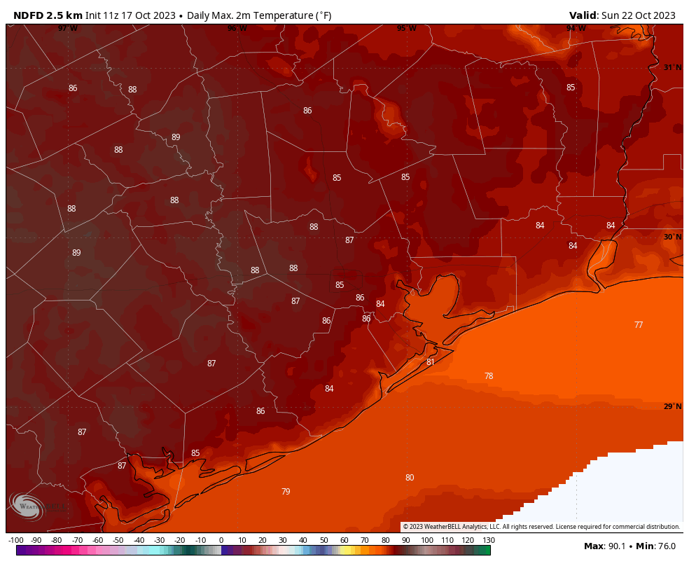
Ahhh, Fall Day. When we had to pick a location and date several weeks ago for planning purposes, this probably isn’t the day I would have picked to celebrate “fall” in Houston. But with high temperatures in the mid- to upper-80s, and not unreasonable humidity levels, it’s still going to be just fine outside from 4 to 6 pm with the Sun lower in the sky. So I do hope you’ll join us for our celebration. Skies will be partly cloudy, likely with a light southerly breeze.
Next week
By Monday the southerly flow will become more pronounced, and we’re looking at a string of days with partly to mostly cloudy skies, a fair bit of humidity, and highs likely in the mid-80s. We’ll also see some decent rain chances starting on Tuesday or so, through around Friday. Some sort of cold front probably will arrive by Friday or Saturday of next week, but the details on that are really hazy this far out.


Hopefully after the warmth, next week can trend cooler so we can end up below average again, which hasn’t happened since May. No Jinxes!
Really looking forward to race day prediction
Unfortunately, we’re headed into a warm up. However, I remind myself this is still early fall, and as the season progresses, we can expect more frequent and longer periods of well-deserved cool or cold and dry air.
I sure hope so. Going back to 90° feels awful. Last year, half of each month in Winter was warm. Hopefully El Nino will help keep us cooler.
I don’t have Facebook, so letting you know here I’ll be at Fall Day.
Awesome, thank you!
Enjoying the cool mornings and daytimes the past few days down here in Sienna, This morning the PWS very near to me reported 43.4 F for the low. Yesterday it reported 46.4 F. Loving it. We actually got to open up some windows on Sunday and get some fresh air inside. Happy Fall everyone!
I had 2 questions. Is the way we now measure temperature make a difference? I seldom see mercury thermometers any more for body or outdoor temperatures. Forgive me if this is a novice question. Also I read an article about us on the verge of entering a cyclical 50 year cooling trend which froze the Thames for ice skating and fairs. Is that still expected and what effect do you think it will have?
To answer your mercury thermometers question, digital thermometers are the better choice as they provide faster, more accurate readings. Also mercury is a toxic chemical which in a glass thermometer is dangerous to have around if it broke
True, thanks you. I was wondering though if a change in the type of thermomter would make a difference to the reading just as the change in location does.