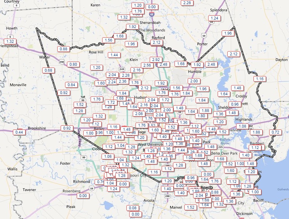
Did the thunderstorms wake you last night? They were a bit stronger and more widespread than anticipated, as the upper-level disturbance in the atmosphere was able to really produce a vigorous upward motion in the lower levels of the atmosphere. As a result most of the Houston area received 1-2 inches of rain during the last 24 hours. Fortunately the heaviest showers came during the overnight hours, as expected, and have now moved along.

TODAY
Skies will clear out today and under southerly winds we’ll warm up into the low- to mid-70s. Those of you who have hated the cold will enjoy a brief respite. Temperatures will fall to around 50 tonight under clear skies.
FRIDAY
Friday should start out sunny, and highs will again be in the low 70s. But then another disturbance similar to the one that passed overhead last night will approach during the evening and overnight hours. Although I don’t expect quite as much rain on Friday night, we could again see some thunderstorms. If you’re planning evening activities or a night on the town, be sure and check the forecast tomorrow.
THE WEEKEND
A pair of cold fronts will move through Houston, first very early on Saturday, and then another one later in the day. As a result, by the late morning hours, skies should be clearing out and we’ll see some sunshine. Expect afternoon highs in the low 60s with a moderate northerly wind gusting up to 15 mph. It should be fine tailgating weather (especially considering the alternative in Kansas City, shown below), but will the Houston Texas open their roof? I’d like to think so, but who knows. Sunday will be cold, starting out at around 40 degrees and only climbing into the low 50s under clear skies.

NEXT WEEK
Monday and Tuesday should be cool as well, before some clouds and a chance of rain will return fairly early in the work week.
I’ll have my Houston Marathon forecast later today.
Posted at 6:50 a.m. CT
It would be EXTREMELY lame if they did not have that roof open.