Eric touched on the flooding issues for our friends to the east in the Sabine River basin yesterday. Check that post and visit the NWS Lake Charles website for the latest. Locally, here are the latest flood gauge levels and forecasts around Houston.
We got away with a mostly quiet Thursday. Judging by the weather model trends, today will hopefully have a similar outcome.
TODAY
The upper low over Mexico the last couple days is projected to end up over South Central Texas this afternoon. That means we are slowly drawing closer to the end of this frustrating weather pattern.
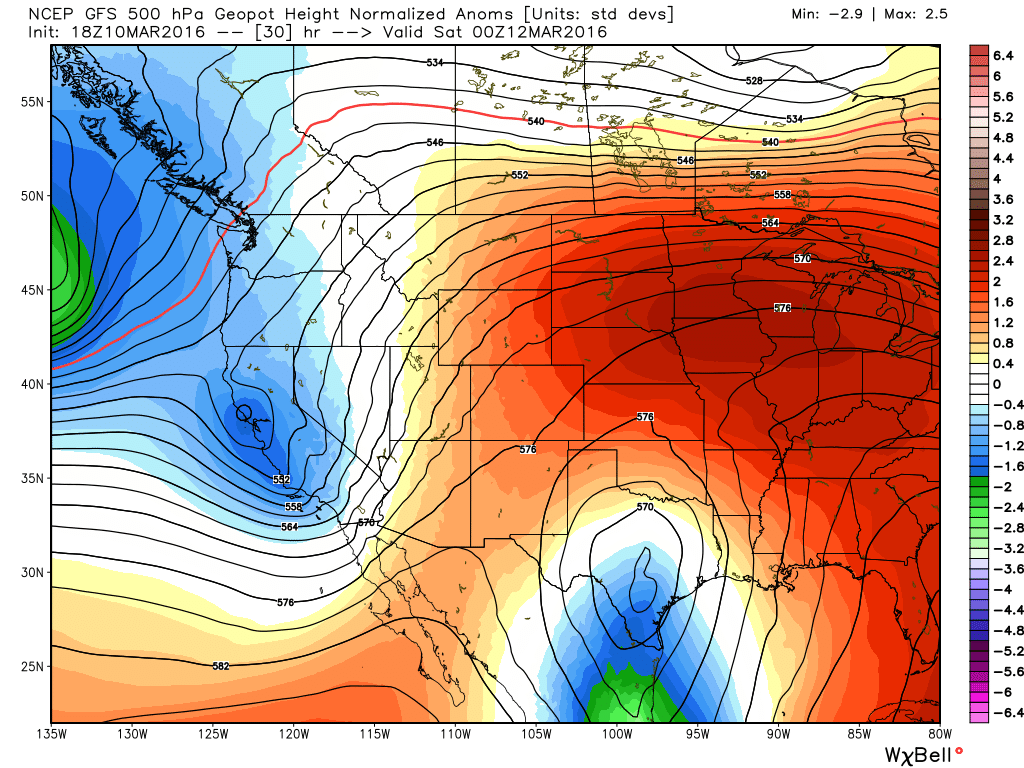
There will still be a few spokes of energy pivoting around the upper low today, so we will still carry a chance of showers or a thunderstorm throughout the day (showers this morning are popping up west of Houston already). But the heaviest storms will be in Eastern Louisiana and Mississippi. There will also likely be areas of showers/storms on the periphery of the upper low in interior Texas (basically north, west, and south of us). That puts us in between. So I’ll put an optimistic spin on things and say, “Yes, a chance of showers or storms through the day today, but I will lean toward the bulk of the day not being too bad.” We’ll see if that works out.
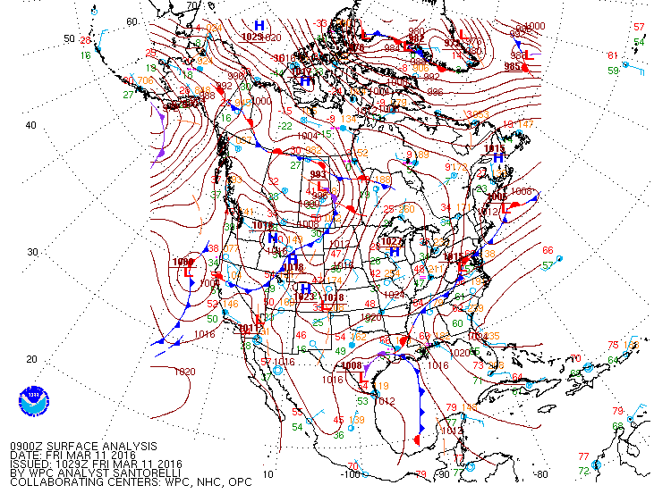
Cool meteorological geek-out sidebar here: If you look at the weather map analyzed in Texas this morning, you see what is known as an occluded front moving north and east across Southeast Texas. Presumably, you know of warm fronts and cold fronts.But occluded fronts? Well, they’re common…just not in Southeast Texas. These typically form in mature storms (storms that have peaked in intensity). Simply: It’s when a cold front moves quick enough and at the right trajectory to overtake a warm front. Today, there’s an area of low pressure (a storm) at the surface, located west of Corpus Christi. The occluded front extends northeast from it to what we call a “triple point” (located near Lake Charles this morning). If you want to read more and learn more about this, you can here or here. The weather geek in me just thought it was fun to mention.
WEEKEND
On Saturday, the upper low passes to our north. As it does, we’ll have one more shot at some scattered showers or storms. Again, this chance isn’t especially high. But, it’s there. And it’s gone by Saturday night. Sunday looks fine. Oh, and warm. Low 80s and sunshine in mid-March? You are clear for launch this weekend.
NEXT WEEK
The timing and specifics are going to change next week, but it should play out in this fashion: Sunshine and warm temperatures early in the week gradually give way to increasing clouds and humidity late in the week. A cold front will approach toward the weekend. It’s mid-March now and cold fronts begin to slow down a bit more as they move toward the Gulf. We should see an uptick in showers and thunderstorms toward next weekend as the front drags through. Plenty of time to watch for that, but if you have plans late next week or next weekend, just keep that in mind.
I had been wondering about those purple lines on the maps. Thanks for the links.