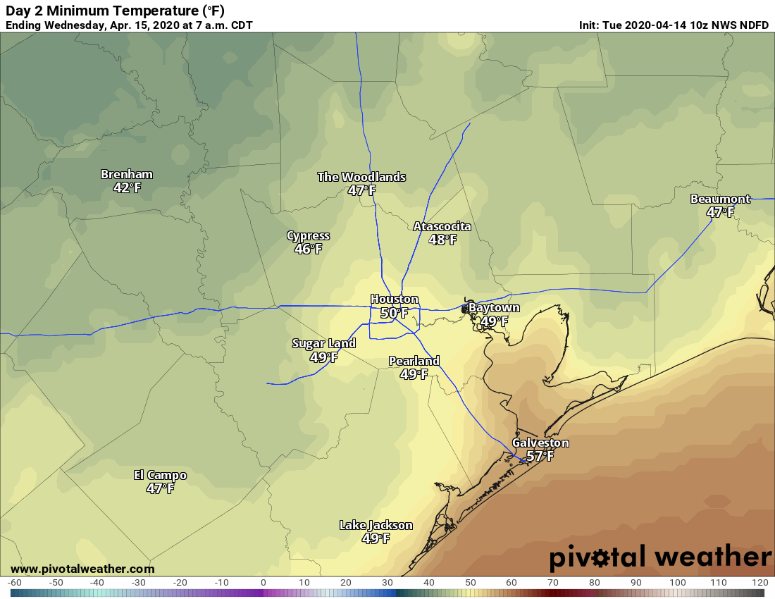
Low temperatures this morning are running a good 10 degrees below normal for mid-April, with the mid-40s far to the north of Houston, around 50 in the city, and mid-50s along the coast. This cooler weather will last for a few more days before a warmer pattern begins to emerge by Thursday.
Tuesday
Houston remains under the influence of high pressure over much of the United States, allowing for a cool, northerly flow to dominate our weather. As a result we can expect mostly sunny skies, with a March-like high of 70 degrees. Winds will be fairly light, out of the north at about 10 mph. With a secondary front pushing through during the overnight hours, Tuesday night and Wednesday morning likely will be the coldest of the week—perhaps the coldest night for the rest of spring. Lows probably will reach the upper 40s for most of the area.
Wednesday
Another stellar stay, with mostly sunny skies and light winds out of the north. With highs of around 70 degrees, this, too, may be the last “cool” day for quite a while in Houston. We should have one more really chilly night, with low temperatures dropping down to nearly 50 on Thursday morning.
Thursday
Winds turn southeasterly on Thursday, beginning the process of a warmer, more humid onshore flow. This should still be a pretty nice spring-like day, however, with highs in the upper 70s under sunny skies. Lows Thursday night will be warmer, dropping only into the 60s.

Friday
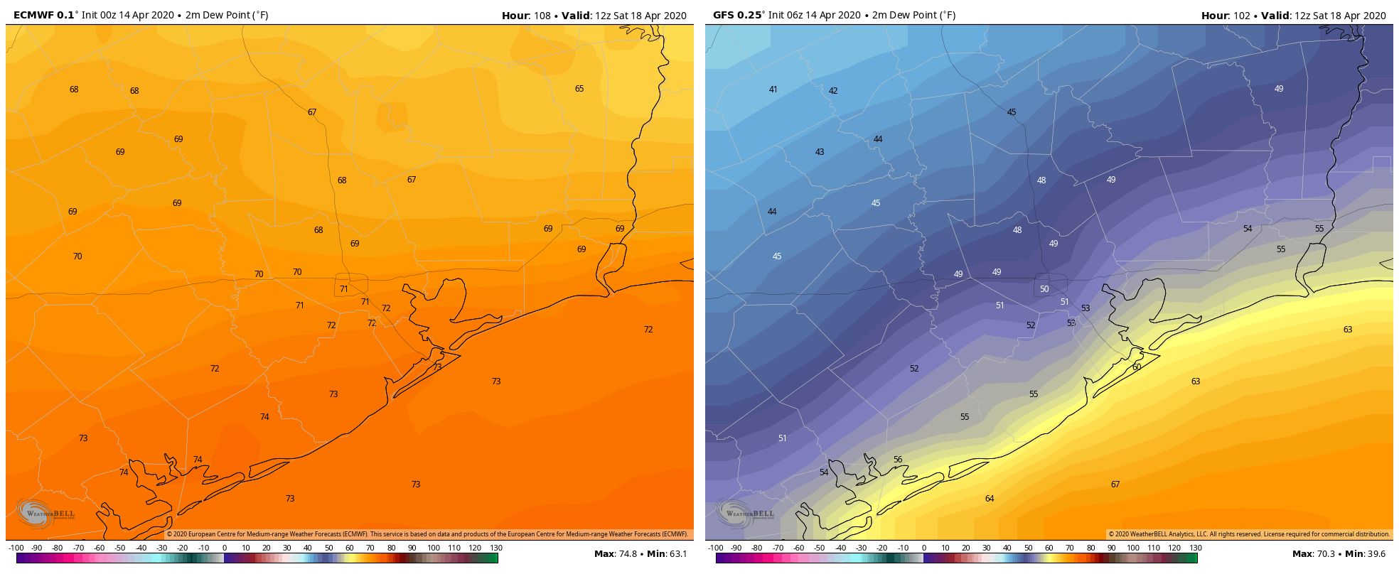
Clouds probably will begin to return Thursday night, and this will make for a cloudy Friday, with highs likely reaching about 80 degrees or a bit higher. Some scattered, light showers are possible, but for most of us there should just be clouds. Later in the day some sort of front is going to limp toward the Houston region, but I’m not sure how profound its effect will be on the region, especially the southern half of Houston (see the image below for the broad divergence in forecasts). Lows Friday in Houston probably will be somewhere in the 60s in the city—cooler to the north, and warmer along the coast.
Saturday and Sunday
The weekend forecast remains somewhat muddled. First of all, there is the question of whether Friday’s front has all that much sensible influence on our region’s weather, and then there is the evolution of another front moving in from the west, along with possible storms with that system. Right now, the best guess is for conditions on Saturday similar to Friday, which is to say highs of around 80, with mostly cloudy skies, and a lowish chance of rain.
For Sunday, rain chances are better as the second front nears and pushes through the area. As for accumulations, a few tenths of an inch are most likely—but they could run anywhere from nothing to 1 inch or more. Sunday will likely we warm, in the mid-80s, and after the front we should see drier air.
Next week
Although the Sunday front will be a weaker front than the one bringing chilly nights this week, the infusion of dry air could still help nights get into the upper 50s or around 60 degrees during the first half of next week. For late April, that will be just fine.
The good weather should make working from home and being a shut-in during the evening a little more tolerable. Never thought I would actually look forward to going into the office some day.
I love both Eric’s and Matt’s weather reporting – but, I’m hoping they are wrong about this being the last cool spell for a while. A repeat next week and the week after would be great before beastly summer arrives.
After hitting mid 90s on Sunday, I’m loving this weather, especially knowing what’s coming – 5 to 6 months of high heat and humidity.