Happy Sunday to you. Eric and I wanted to offer a quick update on the weather for ALCS game 4 in New York, the potential clincher. Additionally, we have some more clarity on our rain chances here in Houston for tomorrow.
Astros weather
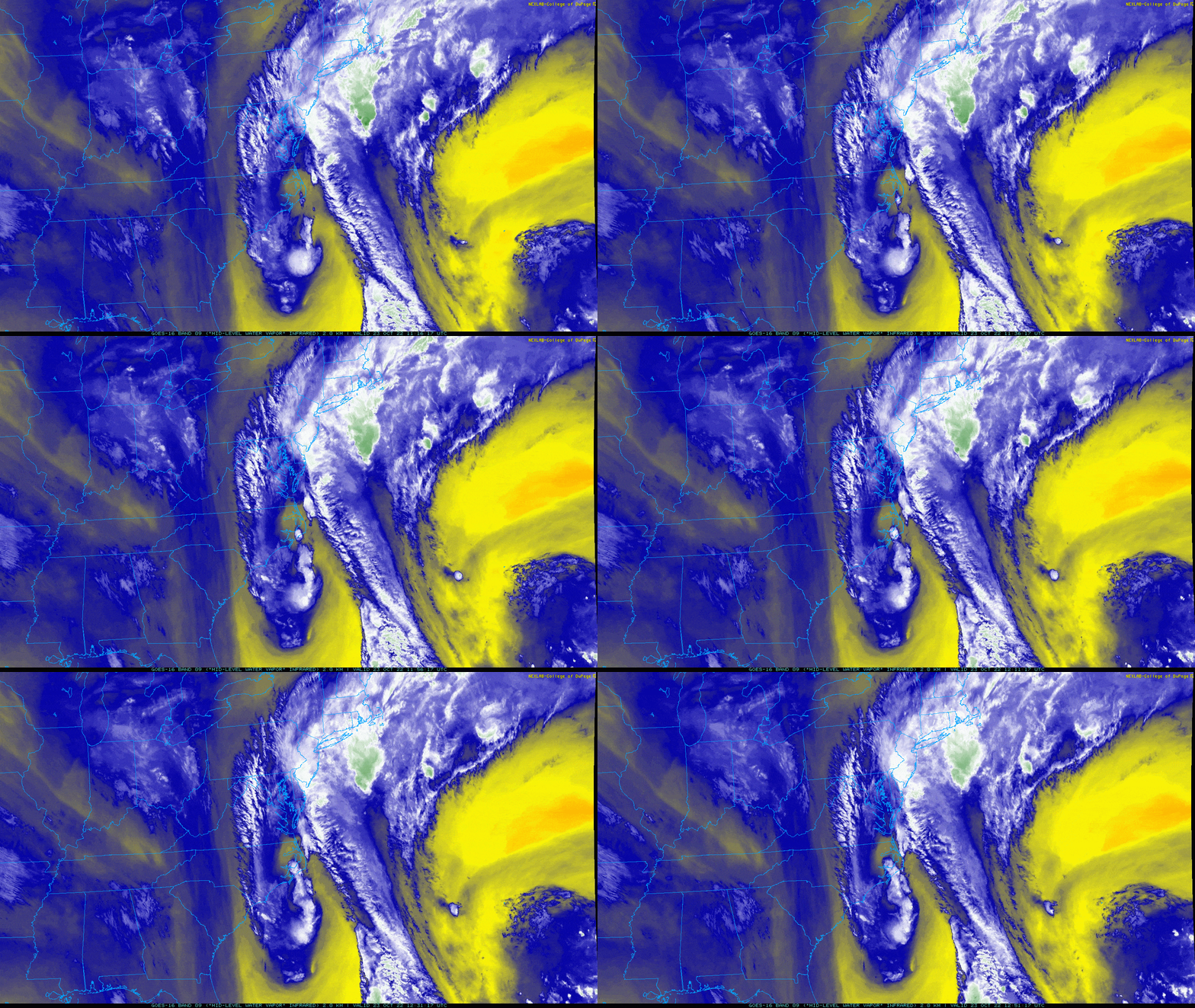
In a perfect world, the Yankees would simply close the roof for game 4 tonight, and we’d play ball without any weather concerns. It would surely give them a bit less to complain about. Alas, the world is not perfect. You don’t need to be a meteorologist to look at the water vapor satellite image below and see that there’s a lot of something aimed at New York City.

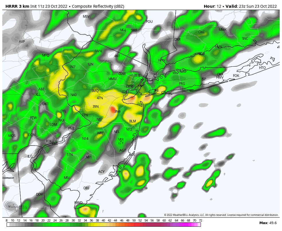
As it turns out, it’s a deep plume of subtropical moisture that is aimed right at New York and New England and extends back to the Caribbean. In English, this means rain is likely in the Bronx today. The first pitch tonight is just after 7 PM Eastern time. The latest HRRR model forecast radar shows rain still in the area at this time.

Will it be raining enough in New York City at the planned start time to mess things up? No model is perfect, but a few have shown this outcome, so I am becoming more and more pessimistic that we’ll get a game in without some kind of scheduling issue today. Obviously, this is a problem because there are no off-days for the rest of the series. But that’s Major League Baseball’s problem to deal with. Our message is: If you have the brooms out tonight, there is at least some chance they may need to stand by until very late or tomorrow.
If the game does somehow on as planned tonight, you can expect temperatures in the 50s and a northeast wind (which at Yankee Stadium is blowing in) around 10 mph. Additionally, you’d almost certainly have intermittent showers, light rain, or drizzle. Philly will have similar issues today as well. So if you’re scouting the other side, you may have some issues there too. Tuesday’s weather won’t be perfect, but it looks better if they need to slide things a day.
Houston weather
Locally, we have no issues for Sunday so if you have an Astros watch party planned you might just have to find other ways to entertain yourselves. We will have a few extra clouds today, as some of the high clouds from Pacific hurricane Roslyn head this way. Otherwise, it will be warm and humid with 80s. Much like yesterday, there will be a healthy breeze off the Gulf today, gusting to 20 to 25 mph, possibly a bit more over the water. A shower is possible south of I-10 today, but it would likely be light and brief…maybe just enough to wet the ground.
Our cold front begins to arrive later tomorrow. Ahead of it, look for more clouds, a few isolated sprinkles or showers, and yes, more wind. Other than that, daytime Monday looks fine.
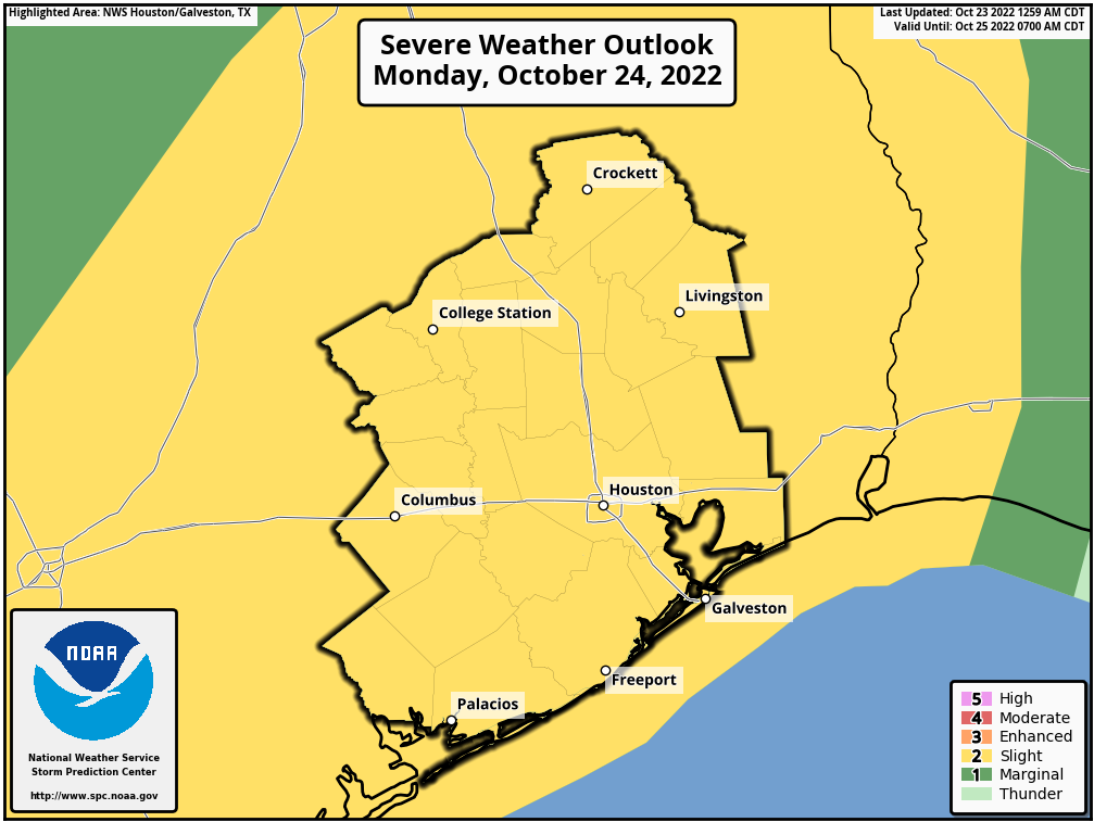
Monday night is when things get interesting. The good news is that Hurricane Roslyn will get shredded over Mexico. So, we don’t need to worry about that. But the remnant moisture and some of the “oomph” from Roslyn is going to interact with the cold front as it moves through Houston. This should allow for a developing, if not strengthening line of storms to push in Monday night with the front.

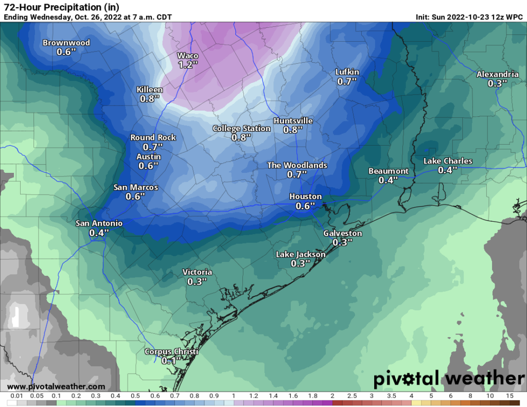
As the storms move in, there is at least some chance they could become strong to severe, with gusty winds being the main threat. This would, again, be late in the evening, if not after midnight. Eric will have the latest for you on Monday morning regarding any severe weather risk. Most of the area, especially north of I-10 should see a quarter to half-inch of rain, with isolated higher amounts possible. Helpful, but it won’t do much for the drought.

Tuesday should be much cooler and windy. It will feel like autumn again. More from Eric in the morning!


Go ASTROS!
Rain likely sweeps in tonight to sweep the Astros’ sweep into another day. Phillies sweep possibly swept with same broad weather broom.
Many thanks to Astros baseball for being the excuse needed to slip in a very timely early week rain forecast.
Thank you, Matt,
TE
Thanks Matt for the update!