Good morning. A robust cold front will sweep into Houston tonight, bringing a line of showers and thunderstorms. This will be an in-your-face front, which in addition to the potential for storms will also bring gusty winds up to 40 or 45 mph—presumably enough wind to terrify a New York Yankee—and an almost immediate influx of drier air. The front will set the stage for a pleasant fall week. Halloween, too, looks pretty mild at this point.
On a related note, Sunday marked the seventh anniversary for Space City Weather. I’d like to thank the Astros for the win, which advances them to the World Series, and to all of you who have found the site and spread the word to others. Matt and I do appreciate it.
Monday
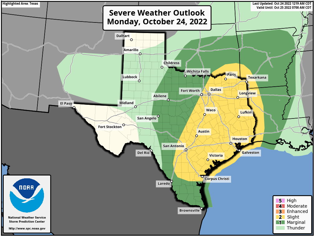
Today, ahead of the front, will be warm with temperatures in the mid-80s. Skies will be partly to mostly cloudy with southerly winds that at times gust to 20 or 25 mph. Expect a few, very scattered, light showers. The big changes won’t come until the arrival of the front. There remains some wiggle room in timing, but it will likely push into the College Station area before or around midnight, reach Katy and The Woodlands shortly after midnight, downtown Houston around 2 to 3 am, and push off the coast a couple of hours before sunrise.
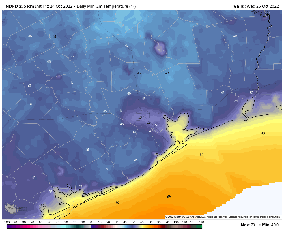
In addition to thunder and lightning, these storms have the potential to produce strong straight-line winds, and maybe a tornado or two. Most areas probably won’t see severe weather, but it remains a possibility for all locations. In terms of rainfall, most areas will pick up between 0.25 and 1 inch of rain. Winds will blow out of the north at 15 to 20 mph after the front’s passage, with higher gusts. Temperatures should drop into the 50s for most areas by Tuesday morning.
Tuesday
Showers will end quickly with the front’s passage, so Tuesday should be a sunny, windy day. Expect highs in the low 70s. Winds should finally start to die down by around sunset, falling back to 5 to 10 mph. This should help drop temperatures down to around 50 degrees in Houston, with cooler conditions inland, and warmer weather along the coast.
Wednesday
Another clear, sunny, and fine day with plenty of dry air and highs probably in the upper 70s. Lows on Wednesday night will be a couple of degrees warmer than Tuesday night.
Thursday
As winds swing around to become more southerly, look for warmer and somewhat more humid conditions on Thursday, with a high near 80 degrees. Lows Thursday night will be in the 60s.
Friday
The good news is that these southerly winds will pump more moisture into the atmosphere, and this, in turn, will help amplify rain chances with another cold front later on Friday. The timing of the front is still somewhat in question, but right now I’d expect a healthy chance of showers and potentially thunderstorms on Friday as this front moves through. Perhaps there will be an inch of rain, or so, with this front. We’ll see.
Saturday and Sunday
In the wake of the front, the weekend looks sunny and cool, with highs in the low 70s and nighttime temperatures probably in the 50 to 55 degree range.
Halloween
We’re now one week from Halloween, on Monday October 31st, and by then the winds will probably have started to come back onshore. Daytime temperatures accordingly should be somewhere in the upper 70s, and evening temperatures rather mild, perhaps in the upper-60s to 70 degrees. At this long range I cannot rule out a chance of rainfall, but right now chances look rather low, and any rainfall probably would be light. For now, my expectation is a mild evening with a tinge of humidity.


Ah c’mon Eric!
You spooked me with your headline!
Is that cold front coming in from NY?
Looks like for once we won’t be sweating our butts off at Wings Over Houston!
Speaking of the Ellington area, it’s raining here.
So bad news for the drive in air show on Friday?
Bad news for the special needs show. Hopefully over by the time of the drive-in air show. Cautiously optimistic that my WWII Jeep will be with the 6th Cav encampment at the southern end of the field. If you’re at the show on Saturday look for the Jeep driven by a sailor (in Navy Dungaree’s)
Keep up the good work!
Best part of the foercast: “storms will also bring gusty winds up to 40 or 45 mph—presumably enough wind to terrify a New York Yankee”- Haha!
I had to truly guffaw at the “presumably enough wind to terrify a New York Yankee” line. Even Space City Weather gets some shade in.
As for the 7th anniversary of SCW, happy birthday/anniversary to being really a Houston gem. To illustrate how you’ve spread into the zeitgeist, I wore my SCW t-shirt to the pharmacy Friday and the pharmacist actually pointed to the logo on the shirt and said: “I love those guys.”
I guess the roof will be closed for game one on Friday! Lol!
Thank you and Matt for your service to our community the last 7 years.
Thanks for 7 years!
Happy anniversary!! Thank you for all you do for us!