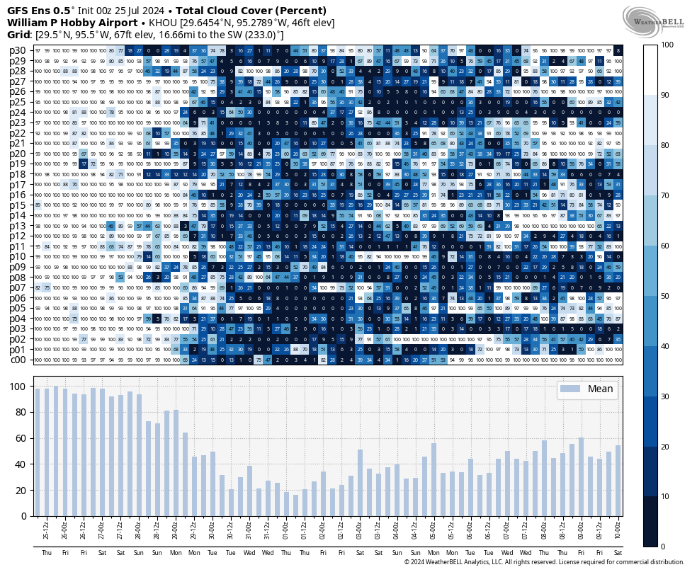
In brief: This post describes the distinct pattern change we’ve seen from a wet end of July into a warmer August. Yes, sunshine is back on the menu. Additionally, we take stock of where we are with summer in Houston now that we’re about half way through it.
Where we are so far
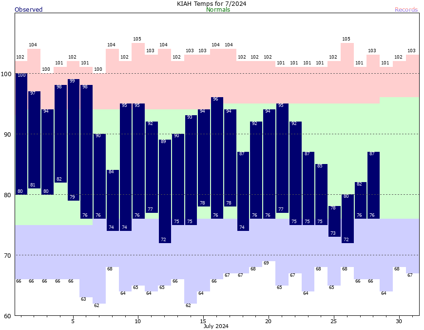
By most measures we are about half way through summer in Houston, having gotten through June and nearly all of July. Moreover, as of today, we have reached the historically “hottest” time of year, when daytime and nighttime temperatures peak. This period runs through July 29 through August 12, typically the warmest two weeks of the year. So congratulations, we had to come through a Category 1 hurricane and some pretty nasty power outages to get here, but we are making progress toward fall.
What I didn’t say above is anything about extreme temperatures. That’s because, so far, temperatures this summer have been near normal for the last 30 years. The monthly average temperature in June was 1.6 degrees above normal, and for July we are likely to end up at around 1 degree below normal. Thus far this summer, we have hit 100 degrees just a single time, on July 1. Last month we actually had one day with a high of 78 degrees, thanks to the persistent rainfall during the last 10 days of July.
So where does that leave us staring into the abyss of August? Well, there is no drought for as far as the eye can see, and indeed well beyond that. With our saturated soils, we are well positioned for the rest of summer. The wet soils should also help moderate daytime high temperatures, at least a bit, for a few weeks. And, of course, all the rain during the last week will continue to produce a bumper crop of mosquitoes for awhile longer.
August is my least favorite month of the year, by far. It is prone to the hottest weather, and it is when the threat of large and powerful hurricanes starts to peak. (While the Atlantic tropics are starting to wake up from their slumber during the second half of July, there are as yet no threats to Texas). Honestly, if we can get through the next eight weeks, then fall is distinctly on the horizon, and we’ll be near the end of hurricane season for Texas.
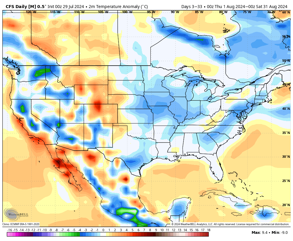
Most of our modeling guidance (CFS, European, GFS temperature 30-day temperature forecasts) suggests that temperatures in August will be near normal. In terms of precipitation, we are also likely looking at near-normal levels of precipitation. We shall see. One tropical system can scramble all of that.
Monday
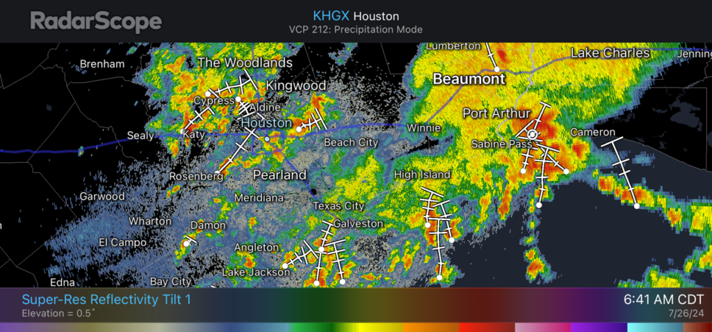
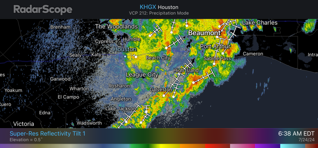
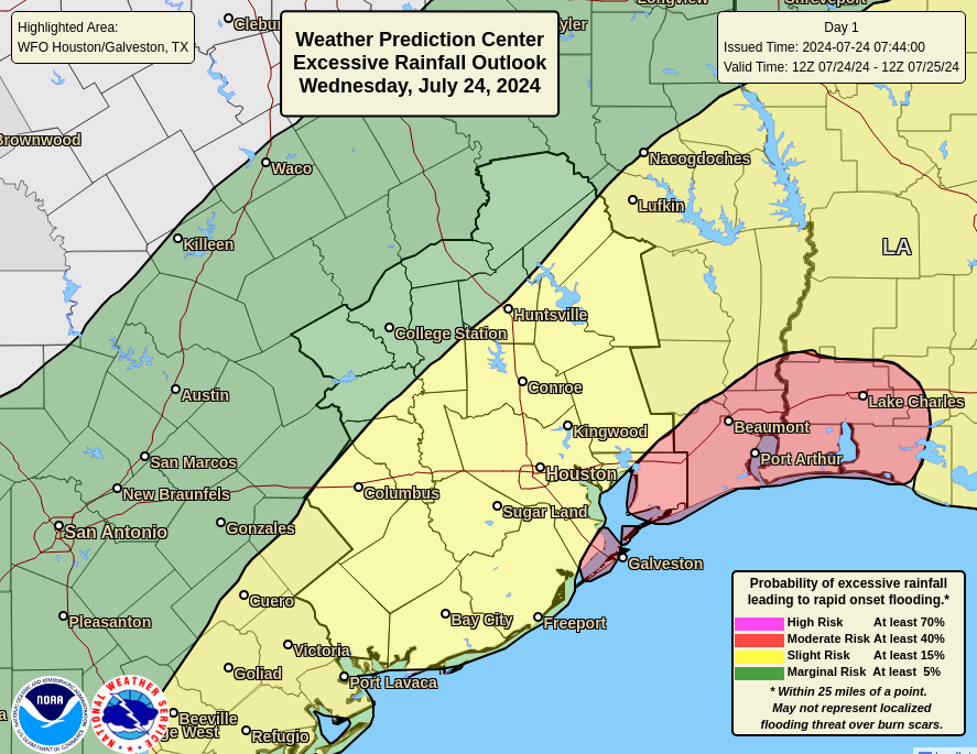
The long-awaited pattern change has arrived. For the first time in awhile, as I checked the radar, there wasn’t much happening in the Houston area this morning. This is because we’re beginning to feel the influence of high pressure, which will help suppress rain showers. That is not to say rain chances will be zero, but they will be much lower, on the order of 10 to 20 percent daily, with a few showers possibly popping up along the sea breeze.
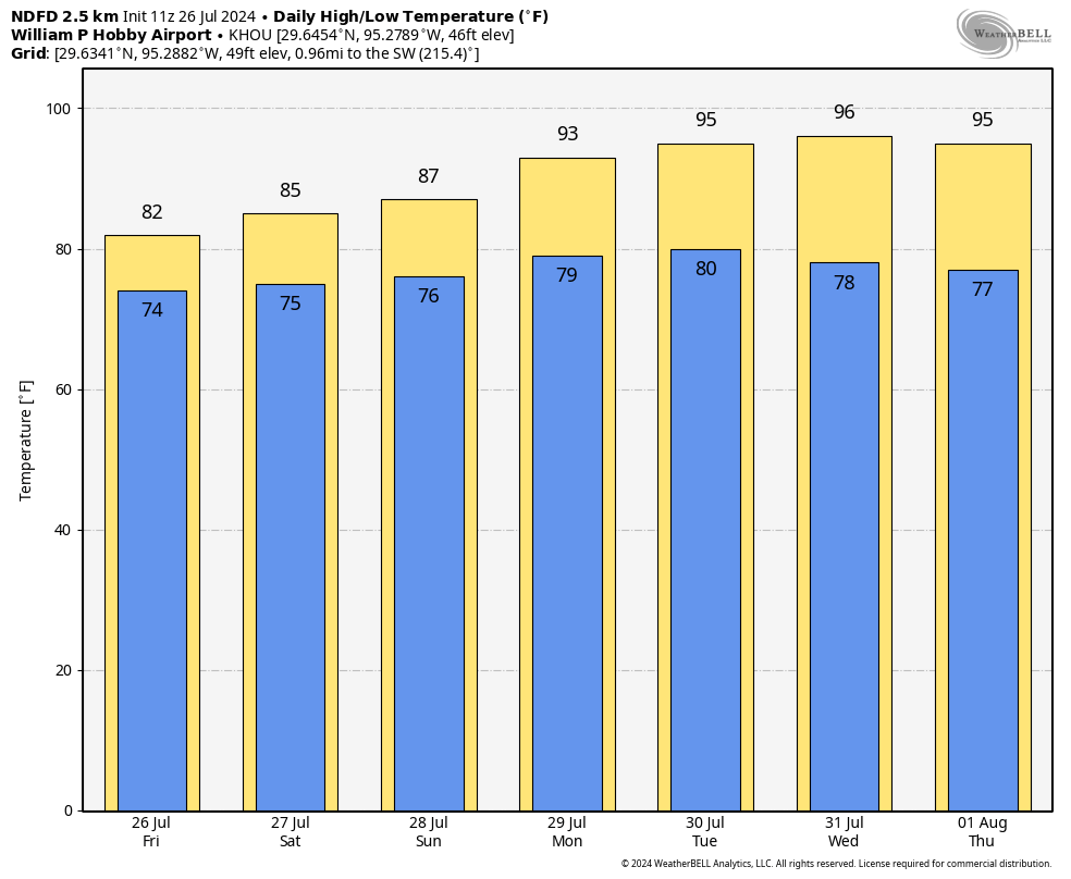
High temperatures for much of Houston will likely rise into the low- to mid-90s for much of the region today. Skies will be partly sunny, with south winds at 5 to 10 mph. Overnight lows should drop into the upper 70s for most areas except the coast.
Tuesday
Conditions will be similar to Monday, although skies may appear to be a bit more hazy. This will be due to the influx of Saharan dust. This same dust has helped keep a lid on hurricane activity over the last week or two across the Atlantic basin. The spread of this dust typically peaks during July, and its decrease in August is one of the reason we typically see more hurricane activity in August and September.
Wednesday and Thursday
Both of these should be sunny days, with high temperatures in the mid-90s. We’ll continue to see some haze on Wednesday, although it may start to wane on Thursday.
Friday, Saturday, and Sunday
Our mostly sunny pattern should continue into the weekend, when we see high temperatures in the mid- to possibly upper-90s by Saturday and Sunday. Atmospheric moisture levels could rise a bit, and this may introduce rain chances in the 20 percent range daily, but for the most part I expect these to be sunny days. If you have outdoor plans for this weekend they look, tentatively, pretty good expect for the heat. But what else would you expect in August, in terms of temperatures?