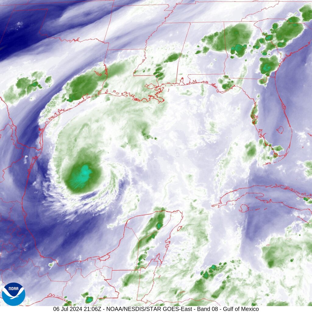
In brief: So far Beryl hasn’t strengthened much today, but there is yet time for intensification before a final landfall tonight. This post goes into the likelihood of such intensification and what it would mean for Houston in terms of winds and the potential for power outages. We also look at the latest rain and surge forecasts.
Beryl status at 4 pm CT
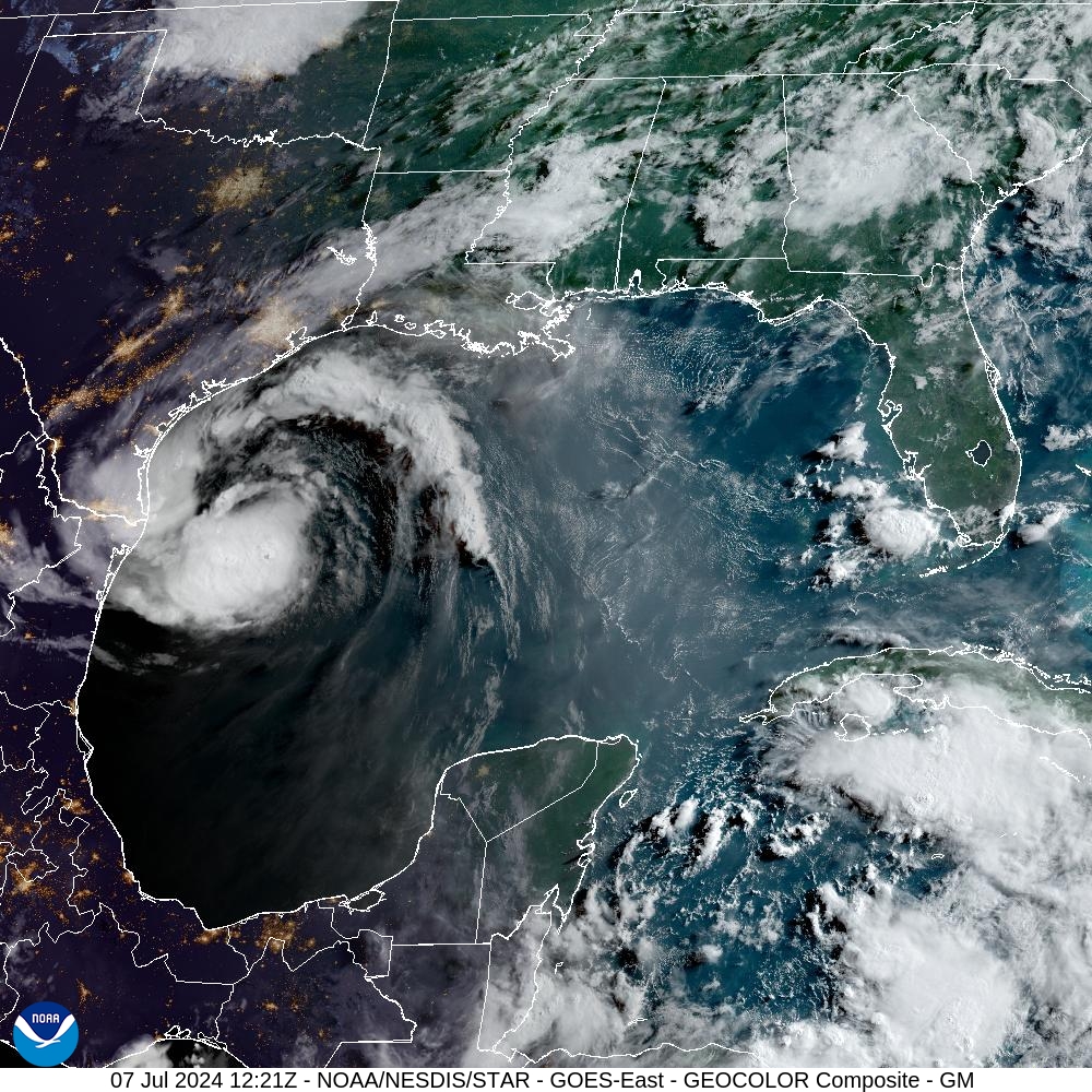
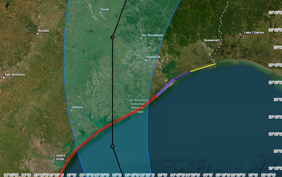
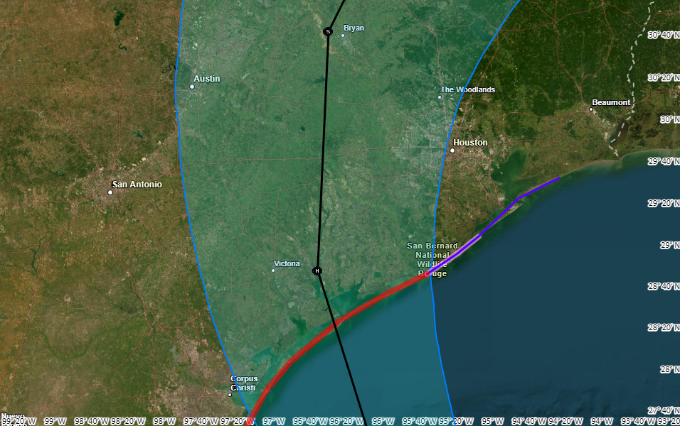
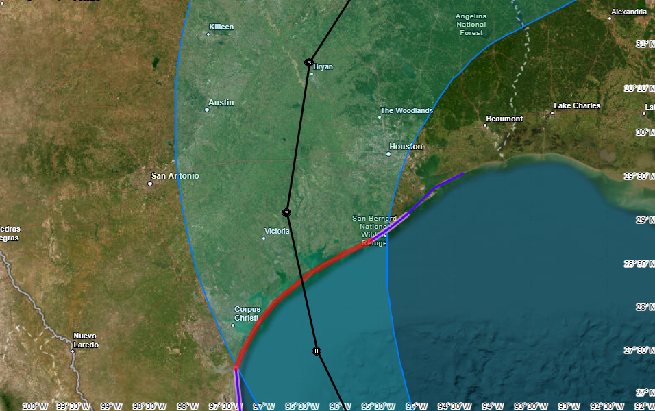
As of this afternoon Beryl remains a tropical storm with 65 mph winds. Its central pressure has dropped a bit to 988 mb, indication a trend toward better organization. The storm is moving to the north-northwest at 12 mph and remains on course to make landfall near Matagorda between midnight and 4 am CT on Monday.
Intensity and track outlook
The fact that we’re not seeing significant increases in Beryl’s winds this afternoon is great news. The biggest threat to the greater Houston area from Beryl is damaging winds, and less intensification means less damage once onshore.
Beryl is running out of time to strengthen—that is not a taunt, mind you. Please let the record show I did not taunt Beryl. The storm will move inland in 8 to 12 hours. There is still time, and the waters are very warm with atmospheric shear low. However, forecasters at the National Hurricane Center note the storm is still struggling to shrug off some dry air in its core. They are still calling for an 85-mph, Category 1 hurricane at landfall, with the likelihood of rapid intensification this evening. This certainly seems plausible, but I am rooting for that dry air to keep disrupting things for just a little while longer.
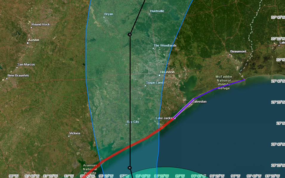
In terms of track there is very little change to the system. Beryl should come ashore early on Monday, and pass near Katy a little before noon before it lifts further out of the Houston area. This rapid forward movement should continue, allowing the worst effects to begin clearing out of the city during the afternoon hours.
What to expect, and when to expect it
Tropical-storm force winds should reach the coast, near Matagorda Bay, around sunset on Sunday and push into Galveston Island a few hours later. The stronger winds will move into much of the rest of the metro area just before or after midnight tonight. The heaviest rains will arrive around the same time. Please find shelter a few hours before this.
How bad will the winds get?
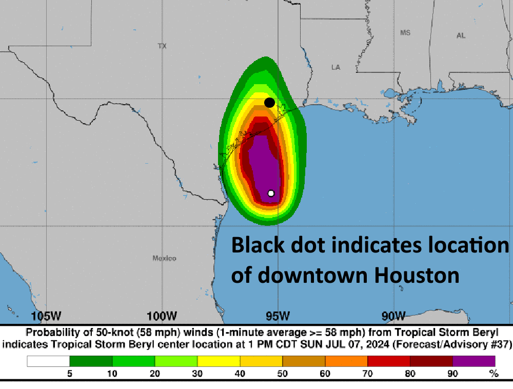
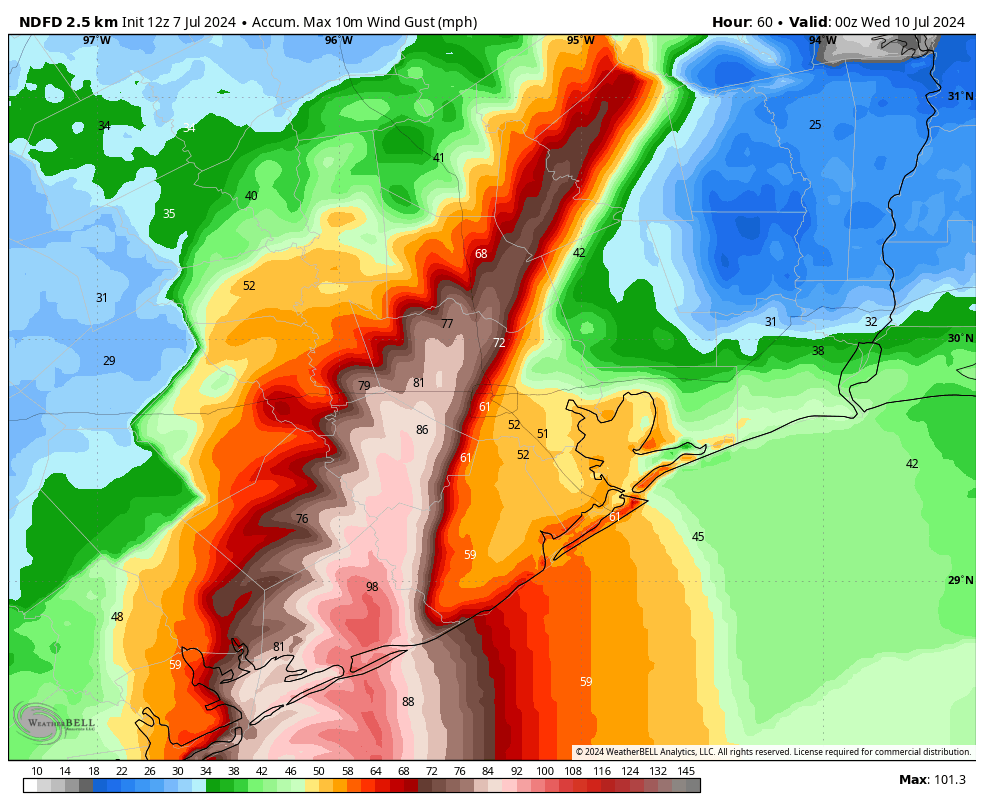
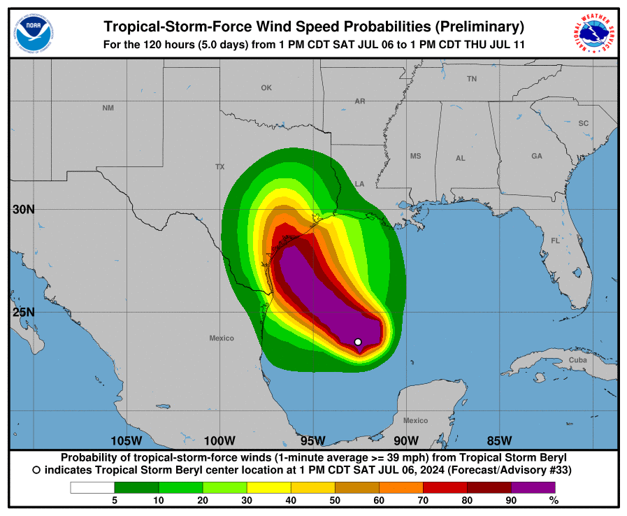
For this outlook I am going to focus on the possibility of seeing sustained winds of 60 mph or greater, which is likely near the threshold for widespread power outages. The map below shows the National Hurricane Center forecast for the probability of winds of 58 mph or greater from Beryl. I’ve annotated it with circle that roughly denotes Loop 610. Winds at this speed likely will not cause roof damage (that threshold is higher, perhaps 70 to 90 mph sustained winds). The map clearly shows the risk for damaging winds and power outages is greatest to the southwest of Houston:
Several readers have asked about tornadoes. Yes, they’re possible within the rainbands of Beryl tonight and on Monday morning. However I expect their development to be fairly scattered, and the bigger threat for a majority of people will be winds directly related to Beryl’s circulation.
Some thoughts on power outages
I’ve spent a couple of hours today doing some digging to try and set some expectations for power outages tonight and later on Monday as the core of Beryl’s winds move into the greater Houston area. Our most recent tropical system with a major “wind” component was Hurricane Ike, a Category 2 storm that made landfall in 2008. It came ashore about 90 miles further east than where we expect Beryl, but it was a much larger and more powerful hurricane. Here is what Ike’s sustained winds looked like.
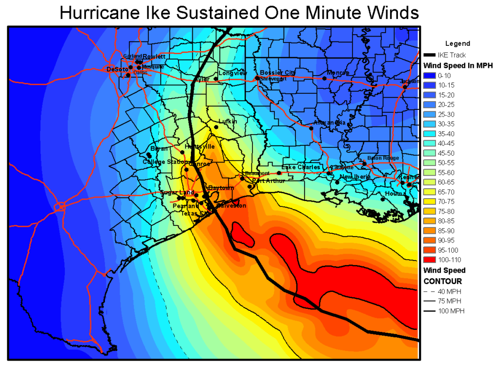
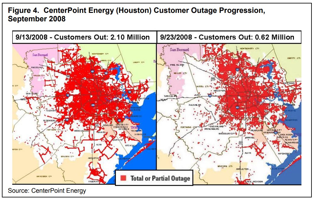
Ike knocked out power to 2.1 million CenterPoint Energy customers in Houston, and 10 days later the power remained out for about one-third of these customers. I want to be clear, I do not think Beryl will have this magnitude of an effect. Far from it, likely. But it’s useful to study the map of outages below and see where there were fewer problems (i.e. northwest Houston).
My back-of-the-envelope estimate here is that widespread power outages start to become more likely at sustained wind speeds of about 60 mph. The majority of Houston will probably less than this tonight, although such winds are likely in many areas of Brazoria, Fort Bend, and Matagorda counties. They are also possible west of Houston, in locations such as Katy.
My general expectation, therefore, is that power losses will be in the hundreds of thousands, and restorations in days; rather that losses above 1 million with a week or two of restoration. However that is a guess rather than a firm conviction, and given since so many people are understandably concerned about this issue.
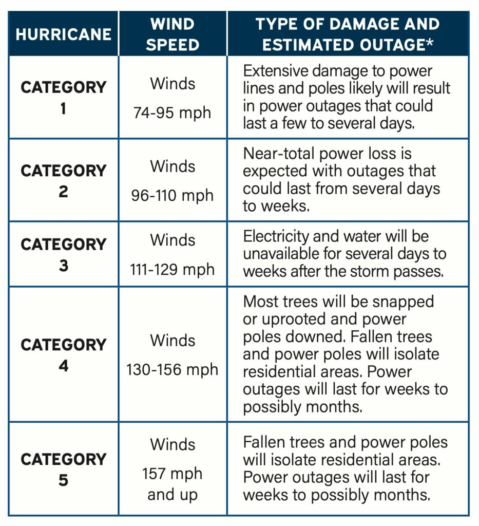
Finally, I very much do not expect hurricane-force sustained winds tonight in any part of the Houston metro area apart from the immediate coast near Matagorda, and possibly locations such as Freeport or Lake Jackson. For what it’s worth, CenterPoint’s estimate for Category 1 winds is: “extensive damage to power lines and poles likely will result in power outages that could last a few to several days.”
The bottom line is that power outages will be a wait-and-see game. Good luck. Charge those phones now, my friends.
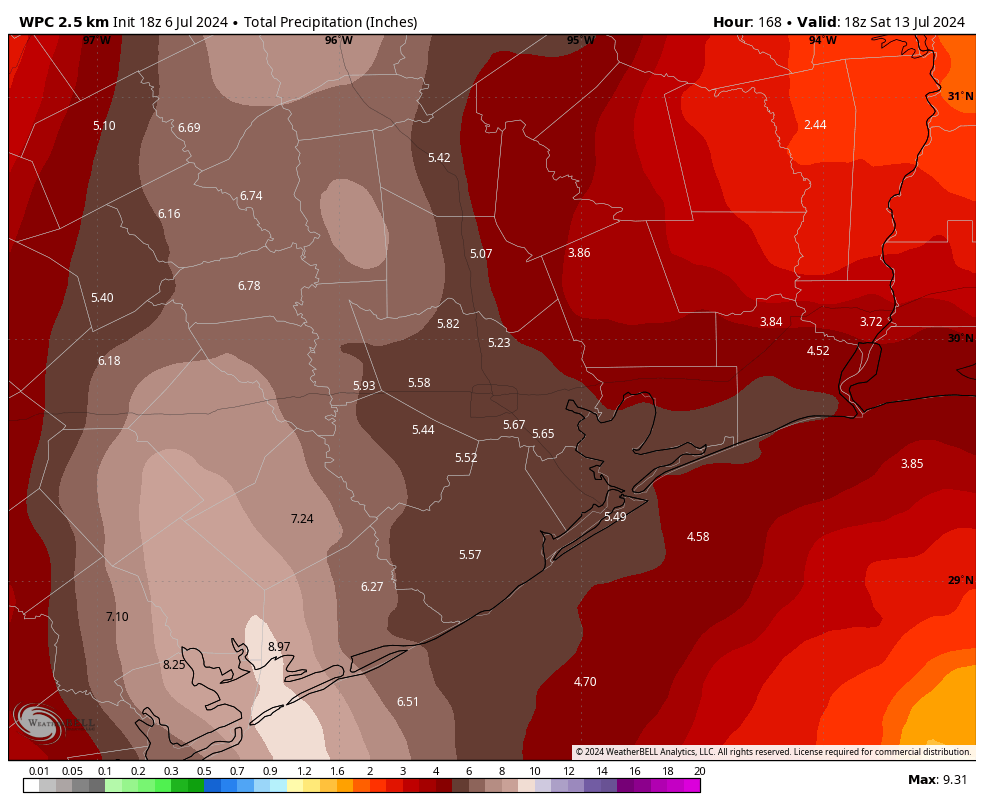
Let’s talk rainfall totals
We’ve seen some fairly widespread shower and thunderstorm activity today as Beryl’s outer rainbands have moved onshore. So far, it’s been fine. I expect to see additional storms this afternoon and evening, but it should be mostly manageable.
The main event should arrive at the coast a few hours before midnight, and push into Houston around midnight. Based on the latest modeling the “thickest” rain band will likely move through the city around 4 to 8 am, bringing intense rains that will quickly flood streets. Conditions should start to improve during the late morning hours. However I would expect to see additional rain showers later on Monday night and Tuesday due to trailing bands (which won’t be as intense). In any case, this is another good reason to stay home from this evening through Monday morning.
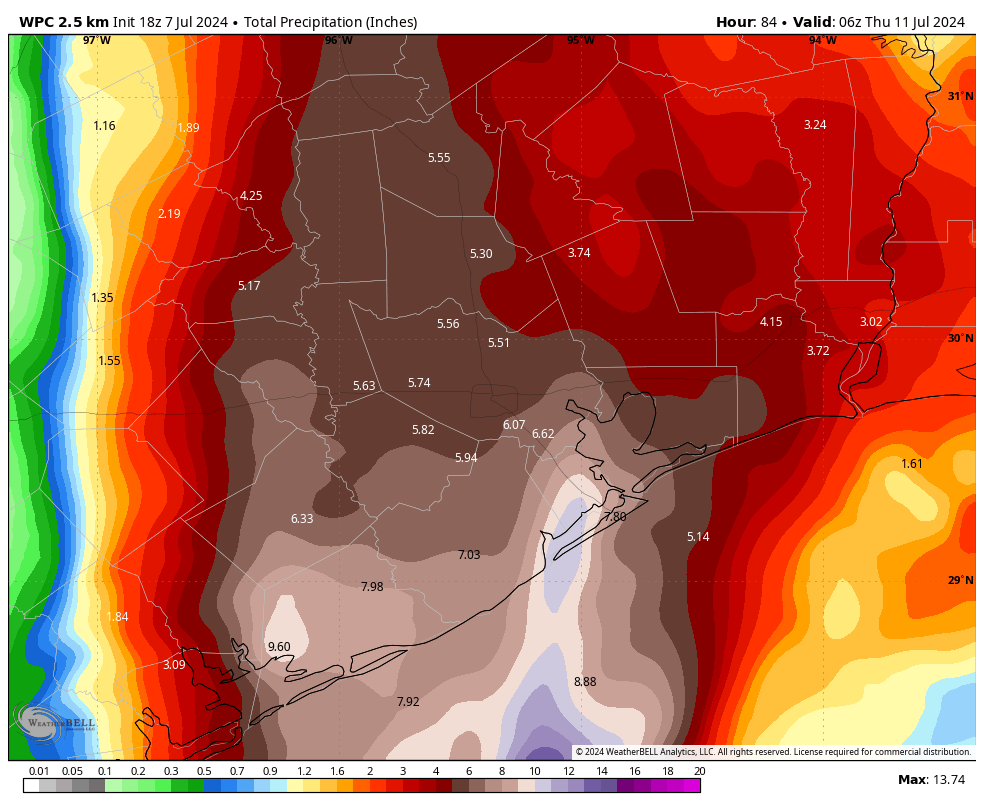
In terms of accumulations, it still looks like coastal areas face the highest risk, with totals of 5 to 10 inches likely, and accumulations further inland of perhaps 4 to 8 inches. What we’re most concerned about are more isolated areas that fall under the heaviest banding. These locations could see 10 or more inches of rainfall. It is impossible to predict precisely where these will set up, but the latest modeling is hinting at higher totals near Galveston Bay. We’ll see. We have a Stage 2 flood alert in place.
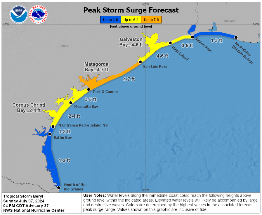
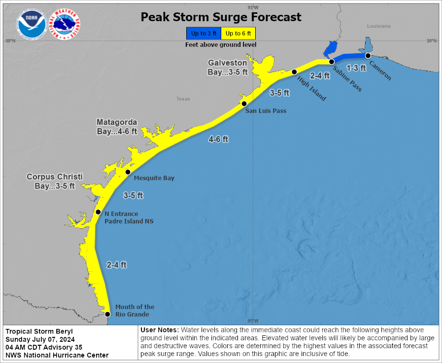
Storm surge
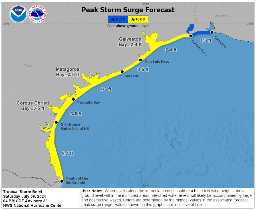
Peak storm surge levels, the combination of high tide and surge, should arrive on Monday morning the upper Texas coast. For Galveston Island and Galveston Bay, water levels are expected to be 4 to 6 feet above normal levels. Surge should be slightly higher in Matagorda Bay.
Final thoughts and plans for tonight
Beryl is on our doorstep, and its winds, rains, and waves will move into our area tonight. The key thing I’m watching over the next several hours is whether the storm starts intensifying, as a weaker Beryl will cause far fewer problems in Houston on Monday morning. As always, we will hope for the best and prepare for the worst. Please make plans to get home, or to a safe place this evening, and remain there through the morning hours on Monday.
Our next post will come around 10:30 pm CT tonight, and we’ll continue to post overnight and into Monday as this dynamic event develops.

