In brief: The forecast for this week is fairly boring. If you like dynamic change you’re out of luck, as our days for at least the next week will be rather warm, sunny, but with modestly drier air. Nights will be somewhat cool, but definitely not chilly. Although rain chances are essentially zero for the next seven days, but there starts to be some hope for precipitation after that.
A cool spell ends
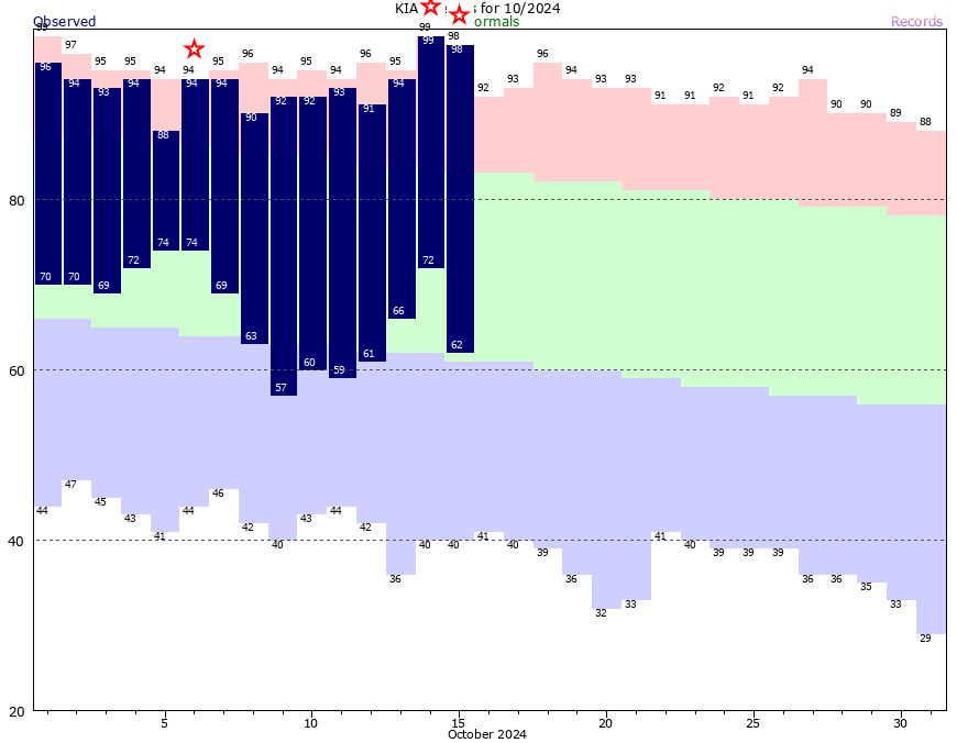
The second half of last week produced the region’s first run of cooler-than-normal temperatures since early September, with a couple of days with high temperatures in the 70s, and a few nights in the 40s and 50s. This provided a nice preview of fall-like weather, but our daytime highs are headed back into the upper 80s later this week.
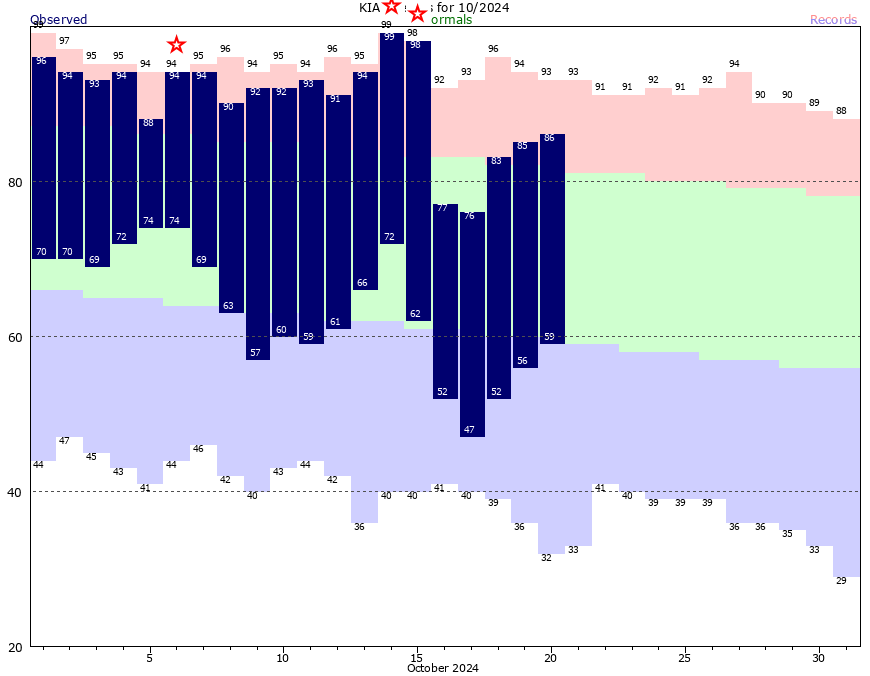
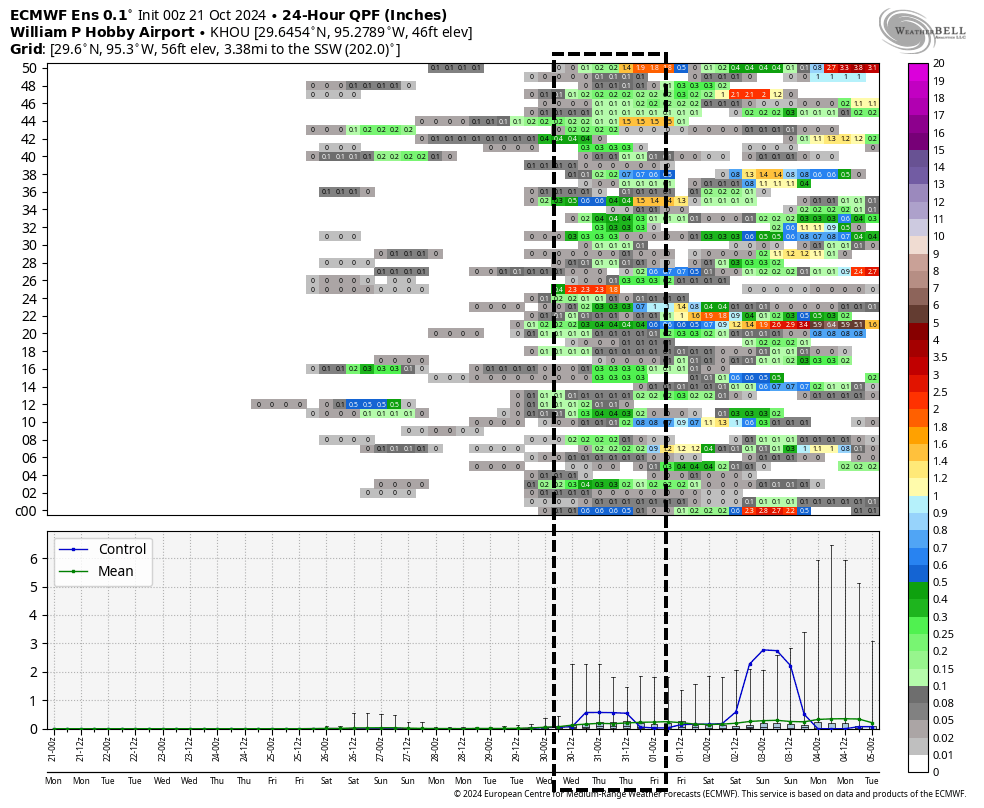
However our nights will remain a touch cooler, with slightly drier air from the northeast helping to cool us off into the low- to mid-60s most nights. As for rain, we’ve been talking about how dry things have been, and that is not going to change this week. However, I have some hope for some change in a little more than a week from now.
Monday
High temperatures will reach the mid-80s today, with sunny skies. Winds will generally be from the east, at about 5 to 10 mph. Skies will be mostly sunny, but with dewpoints in the 50s, the air will feel fairly dry. Low temperatures will drop into the lower 60s tonight. Clear skies should continue to prevail.
Tuesday, Wednesday, Thursday, and Friday
There won’t be much change in the weather this week after today. Each day will see mostly sunny skies, with high temperatures ranging from the lower 80s near the coast, upper-80s for much of the city, and about 90 degrees for inland areas. The air will be modestly dry, and this will help push highs so warm (90-degree days in late October are no unheard of, but they’re quite rare). Lows will drop into the low- to mid-60s for most locations away from the coast, so nights and evenings will be pleasant.
Saturday and Sunday
Not much changes this weekend. A (very) weak front may push highs back down into the mid-80s, and take a degree or two off nighttime temperatures. But we should continue to see sunny days and cool-ish nights. If you have outdoor plans for the weekend, you can make them with confidence.
Next week
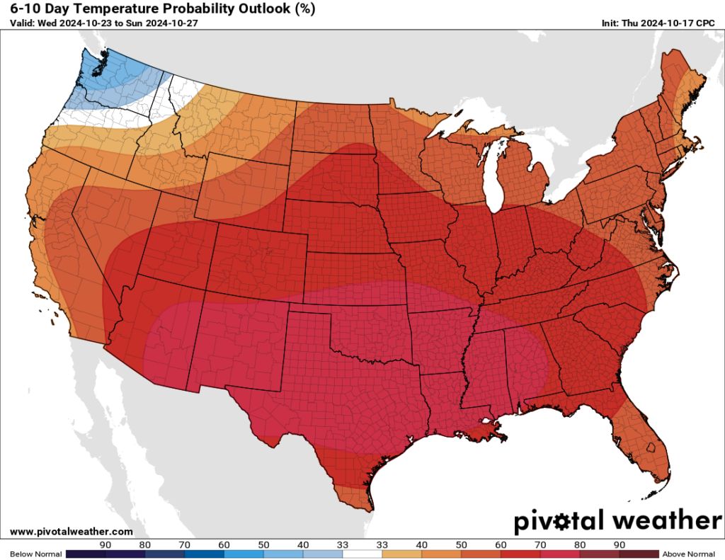
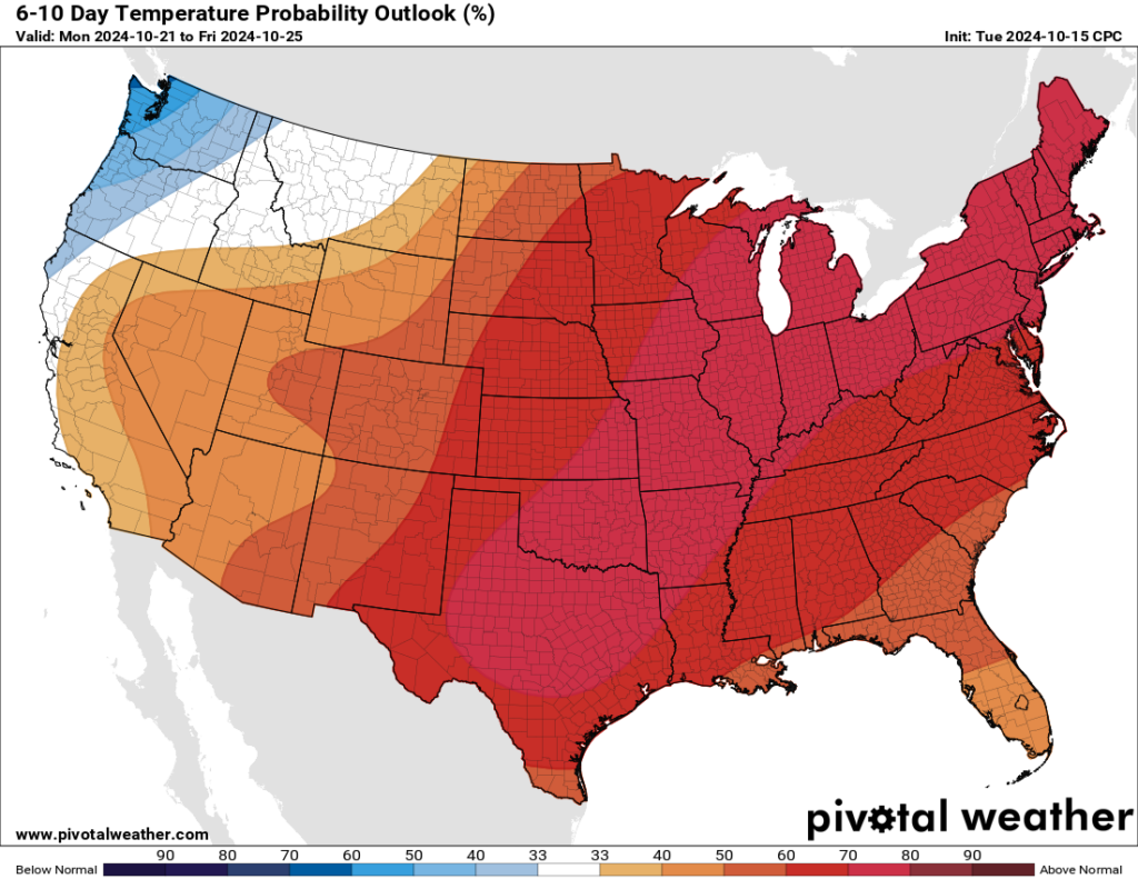
The forecast for next week is uncertain. There are hints of a front in the Monday timeframe, or possibly later in the week, but I don’t have great confidence in any of that happening for sure. However, we may finally see a break from a pattern in which high pressure prevails. Most of our modeling guidance does suggest that Houston may start to see some better rain chances by around Wednesday or Thursday of next week. Now that’s nine or ten days into the future, so I would not set out your cisterns just yet. But it does provide some hope after a very dry fall.

