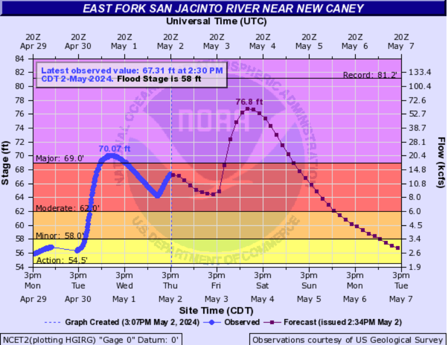
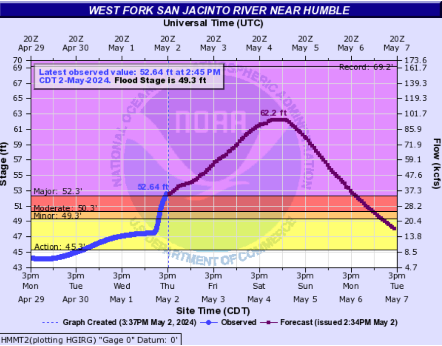
In brief: All our available data continues to point toward the arrival of a line of storms after midnight, moving from west to east across the Houston metro area. Because the heaviest of these rains are likely to fall north of Houston, and the high amounts of rainfall already received there this week, we are raising our flood alert for areas along and north of Interstate 10 to Stage 2 for tonight and Sunday.
The overall pattern we’ve been in for the last several days will persist tonight into Sunday. That is to say, the atmosphere is chock full of moisture and unstable. A forcing agent will come early Sunday as a disturbance moves into the region from the west. In recent days the trend has been toward rain events over-performing expectations. So I don’t want anyone to let their guard down just yet.
After midnight we’re likely to see the development of an MCS to the west of Houston. What is an MCS? In meteorological parlance, it stands for ‘mesoscale convective system,’ essentially a large complex of thunderstorms. But when they come through at night I prefer to think of an MCS as a ‘midnight canine stimulant.’ So yeah, it could be one of those nights.
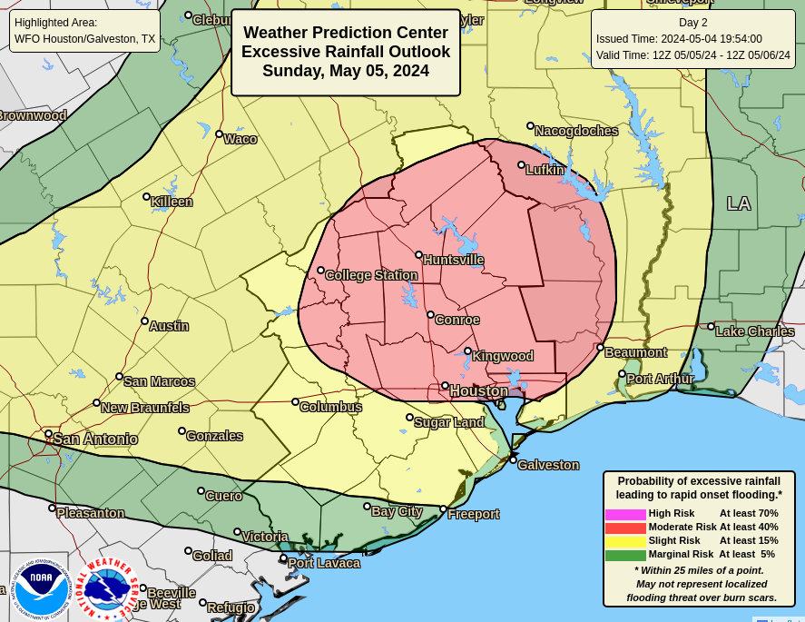
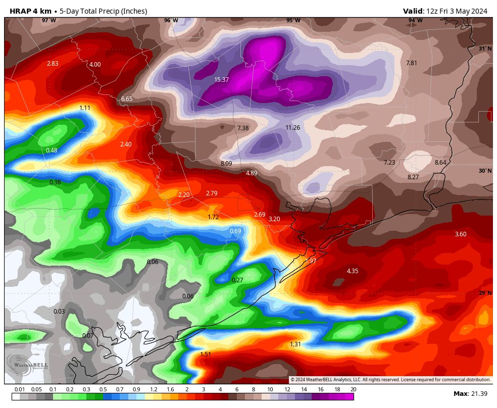
The primary risk is thunderstorms and heavy rainfall. Generally, I think most of the area will pick up 1 to 3 inches, but my concern is the potential for bullseyes of 5 inches, or more. The most probable location for these heavy rains is areas north of Houston, which have already received a foot of rainfall, or more, during the past week.
After the strongest part of the MCS sweeps through, likely around 3 to 6 am for areas such as Katy, 4 to 7 am for downtown Houston, and a little later for the coast, we are likely to see additional showers—on and off—for most of the rest of Sunday. It’s my hope that these will be a little less intense, and a little less organized than the initial push early on Sunday. Matt will have a full update for you tomorrow morning.
You’re probably not going to be believe me, and that’s fine. But I still do expect our pattern to dry out on Monday. We’ll turn sunnier, and hotter for awhile. Rain chances may not go away entirely, but they’ll be significantly diminished.