Today is the summer solstice, and it will sure feel like it—but Thursday could bring some rain showers

Good morning. The Sun reaches its northernmost extent today in the sky, giving those of us in the northern hemisphere our longest daytime of the year. For today, sunrise came at 6:21 am, and sunset is not until 8:25 pm. More precisely, our day length will be 14 hours, 3 minutes, and 31 seconds. That’s in contrast to our shortest day of the year, on the winter solstice in December, when the day lasts just 10 hours, 14 minutes, and 2 seconds.

We’re going to feel every minute of that sunshine today, with one more particularly scorching day. However, we will see a brief reprieve to end the week, with some healthy (and much needed) rain chances tomorrow. Let’s discuss below.

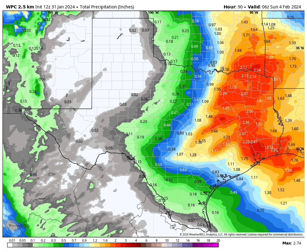
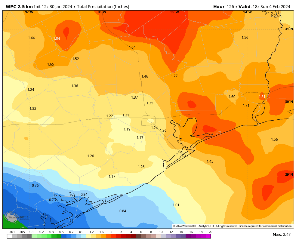
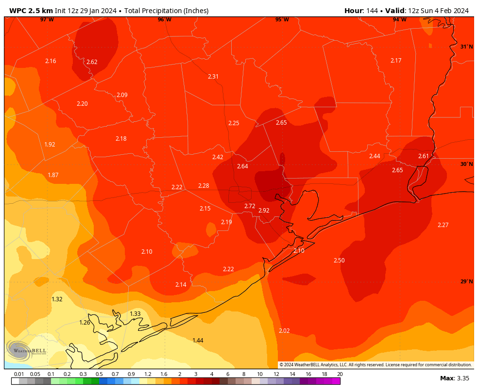
NOAA rain accumulation forecast for Thursday. I’m not sure we’ll see this much, but it will be our best chance for rain for a long time. (Weather Bell)

Wednesday

Skies will be partly to mostly sunny today, with highs again reaching near if not above 100 degrees. However, we’re going to see high pressure start to retreat slightly, and this will open the door to a slight chance of showers and thunderstorms this afternoon. Don’t get too excited. We’re talking about 10 percent. But those odds will improve on Thursday. Lows on Wednesday night should drop into the upper 70s.

Thursday

This will be the most interesting day of the week, weather-wise. With high pressure taking a break, we should see showers and thunderstorms developing to the northwest of our region, around the College Station area, before sunrise. Then a broken line of showers should move through during the morning hours. It’s impossible to say whether you’re going to see rainfall. I’d rate chances at about 50 percent, and these showers will likely be hit or miss, with a few areas seeing in excess of 1 inch, and others seeing nothing. On average chances should be better north of Interstate 10. Skies will turn partly sunny, with highs in the mid-90s.

Friday

This will be the second of our “cool” days this week. Look for highs in the mid-90s again, with mostly sunny skies. Another round of morning showers is possible, but overall chances will be much lower, in the vicinity of 20 percent.

Saturday and Sunday

Sunny and hot conditions return for the weekend, with highs of 100 degrees, as the dome of high pressure builds back over Texas in a big way.

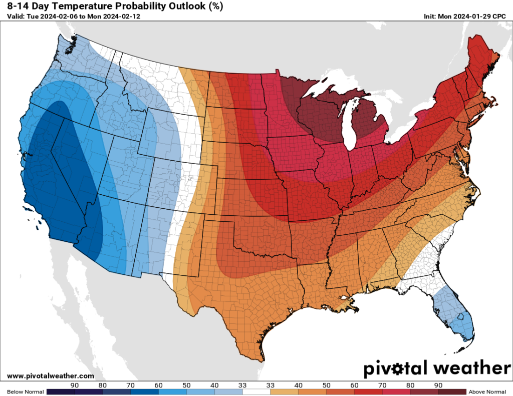
Abandon all hope ye who enter here. (Pivotal Weather)

Next week

Not much to say, I’m afraid, other than that the heat remains in a pretty big way. There is some hint in the models that this pattern may finally break about 10 days from now, but that’s far enough into the future that my confidence in that is pretty darn low.

Another day of excessive heat before we just become abnormally hot

Houston turned up the heat to extreme levels this past weekend, and we’ve got one more day of highs near 100 degrees with humidity pushing the heat index above 110 degrees. After that temperatures will back off slightly for a few days. Unfortunately it now appears likely that this hotter-than-normal pattern will persist through the remainder of June. And after June comes July and August, which is really pleasant to contemplate, you know?

While there is not too much going on with our local weather besides the heat, the Atlantic tropics are unusually active for June. We’ve got all of that covered on The Eyewall. While there are definitely no near-term concerns for the Gulf of Mexico, this is not exactly a great trend for what we might expect later this summer when the Atlantic hurricane season typically get really cranked up.

Everybody gets an excessive heat warning today. (National Weather Service)

Tuesday

Like the last three days, today will be very hot and mostly sunny. Highs should reach about 100 degrees, with a heat index necessitating an “excessive heat warning” from the National Weather Service. If you must go outside during the middle of the day for a prolonged period of time, please drink plenty of fluids and avoid strenuous outdoor activities. Wear lightweight and loose fitting clothing when possible. South winds, at just 5 to 10 mph, will provide little relief. Lows tonight will not drop below 80 degrees.

Wednesday

Temperatures may be a degree or two cooler on Wednesday, but it’s still going to be brutally hot and mostly sunny. I’d say there’s about a 10 percent chance of rain showers for the eastern half of the area.

Thursday and Friday

These will be the most “moderate” days of the week as the high pressure system backs off slightly. Look for highs in the mid- to upper-90s, with nighttime temperatures perhaps a degree or two cooler. The big thing I’m watching for is rain chances. I don’t want to get anyone’s hopes up, because we’re only talking about a 20 or 30 percent chance of rain as instability works its way into the atmosphere. But this is the best chance of rain for the rest of the month, probably.

Saturday and Sunday

As high pressure builds again, temperatures should climb back to about 100 degrees each day. Sunny and hot, rinse and repeat.

The outlook for next week looks pretty hot, too. (Pivotal Weather)

Next week

Hey Eric, does it look like we’re finally going to get a break from this heat wave next week?

No.

Don’t do that to me man.

Ok, at least not during the first half of the week as high pressure remains entrenched over South Texas and Mexico. Maybe by Thursday or Friday of next week? Possibly. Sorry folks, it’s pretty grim.

Excessive heat continues for a few more days before some slight relief later this week

Good morning. Today is Juneteenth, a relatively new federal holiday that has its origins in Texas. Juneteenth is celebrated on the anniversary of Major General Gordon Granger arriving in Galveston and proclaiming freedom for enslaved people in Texas on June 19, 1865. This came two and a half years after the Emancipation Proclamation was issued.

Unfortunately, we will not have freedom from extreme heat today. Some very moderate relief will arrive later this week, as well as a slight chance for our first showers and thunderstorms in awhile. But it will probably be fleeting.

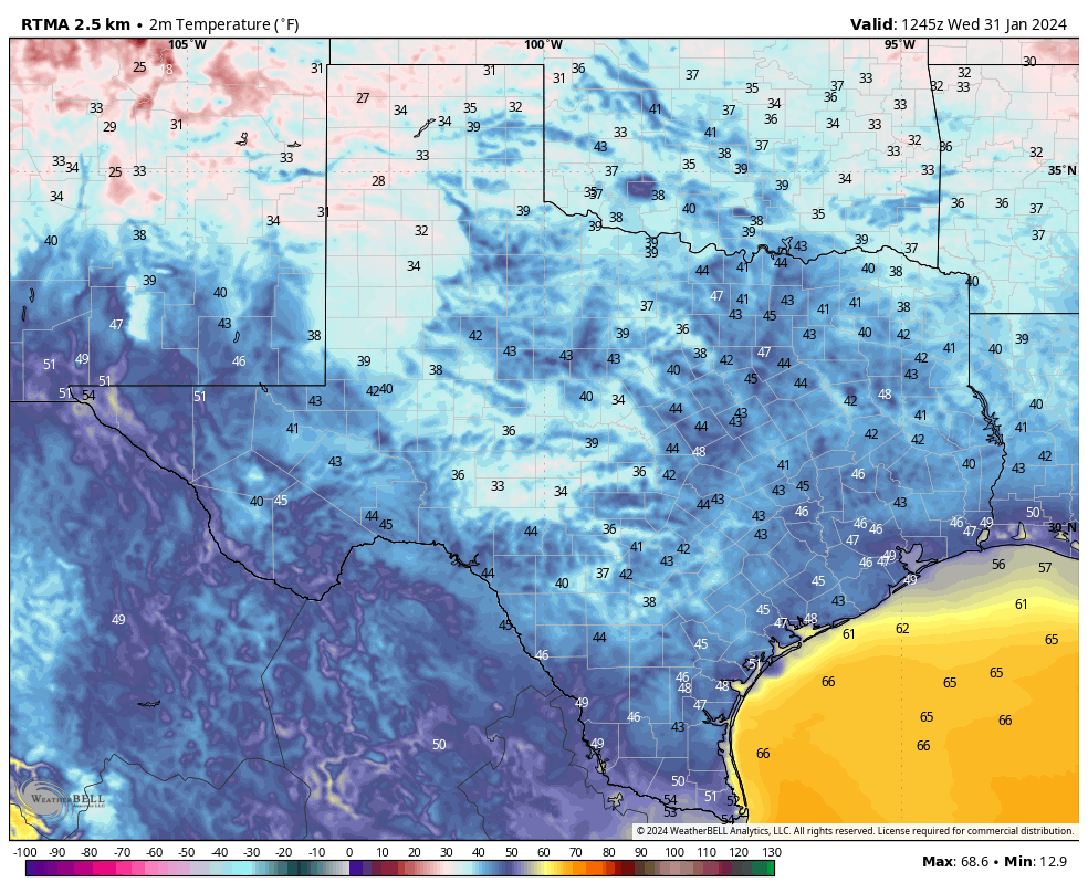
Texas high temperatures on Monday will be one big bucket of yuck. (Weather Bell)

Monday, Tuesday, and Wednesday

For the first two or three days this week we are going to see conditions very much like what the region experienced over the weekend. That is to say, high temperatures of about 100 to the low-100 degrees with high humidity, leading to an extremely elevated heat index. An excessive heat warning is in effect for now through Tuesday, and we can probably expect that to continue through Wednesday. Please continue to take heat safety precautions when outdoors during the middle of the day.

Thursday and Friday

Sometime on Wednesday, the high pressure system that has dominated our weather for several days will begin retreating slightly to the west, allowing for a cloudier and slightly cooler period. The relief will be modest, with high temperatures likely in the mid- to upper-90s, but it should bring down the dangerous heat index for a few days. Some weak disturbances will also drive rain chances into the area for a couple of days. Do not expect much—most areas probably have a 10 to 30 percent chance of rain—but this is better than what we’ve seen for a week now.

Next weekend and beyond

The medium-term looks pretty hot, I’m afraid. At this point the most likely scenario is that the high pressure system starts to rebuild over Texas, including the Houston metro area. So we probably will see the return of triple digit temperatures, sultry humidity, and heat warnings. I wish it were otherwise.

It’s rare to see two tropical waves of note in mid-July, but here we are. (National Hurricane Center)

Tropics

The Atlantic tropics are unusually frisky for this time of year, and we can probably expect the formation of Tropical Storm Bret within the next day or two. The storm, and an additional wave behind it, likely are of no consequence to Texas or the Gulf of Mexico. For full coverage of all things tropics, be sure and check out our new Atlantic hurricanes website, The Eyewall.

We’re making up a new word to describe this weekend’s weather: Houmidity

Good morning. The story of the day, the story of the week, and the story for the second half of June is going to be our region’s dangerous heat. The National Weather Service has expanded the “heat advisory” to cover the entire Southeast Texas region, including all of the Houston metro area. With temperatures around 100 degrees, and the heat index pushing 110 degrees due to high humidity, it is strongly advisable to limit activities outdoors during the middle of the day.

It’s Houston. It’s humid. It’s Houmidity. Perhaps that’s not a slogan the Greater Houston Convention and Visitors Bureau is going to start using, but it does have the benefit of being accurate.

If you’re looking for something a little bit different this morning, over at The Eyewall, Matt authored a feature report about hurricane activity and the Gulf of Mexico. We’ve seen a spate of major storms in the last six years, particularly with rapidly intensifying and extremely damaging hurricanes. Matt dives into the latest research and speaks with hurricane scientists about whether this is really a trend, and what it means for coastal residents.

The location of the average August-October 28.5°C/83.3°F isotherm (line of consistent temperature) has been migrating closer to the Gulf and Southeast coasts since the 1980s, indicating that Gulf water temperatures have been warming, thus becoming more hospitable for stronger tropical systems. (Dr. Kim Wood, Mississippi State University)

Thursday

What is there to say? High pressure is dominating our weather, and this will mean mostly sunny skies, highs near 100 degrees, and southerly winds varying from 5 mph to 15 mph. Nighttime temperatures will offer little reprieve, with lows dropping only to around 80 humid degrees. If you live near the coast, daytime highs will be slightly lower, but the humidity slightly higher. Pick your poison, H-town.

Friday

More of the same.

Saturday and Sunday

The heat peaks this weekend, with much of the area hitting 100 degrees. Expect lots of sunshine. Rain chances remain below 10 percent, daily. Find some water to cool down in if you’re going to be outside.

Feel the burn, Houston. (National Weather Service)

Next week

The first half of next week should bring still more of the same, although there is some suggestion in the models that the ridge will weaken or flatten later next week, and begin to offer some relief. We’re not talking much here, but highs could start to fall back into the mid- to upper-90s. Rain chances by Friday or so may start to tick back up into the 20 to 40 percent range. But that’s eight days out, and I don’t have confidence in the ridge of high pressure breaking down until the models start to definitively show it. In other words, abandon all hope, ye who enter here.