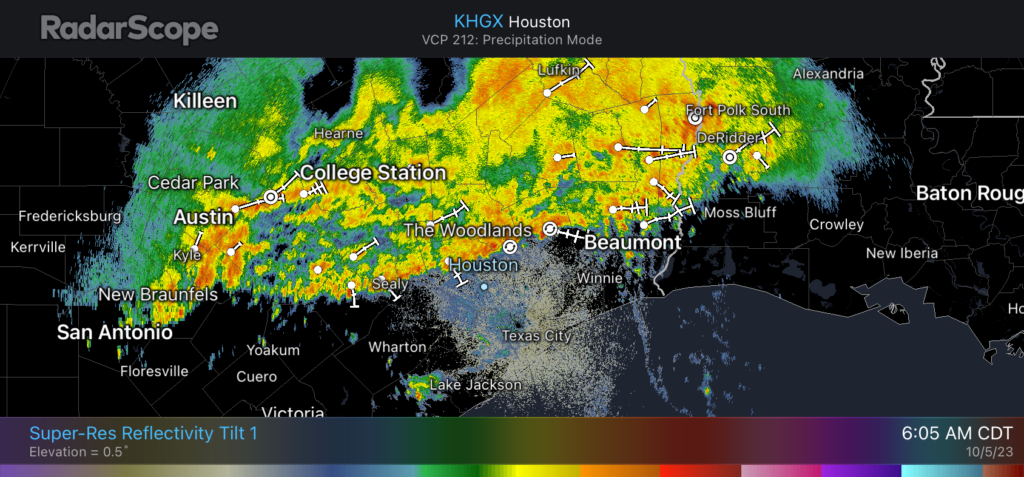
Fall is on the way as a line of showers and thunderstorms advances southward through the Houston area from north to south this morning. These storms are already moving through The Woodlands, and will affect the central part of Houston during rush hour this morning. They should largely be offshore by or before noon. I’m expecting overall accumulations of 1-2 inches, but the concern is high rainfall rates.
Because of this, there is the potential for street flooding along with these storms, and we are therefore keeping a Stage 1 flood alert in effect for the entire metro area through noon this morning. Please take extra care when driving around the city this morning with the potential for water on low-lying roadways and traffic delays. There may also be frequent lightning and gusty winds before the storms pass.
Thursday
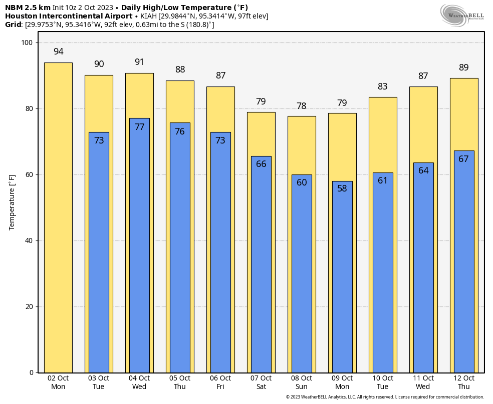
After the main line of storms passes this morning, this afternoon should bring high temperatures of around 80 degrees, with mostly cloudy skies, and winds shifting to come from the north. Additional scattered showers will be possible this afternoon before coming to an end this evening. Low temperatures will drop to around 70 degrees on Thursday night, with the air feeling slightly cooler.
Friday
Friday will see a mix of sunshine and clouds, and high temperatures in the low- to mid-80s. Dewpoints will drop a bit as drier air filters into the area, but we’re going to need to wait until a reinforcing front arrives on Friday night to really bring low humidity and cooler weather. Rain chances, overall, are low to non-existent. Lows should drop into the mid-60s for most areas on Friday night.

Saturday and Sunday
This will be our first fall-like weather of the season and it’s going to be pretty glorious. Saturday will bring partly cloudy skies, with highs likely in the upper 70s. Winds will be out of the north at about 15 mph, with higher gusts. Clearing skies by Saturday night should allow lows to drop into the upper 50s on Sunday night. Sunday looks amazing, with lesser winds and sunny skies to go along with highs in the upper 70s. Sunday night should be cool again, with lows dropping into the upper 50s.
Next week
Highs will start to recover into the 80s by Monday or Tuesday of next week, but at this point it does not appear as though temperatures are going back into the 90s. I’m still watching for the potential for showers in association with tropical moisture by mid- to late next week, but as of now it looks like the focus of that activity will remain mostly offshore in the Gulf of Mexico. At this point it’s likely that another front will arrive to bring some cooler and drier weather into the region next weekend. That’s not certain at this point, but I am hopeful.