In brief: In today’s update we take a look at increasing shower activity today and Wednesday before our rains mostly dry up. That will leave us with a more humid and increasingly warm air mass heading into the weekend. We also take a look at winds this weekend for our friends participating in the MS 150 ride.
Drier air mass is gone
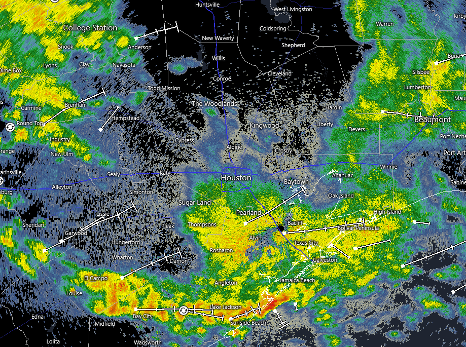
After Houston saw widespread showers on Saturday a drier air mass moved in to the region on Sunday. By Monday enough drier air was holding on such that even though a disturbance moved in from the west was producing precipitation in the atmosphere, much of this was drying out before it reached the ground. The lower atmosphere is more saturated now, so those showers are breaking through.
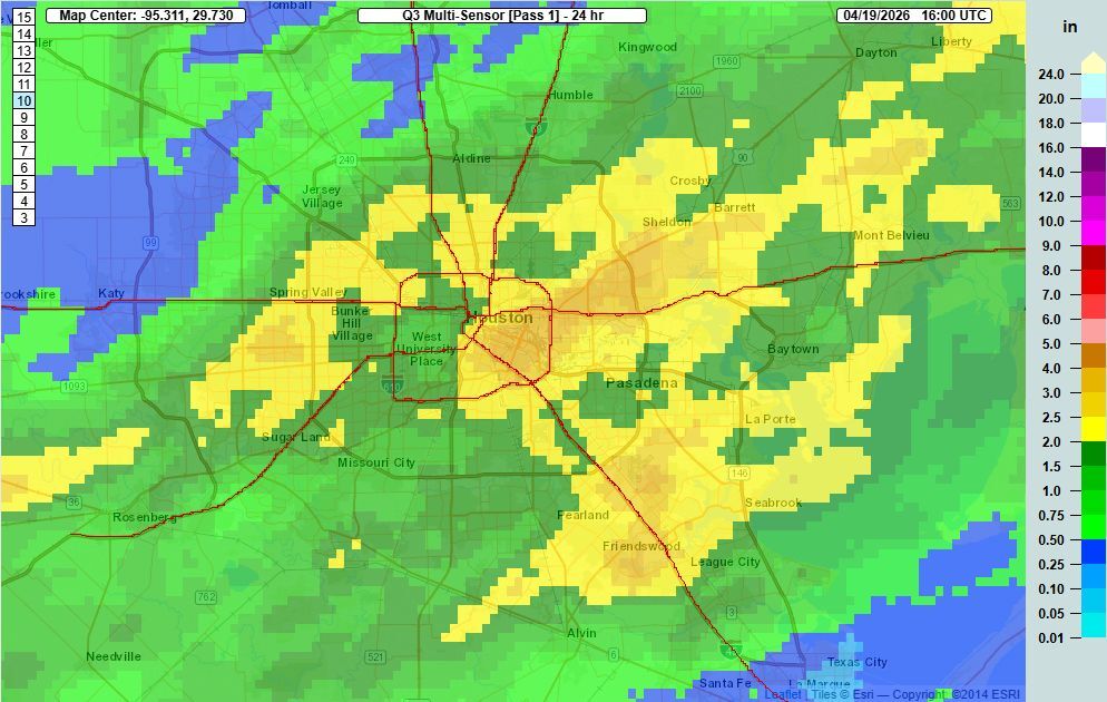
Since midnight much of the region has received between 0.25 and 0.5 inch of precipitation, and we are likely to see ongoing rain chances today and Wednesday. The good news is that, for the most part, I expect these showers to be mostly behaved. That means that while heavy rain and street flooding are always possible, in this case I expect showers to largely be of the light-to-moderate level.
Tuesday and Wednesday
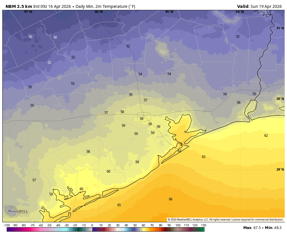
As mentioned above, we’ll see on-again, off-again showers for much of today and Wednesday. High temperatures today will likely top out in the lower 70s, but Wednesday could be a little warmer if we start to see some partially clearly skies later in the day. The rain chances should start to ebb by Wednesday afternoon or evening. By then we’ll just be left with fairly muggy air and warm nights with lows around 70 degrees.
Thursday and Friday
These will be a pair of partly sunny days with temperatures in the 80s. Thursday may be a shade cooler than Friday, but both days will see plenty of humidity and some background rain chances on the order of 20 percent. Afternoon winds will gust up to about 20 mph from the south, with lighter conditions at other times. Nights remain in the lower 70s.
Saturday and Sunday
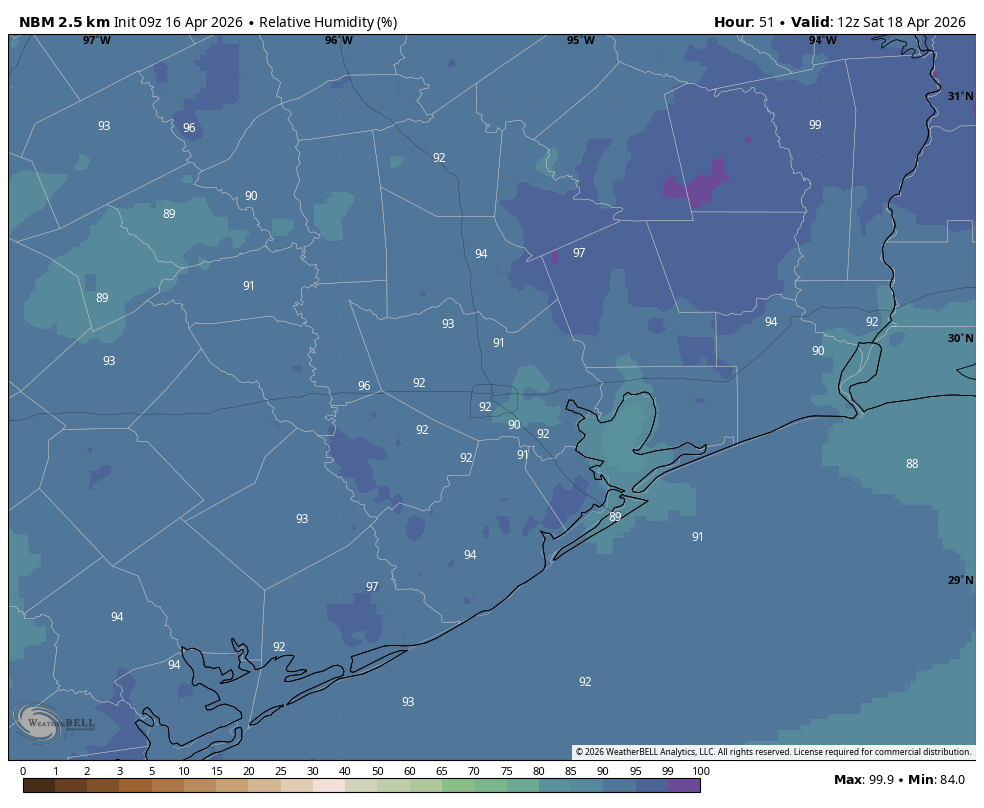
A warming trend continues into the weekend, with highs likely in the upper 80s, and partly to mostly cloudy skies. With dewpoints in the vicinity of 70 degrees it will feel plenty humid. As for rain chances, they’re not zero, but they’re pretty low, and anything that falls should be light.
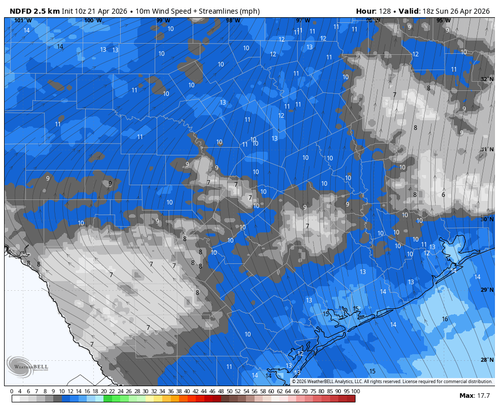
So what about winds? If you’re participating in the MS 150 ride this weekend that’s what really matters. The route on Saturday is generally westerly, and then it turns more northerly on Sunday. Winds at dawn on Saturday will be mostly southerly, at about 5 mph, so a cross wind. They’ll be stronger by the middle of the day, 10 mph with gusts up to 20 mph. The story will be similar on Sunday, so more of a pure tail wind that day. You should be flying that day!
Next week
Warm temperatures, with highs near 90 degrees, will continue into next week. Some sort of front may work its way into Houston by Tuesday or Wednesday, but your humble forecaster is making no concrete predictions on that score. We’ll have to see what happens.