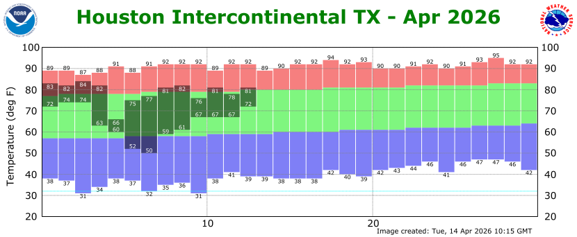
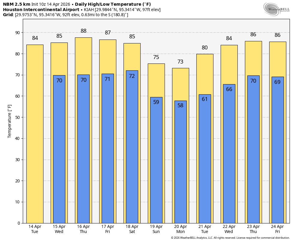
In brief: Houston faces four more warm and humid days before a cool front swoops into the city on Saturday, likely during the evening hours, bringing a healthy chance of rain and then much cooler air. The front should hang on into the middle of next week, with highs in the 70s.
Tax us with your questions
We are planning to run another Q&A about Houston weather (and related issues) during the next several days. If you want to ask a question, the best way is to do so in our Weather Talk forum, but you can also comment below or ask on one of our social media channels. Since it’s Tax Day, we are looking forward to your taxing questions. (We are also looking forward to the end of tax season).
Wednesday
Today will be a lot like Tuesday, with partly sunny skies, highs in the mid-80s, and plenty of humid air. We remain in a pattern with a fairly robust southerly flow, allowing for surface wind gusts up to 25 mph during the afternoon hours. A capping inversion should prevent most, if not all rain showers. Lows tonight will drop to around 70 degrees in Houston, with slightly warmer conditions near the coast.
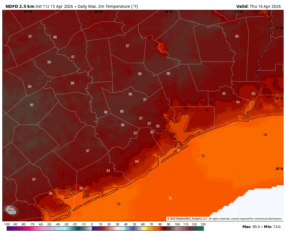
Thursday
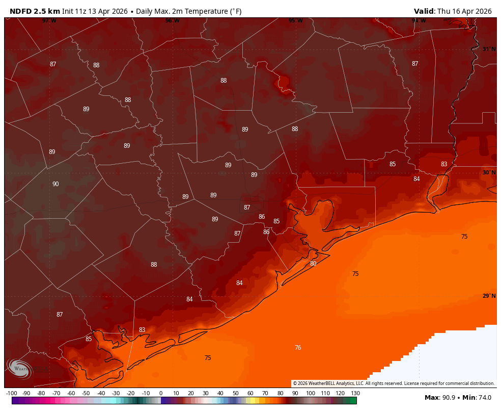
Conditions will be a bit warmer, as skies should be mostly sunny during the afternoon hours. Much of Houston away from the coast will likely warm into the upper 80s, although I think a majority of the area will remain below 90 degrees. Anyway, very warm for mid-April.
Friday
A day a lot like Wednesday, with partly sunny skies, highs generally in the mid-80s, and plenty of humidity. You know the drill.
Saturday
The front half of the weekend will see more warm and humid conditions, and I expect these to persist throughout the daytime. There could be a chance of very light showers, but nothing serious. At some point later on Saturday afternoon, or during the evening hours, a front is going to slide through the region from the north-northwest. I’m starting to think there will be a pretty healthy chance of rain with the front, and even the possibility of some heavier showers. However I don’t think these will last too long, as the front should push offshore in a relatively short order. In any case, you should be prepared for the possibility of showers on Saturday afternoon, evening, and early into Sunday. In terms of accumulations, most of the area will probably get something on the order of 0.25 (more likely closer to the coast) to 0.75 inch (further inland), with higher isolated totals, but that’s far from locked in. Lows on Saturday night should drop into the 50s as drier air begins moving in.
Sunday
This will be a mostly cloudy and cooler day, with high temperatures likely in the vicinity of 70 degrees. We’re going to see a northerly wind, gusting perhaps to 20 or 25 mph. Any rain chances should end before sunrise. I think lows on Sunday night will get into the upper 50s in Houston, with cooler conditions for outlying areas.
Next week
Monday should also be in the low 70s, with another night in the 50s. After that we’ll be on a warming trend and I expect our highs to climb back into the lower 80s. After that it’s possible another front may approach Houston next weekend, or maybe not. The crystal ball is just a little bit too fuzzy that far out.